Southwestern Guesthouses on 265 Acres near Silver City, New Mexico overlooking Bear Creek and the Gila Wilderness
Menu
Casitas de Gila Nature Blog
The Desert Dry Wash or Arroyo
THE DESERT DRY WASH (aka Arroyo):
AN ICONIC LANDFORM OF THE AMERICAN SOUTHWEST
An Exploration into the Natural History of the Dry Wash Trail
at Casitas de Gila Guesthouses in Southwest New Mexico
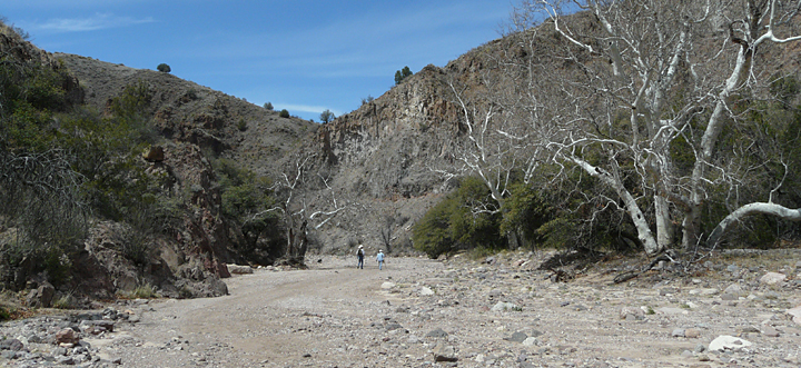
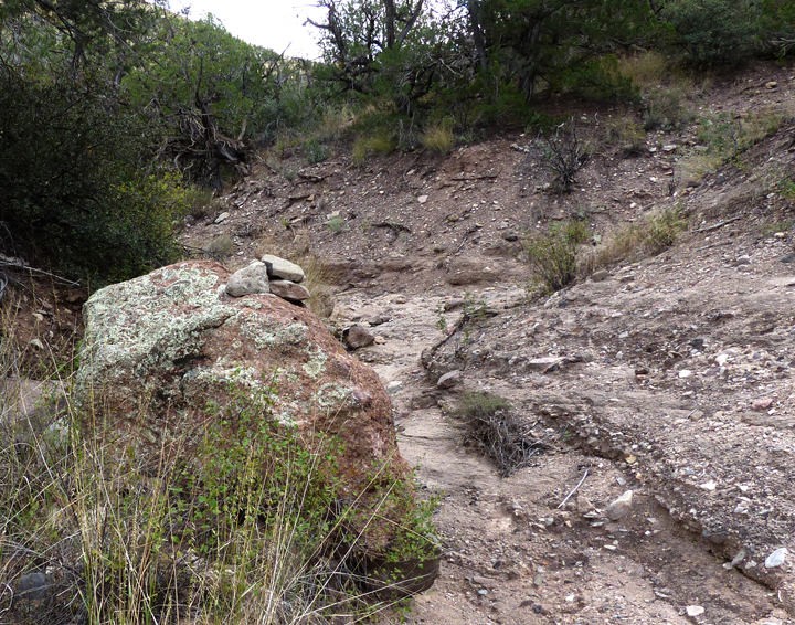
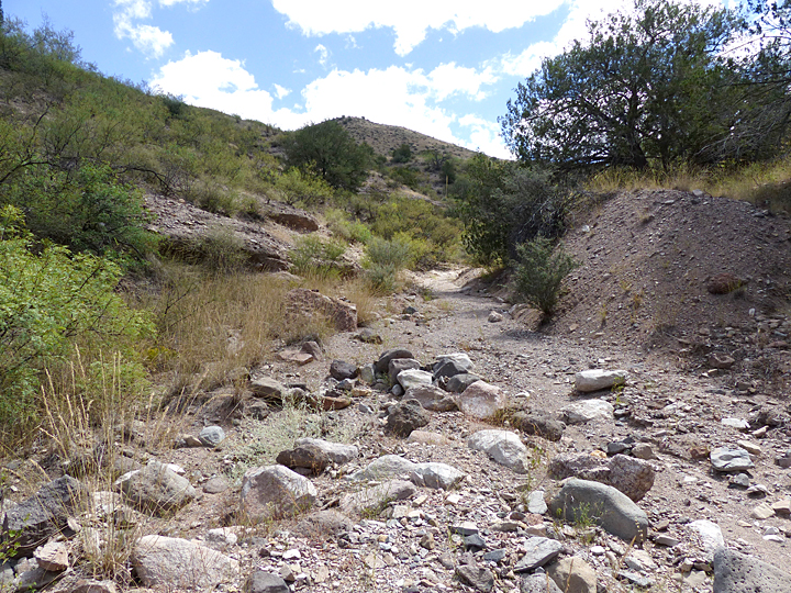
Looking south up the rugged, ephemeral dry wash of Eliot Canyon. During Summer Monsoon Season this dry wash becomes a high-energy stream capable of transporting large volumes of course sediment and boulders. Following the Ambush at Soldier Hill, the Apache Chief Ulzana and his warriors quite likely used this canyon as an escape route to elude Lt. Fountain and Troop C of the 34th US Calvary.
THE DESERT DRY WASH OR ARROYO:
ICONIC LANDFORM OF OUR WESTERN CINEMATIC FANTASIES
For most adults looking back on our early cinematic adventures, it’s hard to think of a favorite film set in the American Southwest in which the iconic landform of the dry wash or arroyo does not feature in at least one scene of high drama. Who among us does not remember that thrill of a Saturday afternoon when watching the classic, adrenalin-filled chase scene where the good guys and bad guys are blazing away at each other (and typically missing) while galloping mile after mile after mile up or down a sandy, boulder-strewn dry stream bed between towering canyon walls. Or, equally familiar, how we watched in nail-biting suspense as the obligatory ambush scene unfolded on the canyon rim, high above the dry-wash defile a hundred feet below, where the hapless and unsuspecting soldiers, wagon train, or strongbox-carrying stage coach would soon pass. It was exciting stuff of which that we never tired.
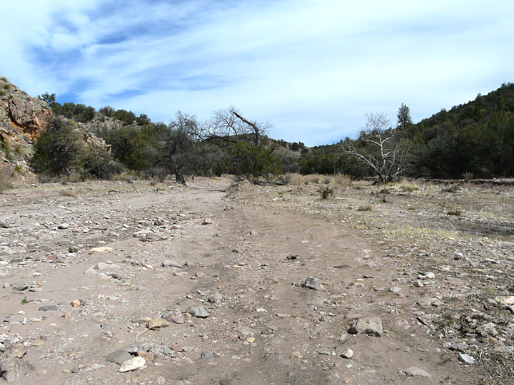
Looking east up the large intermittent stream dry wash of Little Dry Creek Canyon towards Soldier Hill in the distance, site of the ambush of Lt. Samuel Fountain and Troop C of the 34th US Calvary at Soldier Hill by the Apache Chief Ulzana and his warriors on December 19, 1885.
Yet the fact is that these scenes were more than just another artifice in fantasy of Hollywood fabrication. For the most part, the human dramas they portrayed were historically accurate, real-life events that played out over and over again during the golden years of America’s pursuit of its Manifest Destiny. A well-documented local example of one such event was the Massacre at Soldier Hill, which took place on December 19, 1885, when the Apache Chief Ulzana and about nine warriors ambushed Lt. Samuel W. Fountain and the 34-man strong C Troop of the 8th US Calvary while on patrol in the Mogollon Mountains. The ambush took place as the soldiers were coming up a steep grade on a small hill located on the north side of a dry wash called Little Dry Creek, located about 20 miles north of the Casitas. Taken completely by surprise, Lt. Fountain’s patrol suffered a loss of five men killed and three wounded before the calvary regrouped and counter attacked. As the soldiers advanced again, Ulzana and his band abandoned the high ground and slipped away to the west, heading down the dry wash of Little Dry Creek canyon about two miles before, quite likely, heading south up the dry wash of Eliot Canyon. From Eliot Canyon, they would have had access and safe passage out of sight into a subsequent maze of rugged dry washes, eventually leading them to the Mule Mountains, and from there, further south to a mining community near Carlisle, NM, where they killed three men and wounded several others on Christmas Eve.
As countless historical and archaeological research studies have documented, the dry washes of the Southwest Desert served as much-used corridors of transit and passage for both humans and wildlife alike throughout both historic and pre-historic time. And despite their dry, dusty, and seemingly insignificant and unimportant appearance, they constitute one of the most critical landform elements in the physical development, evolution, and ecologic sustainability of the arid and semi-arid landscape of the American Southwest.
DEFINING THE DRY WASH OF THE AMERICAN SOUTHWEST
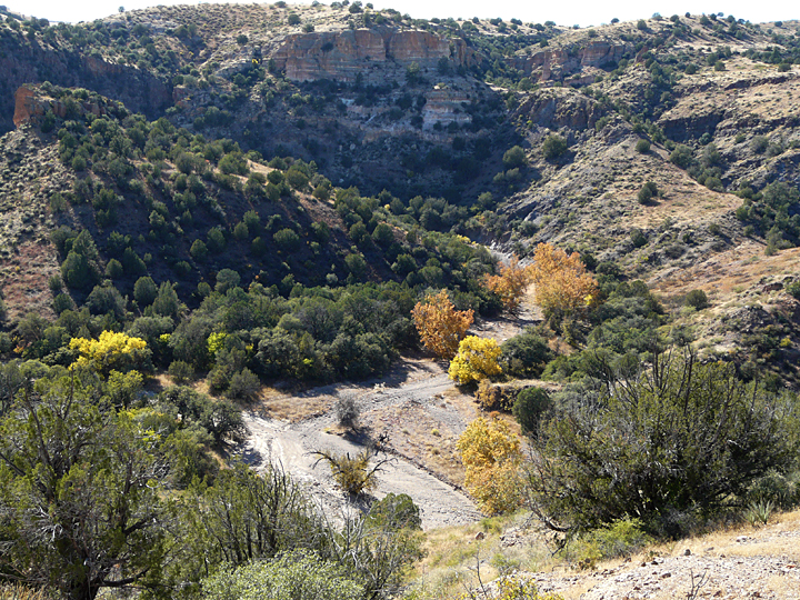
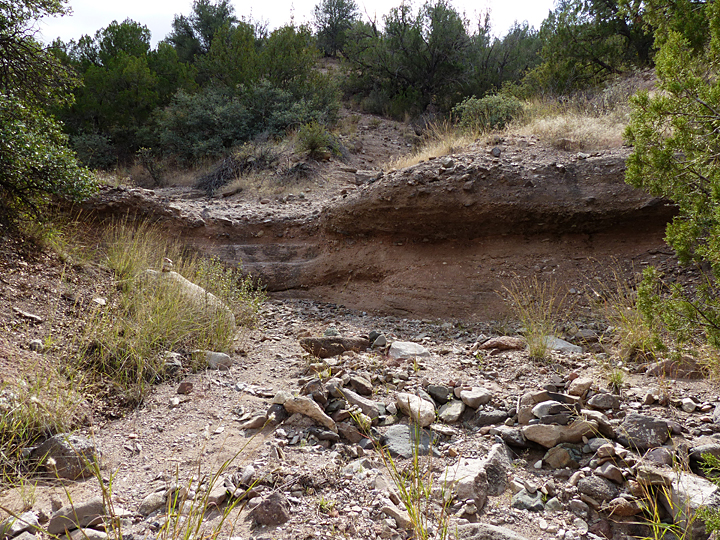
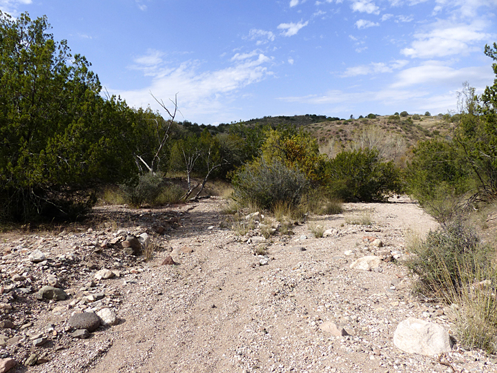
Looking downstream at the intermittent stream dry wash of Little Dry Creek, 2 miles from its confluence with the larger intermittent stream dry wash of Big Dry Creek which flows into the perennial stream of the San Francisco River.
The terms dry wash, wash, gulch, and arroyo are informal terms that tend to be used somewhat interchangeably on a regional basis both in written and spoken word by people living or working in the American Southwest. The simplest definition would be any watercourse or stream bed regardless of size that has flowing water only part of the year. A more definitive definition would take into account the scale of the watercourse both in terms of physical size and volume of water flow, as well as periodicity and duration of flow events1. In this context, a brief definition of the three types of streams found in the American Southwest is useful.
Perennial streams or rivers are those watercourses where water flows continuously all year. As any state map will show, perennial streams are an extremely rare feature in the arid and semi-arid Southwest American landscape. The Gila River, which exits the Mogollon Mountains and the Gila Wilderness five miles northwest of the Casitas, is a perennial stream.
Much more common are those watercourses classified as intermittent streams, where portions of the stream flow continuously only at certain times of the year, such as during seasonal snow melt, or flow from a local ground-water source such as a spring. Intermittent streams can vary in length from short to extremely long, often stretching for many miles across the landscape. Little Dry Creek with its headwaters in the Mogollon Mountains is a classic example of an intermittent stream, having a Spring flow from melting snow high in the Gila Wilderness and sporadic flows during the Summer Monsoon season.
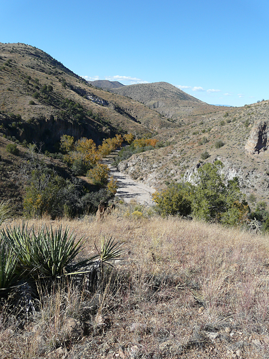
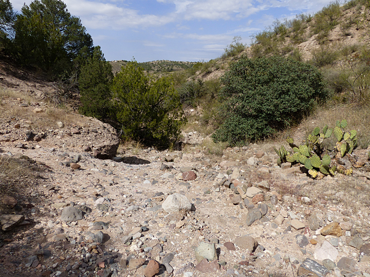
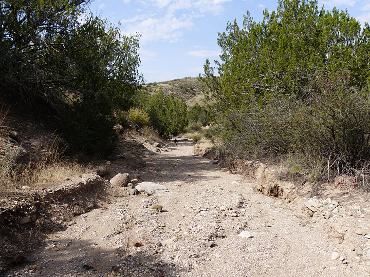
Looking southwest upstream at the ephemeral stream dry wash of Eliot Canyon which drains the vast mesa lands of Cactus Flat Country.
On a much smaller scale, and even more numerous, are those watercourses classified as ephemeral streams, where the water flows as runoff for only very brief periods of time in response to local precipitation. A defining technical characteristic of ephemeral streams are those watercourses where the water running in the channel is at all times separated from, and unrelated to, the ground water table.
In the arid and semi-arid American Southwest, both intermittent and ephemeral stream watercourses are referred to as dry washes, washes, gulches, or by the Spanish term arroyos.
In many ways, desert dry washes can be considered as “corridors of life” that form a branching network of sustenance across this arid and semi-arid landscape, providing water, food, and shelter to the indigenous animals, birds, and insects that live in and near them, as well as those that are just migrating or passing through. For humans, from pre-historic times up through the early pioneer days, in addition to serving as the best likely source of water, food, and shelter, they served as reliable primary foot and horse trails and eventually early roads that provided the easiest and most direct routes through this rough and mountainous arid landscape.
Today, in addition to serving in the above mentioned functions, these networks of dry washes are recognized as a critical and strategic natural resource that must be protected and preserved wherever and whenever possible. Not only are they invaluable, both in maintaining and sustaining a complex wildlife biodiversity increasingly threatened by encroaching ongoing human development, but also they constitute a strategic and critical resource for replenishing, preserving, and sustaining local and regional water supplies through the continual recharging of ground water aquifers throughout the arid and semi-arid Southwest.
AN EXPLORATION INTO THE NATURAL HISTORY OF THE DRY WASH TRAIL,
A SMALL DRYWASH AT CASITAS DE GILA GUESTHOUSES
As defined above, dry washes develop along both intermittent and ephemeral streams, and can vary in scale from short features less than a mile in length to landforms stretching for many miles across the landscape. Regardless of scale, however, upon close inspection most dry washes within a region will exhibit many similar physical and ecologic features along their course since they result from the same geologic, climatic, and hydrologic processes acting over hundreds to many thousands of years.
Dry washes are a common landform at Casitas de Gila and the surrounding area, where numerous intermittent and ephemeral streams actively dissect a rugged mesa and canyon landscape lying between the Gila River valley lowlands and the surrounding uplifted mountains of the Mogollon and Pinos Altos ranges within the Gila Wilderness to the north, the Burro Mountains to the south, and the western end of the Silver City Range.
The Dry Wash Canyon Trail
The Dry Wash Canyon Trail is one of several trails established within the Bear Creek Nature Preserve at Casitas de Gila Guesthouses to provide access and up-close and personal experience of the various diverse physiographic features, geology, biology, and ecology that are found along this portion of Bear Creek. Bear Creek is a major tributary of the Gila River, flowing westward some 25 miles from its headwaters at the old mining town of Pinos Altos, about 6 miles north of Silver City. In its upper reaches, the waters of Bear Creek are perennial, eventually becoming intermittent just downstream from the southern boundary of the Casitas de Gila land as the stream gradient (slope) decreases towards its junction with the Gila River.
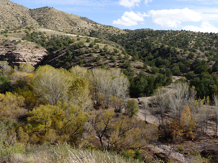
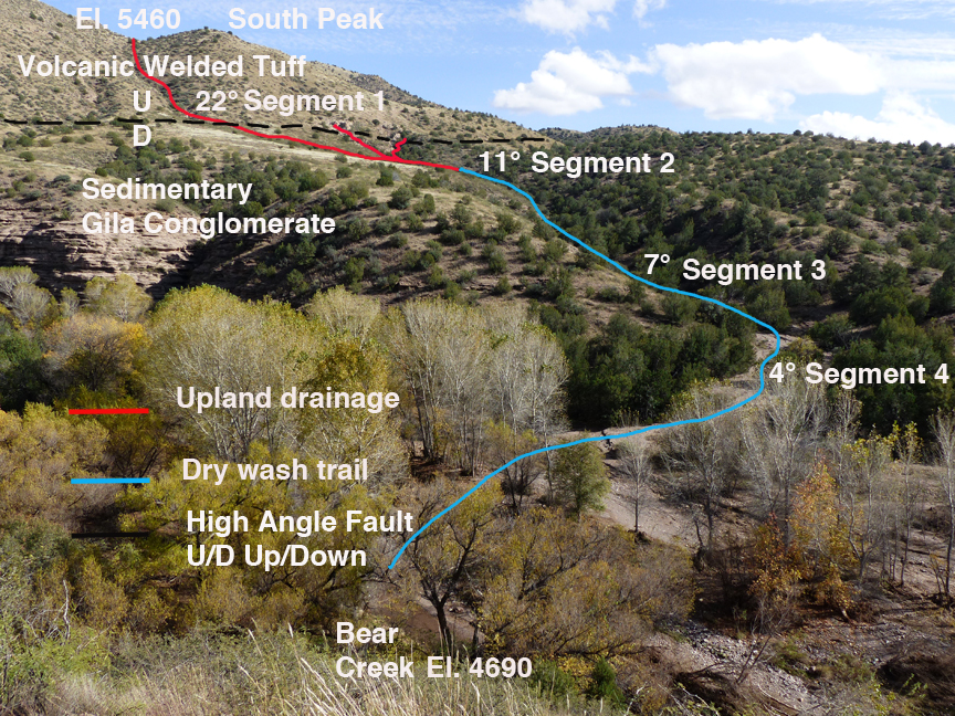
The Dry Wash Trail at Casitas de Gila follows an ephemeral stream dry wash canyon that drains the west facing slopes of North and South Peaks before emptying into the perennial stream of Bear Creek. A short distance downstream from the Casitas’s southern boundary, Bear Creek becomes intermittent.Major geologic features and 4 Segments of Dry Wash Trail Canyon
The Dry Wash Canyon Trail is located within the southern portion of Casita de Gila land. As is shown in Figure 1, the trail extends southeast and then east from Bear Creek up a short (0.7 mile) dry wash canyon that has been cut by an ephemeral stream acting over many thousands of years. The headwaters of the canyon’s drainage lies at an elevation of 5,460 feet in a small topographic saddle between North and South Peaks, just east of the Casitas. From there it eventually drops some 770 feet in elevation to its junction with Bear Creek at an elevation of 4,690 feet.
The course of the Dry Wash Trail Canyon can be divided into four segments based on the gradient or slope of the stream bed, the underlying geology, and the dominant and controlling geological processes, biology, and ecology. From top to bottom, they are:
1. Upland Drainage Basin (5,460 feet down to 5,040 feet in elevation)
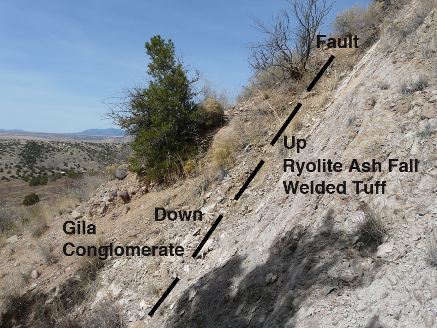
Contact between Segment 1 of the Upland Drainage Basin and Segment 2 as defined by a high-angle normal fault. Volcanic rhyolite ash fall welded tuff exposed on right (east) side of the fault and Sedimentary Gila Conglomerate exposed just to the left of the fault. Note thin soil with vegetative cover of native grasses, Pinon Pine, (with Scrub Oak behind it) and Honey Mesquite in upper right. Casitas de Gila Guesthouses can be seen in center distance.
Segment 1 of the canyon is steep, the bed of the watercourse having gradients of up to 26° or more and averaging 22°. In this segment, the main watercourse of the drainage basin has been cut into 28 million-year-old volcanicrhyolitewelded ash fall tuff bedrock by on-going active weathering, erosion, and downcutting. Only a thin skim of residual soil remains, held in place by a sparse cover of native grasses, and a scattering of native grasses, Sotol, Scrub Oak, One-seed Juniper, and Pinon Pine.
The lower end of this segment is marked by the presence of a major north-south trending, high angle normal fault. This fault separates the uplifted volcanic rhyolite welded ash fall tuff on the east side of the fault from the down-dropped 5-10 million year old sedimentaryfluvial Gila Conglomerate on the west side of the fault. The fault is extensive and can be traced across the western face of South and North peaks east of the Casitas to Turtle Rock on the north by the obvious visual change in slope of the mountainside from the average slope of 22° on the uplifted volcanic welded tuff, to an average 11° slope on the down-dropped sedimentary Gila Conglomerate.
2. Upper Canyon Dry Wash Erosion Within Gila Conglomerate (5,040 feet down to 4,840 feet)
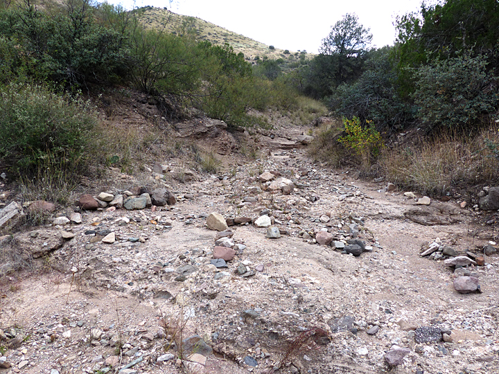
Segment 2 of the Dry Wash Canyon is cut down into the near-horizontal layers of the Gila Conglomerate, with the bed of the watercourse having an average gradient of about 11°. Along this segment, the floor of the canyon is characterized by extensive exposures of Gila Conglomerate as a result of on-going active weathering, erosion, and downcutting. Throughout this segment, all eroded sediment is transported downstream, except for the largest boulders (up to 6 feet in diameter) that have come to a final resting place in the lower part of this segment of the canyon. These large boulders are not being carried further downstream due to the reduction in velocity and energy of the flash-flood waters caused by the reduction in gradient of the watercourse bed.
Gila Conglomerate bedrock exposed Segment 2 in stream bed of canyon, scoured clean of sediment except for loose course gravel left on surface by earlier flash flood.Large lichen-covered pyroclastic boulder left on Gila Conglomerate bedrock exposed in stream bed of canyon in Segment 2. Extensive covering of lichens shows boulder has not moved in several hundred years. Origin of pyroclastic boulder is problematic in that there are no known exposures of this pyroclastic rock type currently exposed in the upstream drainage of this drywash.
Examination of the largest boulders in this segment reveal interesting facts:
The presence of extensive growth of large lichens on the rocks, with diameters of individual lichens up to 4 inches in diameter, suggests that these boulders have not moved for several hundred years or more, indicating a time in the past when the velocity and volume of flash-flood waters in the canyon were significantly higher; a velocity and volume which haven’t reoccurred since.
The composition of some of these boulders is neither rhyolite welded tuff nor Gila Conglomerate, but is that of a volcanic pyroclastic rock, a rock type which is not known to occur anywhere upstream in the bedrock exposed in the present canyon’s drainage basin below North and South Peaks. While there are such pyroclastic rocks a mile or so to the east and to the north in different drainage basins, these boulders present a dandy little geologic mystery just waiting to be solved!
Sides of the canyon in Segment 2 have a thicker cover of soil than Segment 1, in which the soil is derived from the weathering of the softer Gila Conglomerate as opposed to the harder rhyolite welded tuff. On the dry, south-facing slopes of the canyon, this soil supports a vegetative cover dominated by native grasses such as Side-oats Gramma, Honey Mesquite, Western White-thorn Acacia, and Oreganillo. On the wetter north facing slopes, Side Oats and other native grasses, Scrub Oak, One-seed Juniper, and Pinon dominate.
3. Middle Canyon Dry Wash Erosion Within Gila Conglomerate (4,840 feet down to 4,800 feet)
Looking upstream at a 6-ft. dry wash waterfall or pourover in Gila Conglomerate bedrock in Segment 3. This feature is formed when the downcutting of the dry wash stream bed encounters a layer of rock that is much more resistant to erosion than the rest of the bedrock. In this case, it is due to a better-cemented layer of much larger cobbles and boulders of volcanic rock.Looking downstream standing on top of and at the edge of 6-ft. waterfall or pourover shown in adjacent photo on left. All of these large cobbles and boulders are strongly cemented in the Gila Conglomerate presenting a highly resistant layer to erosion.
Segment 3 of the Dry Wash Canyon is cut deeper into the near-horizontal middle layers of the Gila Conglomerate, with the bed of the watercourse having an average gradient of about 7°. In this segment of the canyon, weathering, erosion, downcutting, and non-deposition still prevail, with all eroded sediment still removed from the stream bed by active downstream transport. Active erosion of the canyon floor dominates throughout this segment with little or no sediment remaining over the Gila Conglomerate bedrock.
Vegetation on the dry south-facing and wetter north-facing slopes of the Canyon is similar to that of Segment 2.
Looking downstream in the lower part of Segment 3. Here the Gila Conglomerate bedrock as exposed on both sides of the canyon is quite soft and easily eroded, leading to rapid down downcutting of the dry wash stream channel.
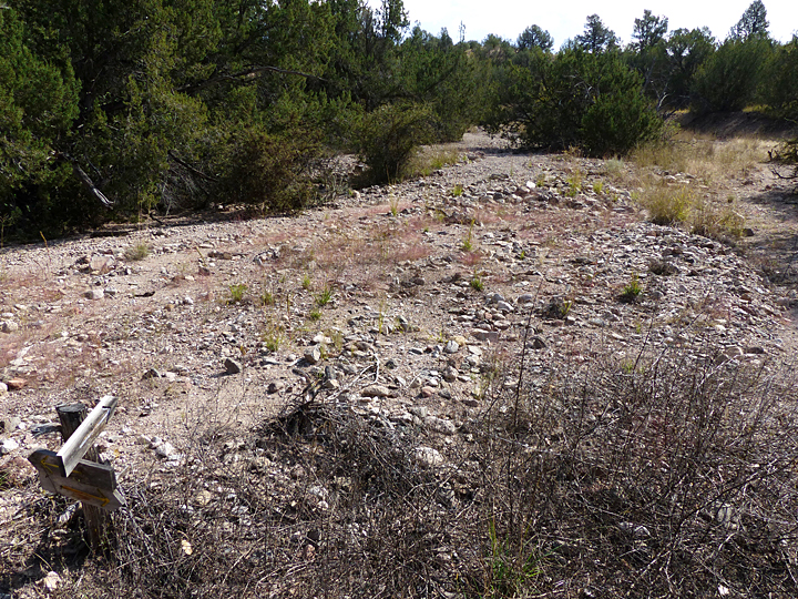
4. Lower Canyon Dry Wash Deposition Within Gila Conglomerate and Across the Bear Creek Floodplain (4,800 feet down to 4,690 feet at Bear Creek)
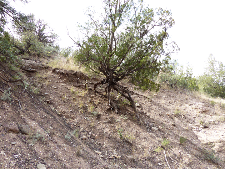
Rapid lateral erosion of the sides of the dry wash canyon takes place in the lower part of the canyon in Segment 4 where the Gila Conglomerate is overlain by deposits of loose, unconsolidated sediment. Here, this One-seed Juniper illustrates this lateral erosion by the exposure of approximately 3 vertical feet of the tree’s root system.
In Segment 4 of the Dry Wash Canyon, the slope of the bed of the watercourse decreases rather abruptly to a slope of about 4° as it approaches its junction with Bear Creek. This reduction in slope is a critical one in that it exceeds a threshold value where the dominant and controlling geologic processes operating within the canyon undergo a fundamental change. The change, in this case, is from an ephemeral stream of erosion that is actively eroding, downcutting, or in geological terminology, degrading its stream bed as described in Segments 1, 2 and 3; to an ephemeral stream of deposition that is actively building up, raising, or in geological terminology, aggrading its bed through the deposition of transported sediment as discussed below.
Layers of Gila Conglomerate exposed on the arid north side of dry wash canyon in Segment 4.Western White-thorn Acacia (Vachellia constricta) growing along edge of dry wash stream bed in Segment 4.
Looking east and upstream in upper part of Segment 4. South Peak can be seen in the distance.
Plants and wildlifes are much more diverse and abundant within Segment 4 than in Segments 1-3. This is because of the presence of water that is retained for varying lengths of time within the sediments covering the stream bottom following the periodic flash-floods that occur during the year. The distribution of the various plant species within Segment 4 is highly variable, depending upon the amount and time duration of the retained water, which in turn are a function of the thickness, size distribution, and location of these unconsolidated deposits of sand and gravel that cover the Gila Conglomerate bedrock. Characteristic plants of Segment 4 include Desert Buckthorn, Desert Willow, Squawbush or Skunkbush, Prickly Pear Cactus, Cane Cholla Cactus, Wait-a-minute Bush or Catclaw, Honey Mesquite, and Thread-leaf Snakeweed.
Looking downstream in Segment 4. In Segment 4, the Gila Conglomerate is buried under thick deposits of sand to gravel sediment carried downstream from Segments 1, 2, and 3.In the lower parts of Segment 4, the dry wash channel widens considerably. With each successive flash-flood the stream channel shifts back and forth over this low slope surface as rapidly deposited sediment blocks old channels and new ones are formed.
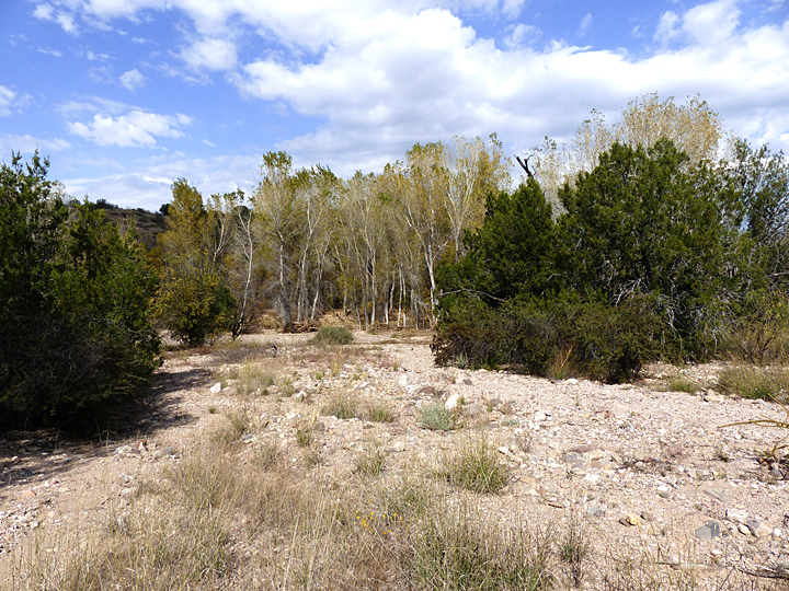
Here Segment 4 of the Dry Wash Trail Canyon approaches Bear Creek, flowing from right to left and out of sight just beyond the row of young, white-barked cottonwoods in the middle distance. Here it flows out across the Bear Creek floodplain depositing sediments carried downstream from Segments 1-4, which are carried away when Bear Creek floods.
GEOLOGIC PROCESSES AND FACTORS CONTROLLING THE FORMATION OF
THE CLASSIC LANDFORM OF THE DESERT DRY WASH
The development of the desert landform known as the dry wash as found in Segment 4 of the Dry Wash Canyon Trail at Casitas de Gila can be summarized by the following interacting geologic principles, processes, and sequence of events.
It is a fundamental principle that as the gradient of a stream bed decreases going downstream, it results in a corresponding reduction in the velocity and energy of the water flowing down the stream.
As the velocity and energy of the flowing water in a stream is reduced, this in turn results in a corresponding decrease in both the volume as well as grain size of sediment that can be transported by the stream.
Dry wash canyons are formed by ephemeral streams resulting from short-term precipitation events that produce short-lived, but high-energy, flash-floods within the canyon. In the Dry Wash Trail Canyon, the steep slopes of Segments 1-3 (22° to 7°) are characterized by having extremely high velocity and energy downstream runoff during precipitation events that cause erosion and downcutting of the stream bed, with all eroded material being carried downstream. When this transported eroded sediment reaches Segment 4, where the gradient of the canyon floor is much less (4°), the velocity and energy of the water is reduced to the point were the runoff water can no longer transport the sediment, causing it to be the deposited over the stream bed, burying any Gila Conglomerate bedrock exposed in the stream bed in the process.
In a dry wash stream system, however, it is important to note that the sediment deposition as observed in Segment 4 is typically only temporary, since these sediments may only remain in a particular place until the next flash-flood occurs. When the next flash flood does occur, depending on the magnitude and duration of the flood, the previously deposited sediments may be washed away, often right down to the bedrock itself, only to be subsequently replaced by new sediments in transport downstream that are deposited when the flood waters subside. Over long periods of time, the repeated bedload transport of this sediment downstream across the bedrock surfaces exposed during the periodic flash floods will slowly grind down the surface of the bedrock, resulting in a gradual lowering of the canyon bottom.
It is through these processes, then, that the classic and unique landform of the Dry Wash of the desert Southwest is formed and evolves. For many people, especially those new to the Southwest, the Dry Wash may go completely unnoticed or merely thought of as an unimportant, static landform where nothing ever changes. The true reality, however, is that the Desert Dry Wash is a highly dynamic and ever-changing landform that is critical to the long-term stability and sustainability of the life forms that make their home there.
Looking upstream from the Bear Creek floodplain at the lower end of Segment 4 of Dry Wash Trail Canyon. Note trail marker arrow in lower left.