IN THE MOGOLLON MOUNTAINS OF THE GILA WILDERNESS
in the Mogollon Mountains of Southwest New Mexico
THE MOGOLLON MOUNTAINS: ANCIENT LAND BORN OF FIRE
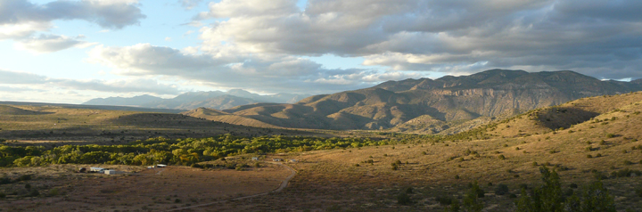
Just a few miles north of Casitas de Gila Guesthouses, the majestic Mogollon Mountains rise over 6,000 feet in elevation from the Gila River Valley to form an imposing 30-mile-long escarpment between the communities of Gila and Glenwood. The Mogollons are the highest mountains in Southwestern New Mexico with several peaks just under 11,000 feet: Whitewater Baldy at 10,895 feet and Mogollon Baldy at 10,770 feet. Most of the Mogollon Mountains lie within the vast 557,873 acres of the Gila Wilderness that cover some 872 square miles and offer hundreds of miles of hiking trails (US Forest Service map; .pdf file).

Geologically, the Mogollon Mountains lie in the southern part of what is known as the Datil-Mogollon Volcanic Field, a huge 10,000 square mile area at the southeastern corner of the Colorado Plateau Province consisting of numerous volcanic calderas that erupted during the development of the Basin and Range Province during the Late Tertiary Period (Paleogene and Neogene Periods). Almost all of the volcanic rocks comprising the Mogollon Mountains were formed during the Oligocene and Miocene Epochs, the largest volume resulting from the eruption of the Bursum Caldera, 28 million years ago. Following the eruption of the Bursum Caldera, extensive faulting and uplift occurred within the Mogollons between 20 and 15 million years ago resulting in the mountainous terrain that is seen today. It was also during this time period that the collapse of the Bursum Caldera took place, with the development of ring faults around the subsiding caldera periphery within which subsequent emplacement of veins of metallic minerals took place. It is these veins that would eventually yield the greatly-sought-after mineral deposits of gold, silver, copper, and fluorite that were actively mined in the Mogollons beginning around 1870.
THE MOGOLLON MOUNTAINS: ANCESTRAL HOME OF THE MOGOLLON CULTURE
The Mogollon Mountains have been a magnet for Native Americans for several thousand years, beginning with the nomadic gatherer, hunter, and eventually incipient agrarian Archaic Cochise Culture. The primary reason for this draw is because of the extreme diversity of landscape, wildlife, and plant life that is found there. Starting at the Gila River Bridge, at an elevation of 4,500 feet, it is only 25 miles north to the crest of the Mogollons at Mogollon Baldy at 10,895 feet. In that short distance the landscape passes through five ecologic zones:
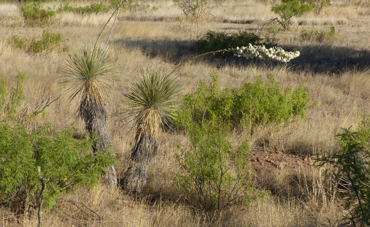
High Chichuahan Desert Zone: 4,500-5,000 feet. Characterized by Honey Mesquite, Wait-A-Minute Bush, Soaptree Yucca, and Cacti. Average precipitation between 10 and 15 inches.
Juniper and Pinyon Zone: 5,000-6,500 feet. Characterized by a slow-growing and drought-resistant “dwarf forest” of One-seed Juniper, Alligator Juniper, Pinyon, Gray Oak, and Desert Scrub Oak, plus Sotol, Prickly Pear Cactus, and Agaves. Average precipitation between 15 and 20 inches.
Pine and Oak Zone: 6,500 to 8,000 feet. Characterized as the lowest biome of true forest consisting of Ponderosa Pine and Gambel’s Oak, plus numerous shrubs and weeds from lower and higher elevations. Average precipitation between 20 and 25 inches.
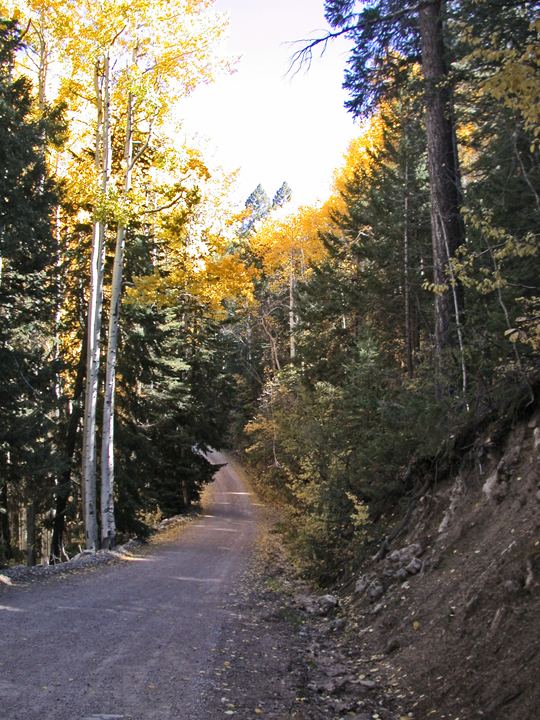
Fir and Aspen Zone: 8,000 to 9,500 feet. Characterized by extensive growth of dark-green Douglas Fir and white-barked Quaking Aspen, plus numerous shrubs and weeds from lower and higher elevations. Average precipitation 25 to 30 inches.
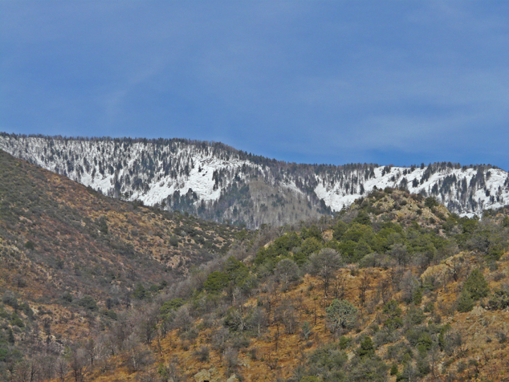
Spruce and Fir Zone: 9,500 feet – 11,000 feet. Various species of spruce and fir trees are the dominant trees with dense stands growing up to tree line and commonly interspersed with alpine meadows. Numerous other high-altitude shrubs, grasses, and weeds not found at lower elevations occur here. Average precipitation ranges from 30 to as much as 90 inches, with north-slope snow drifts lasting into June.
Thus, within this relatively small geographic area Native American cultures had access to an extremely diverse variety of food sources including an incredible number of edible plants and fruits, small and large game animals, birds, fish, and eventually, as the indigenous cultures evolved, bottom land suitable for agriculture along the Gila River and its tributaries, such as Bear Creek. In short, for pre-Columbian Native Americans, the Mogollon Mountains and the adjacent lowlands were truly a Garden of Eden. And they remain so today.
THE PRE-COLUMBIAN NATIVE AMERICAN MOGOLLON CULTURE
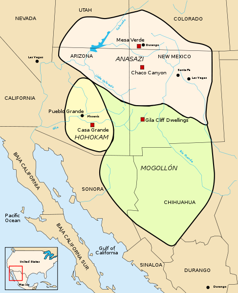
The Mogollon Culture was one of four essentially contemporaneous prehistoric Native American cultures that included the Anasazi or Ancestral Pueblo People, the Hohokam, and the Patayan cultures. These cultures thrived a huge area in the Southwestern United States and Northern Mexico that is sometimes referred to as Oasisamerica during the time period of roughly 1200-100 BC until 1300-1450 AD, a time span that has been subdivided into various eras under the Pecos Classification in the Four Corners area.
The large area in which the Mogollon Culture lived included Southern New Mexico and Southeastern Arizona in the U.S., plus Eastern Sonora and most of the Chihuahua states in Northern Mexico. Their cultural boundaries joined with the Hohokam Culture of Southeastern Arizona on the west and the Anasazi or Ancestral Pueblo Peoples Culture of the Four Corners area of Utah, Colorado, Arizona, and New Mexico on the north.
The Mogollon Culture is thought to have developed from an earlier nomadic Archaic Culture called the Cochise around 150 AD, at which time pottery was introduced, probably from the south in Mexico. Over the years, archeological investigations of the Mogollon Culture have led to the recognition of several chronological phases in the development of the culture1, including:
- the Georgetown Phase, 550 to 650 AD, characterized by deep, round pit houses for living quarters, development of San Francisco Red, Alma series plainwares and San Lorenzo red-on-brown pottery
- the San Francisco Phase, 650 to 750 AD, characterized by shallow rectangular pit houses with rounded corners, continued production of San Francisco Red and Alma Series plainwares, plus the development of Mogollon red-on-brown and Three Circle red-on-white pottery
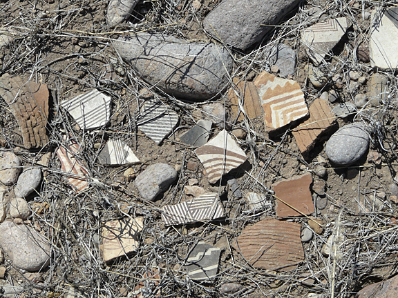
- the Three Circle Phase, 750 to 1000 AD, continued use of shallow rectangular pit houses with rounded corners, gradual replacement of San Francisco Red and Alma Series plainwares by Reserve Plain and Corrugated wares, plus development of the Puerco and Mimbres black-on-white pottery
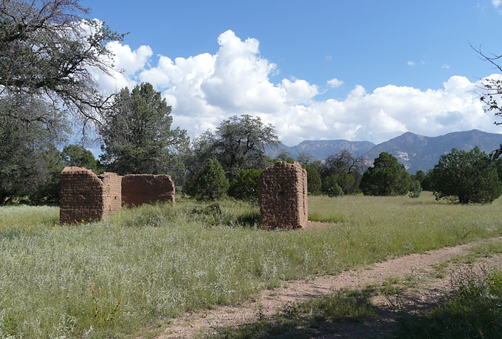
- the Reserve Phase, 1000 to 1125 AD, pit houses giving way to surface pueblos of rock and adobe, development of the Reserve black-on-white pottery
- the Tularosa Phase, 1125 to 1300 AD, rectangular surface pueblos now the preferred building mode plus development of cliff dwellings, introduction of Tularosa black-on-white and some polychrome pottery
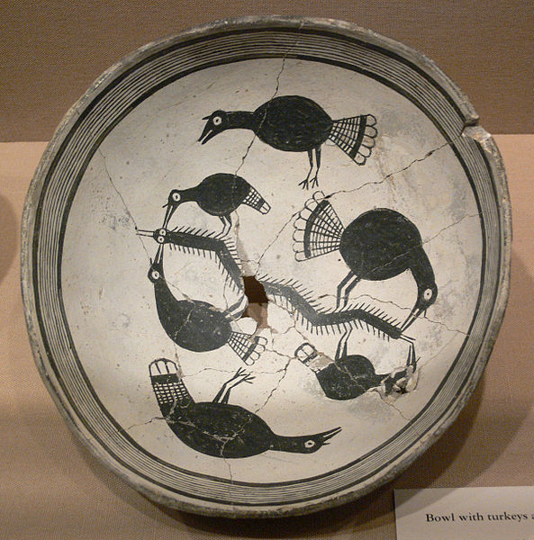
- the Mimbres Phase, 1025-1300, rectangular surface pueblos, some attaining large compounds of adjoining room blocks up to 150 or more rooms, development of the classic black-on-white Mimbres pottery which featured intricate geometric designs as well as figures of animals, birds, insects and humans
Starting in 1250 to 1300 and continuing until 1400 to 1450, the Mogollon people began to abandon the large pueblo complexes and disperse. Traditional explanations for this depopulation have centered on climate change, as evidenced by a 50-year period of extended and persistent drought that began in 1250. More recent investigations have considered outside pressures brought on by an influx of other Native American cultures with resulting conflict and warfare.
A HIKE IN THE FOOTSTEPS OF THE ANCIENT ONES
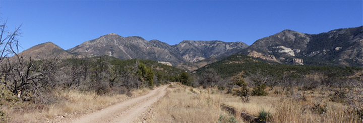
One of the most visually rewarding automobile excursions that can be taken in the vicinity of Casitas de Gila is Sacaton Road. This easily-traveled road (except during wet weather! Inquire first!) is a 25-mile county-maintained, public gravel road that runs west from the Gila River at the small community of Cliff along the south-facing escarpment of the Mogollon Mountains to intersect U.S. Highway 180 just south of the community of Pleasanton. To drive this road is to take a trip back in time to an earlier New Mexico essentially unchanged since pioneer days. For most of the journey the road crosses the southward sloping surface of Sacaton Mesa, a vast flat to slightly undulating expanse of grass-covered ranch lands dotted with juniper and pinyon. Beneath these grasslands lie thick deposits of alluvial sediment that were washed out of the Mogollon Mountains that rise up just a mile or so to the north of the road, over the last several hundred thousands of years.

To travel Sacaton Road is to travel a route in continual use for thousands of years. For the early Native Americans it was the obvious best north-south trail because of the gentle terrain, the abundance of game, and, of course, dependable water supply from the numerous creeks that flowed south out of the mountains. We now know that Coronado passed this way too, in 1540, led by Native American guides following in the footsteps of their ancestors. Over the next 300 years Sacaton Road became a primary route for the nomadic Apache, who were none too pleased when the Anglo miners and settlers began to use their trail at first by foot and horseback and later as an established stage coach and freighting route. In those years, to travel what was to become known as Sacaton Road was often a gamble of life or death.
Today, numerous trailheads leading into the Gila National Forest and the Gila Wilderness beyond are accessed along Sacaton Road, each offering unique and spectacular day hikes for those who seek the trail less-traveled in pristine nature.
A HIKE UP SACATON CREEK
Such a trail is the trail up Sacaton Creek, and the one our small band of overstuffed Turkey Day gluttons headed for following the annual day of decadent feasting.
There is a familiar sentiment or feeling that prevails no matter which one of the numerous trails one hikes in the Gila National Forest and Wilderness. Simultaneously, one may experience a mixture of solitude yet peacefulness, wildness with an overarching sense of the primeval, but yet, at the same time, an unexpected feeling of welcoming. For unlike many areas of the Rocky Mountain West, such as the high country of Colorado or Montana or Alaska where one can feel the unease of being the lonely pilgrim in an inhospitable foreign land, for most visitors, the Gila is a welcoming wilderness, a place to feel close to Nature, possibly as never before. Perhaps it is because of the lingering presence of those countless numbers of Native Americans, early explorers, prospectors, miners, pioneers, and ranchers who have all travelled the same trails up the same creek valleys and ridges in days gone by, each engaged in their own optimistic search for sustenance or riches or just the unequaled joy that accompanies any exploration of the unknown.

Thus, regardless of where you hike in the Gila, you are very likely not the first to have travelled there. For the Gila is a young and rugged terrain, an up and down volcanic maze of steep slopes and vertical volcanic precipices, where only the creek valleys and the intervening ridges can be travelled with relative ease. Traveling these trails, the signs of those who have passed before you are everywhere if you are observant and look for them. Or, as more often is the case, they will suddenly pop into your awareness when you least expect it, be it a line of thoughtfully-placed lichen-covered rocks, a bit of old mining equipment, an ancient campsite, a curious slab of petroglyphs placed for all to see, or a well-hidden, mysterious, and haunting pictograph.
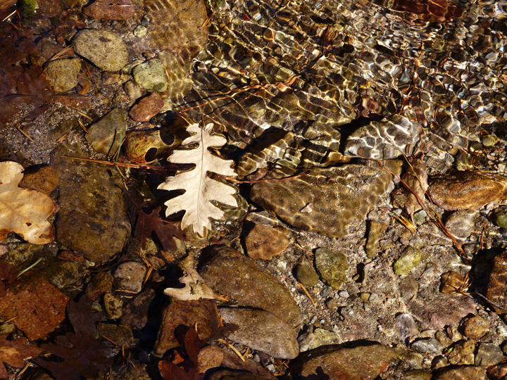
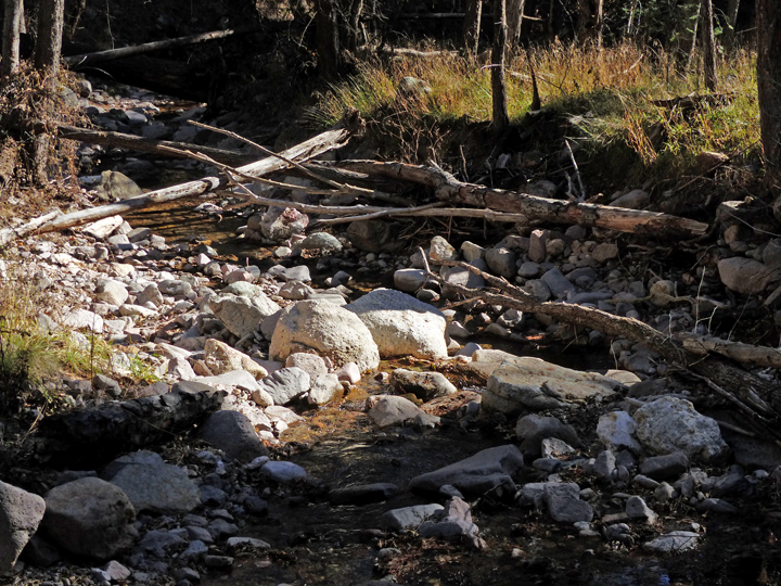
Most of the canyon bottom trails into the Gila follow small creeks that are perennial in their lower reaches. Except for the possibility of flash floods during the Monsoon Season or the brief time of high water during Spring runoff, these trails are a delight at all times of the year. Cool and shaded in the Summer and warm and protected in the Winter, these trails can be counted on for a great day’s hike.
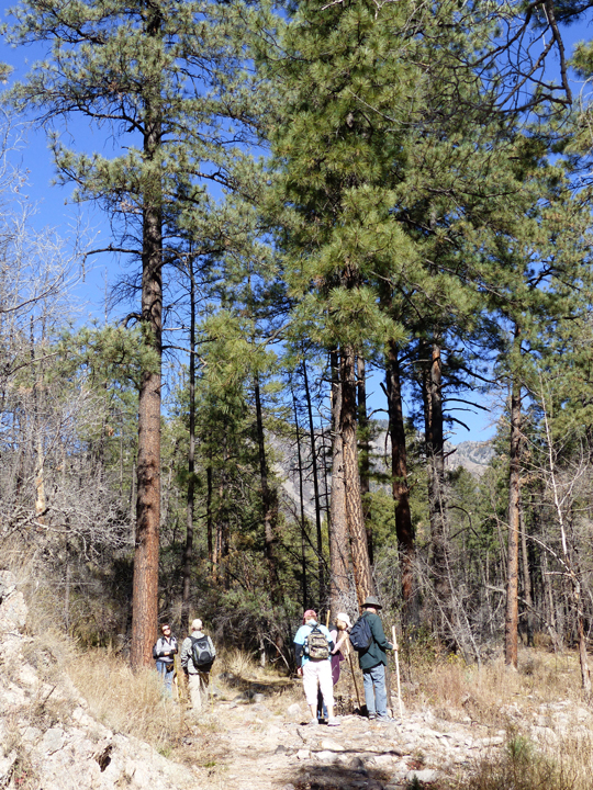
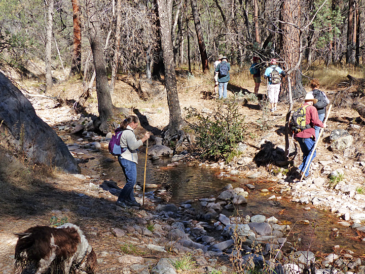
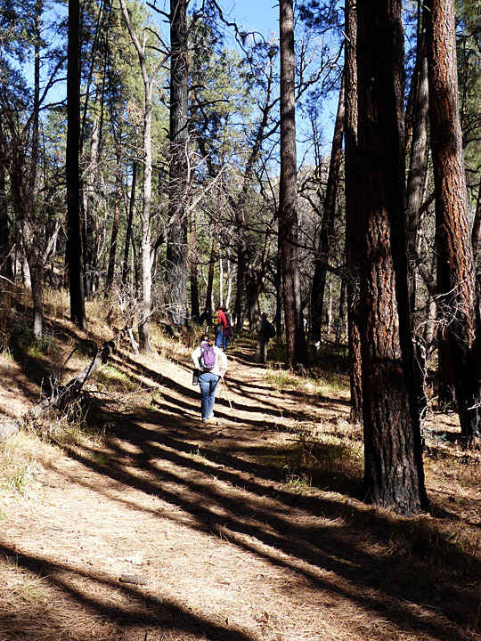
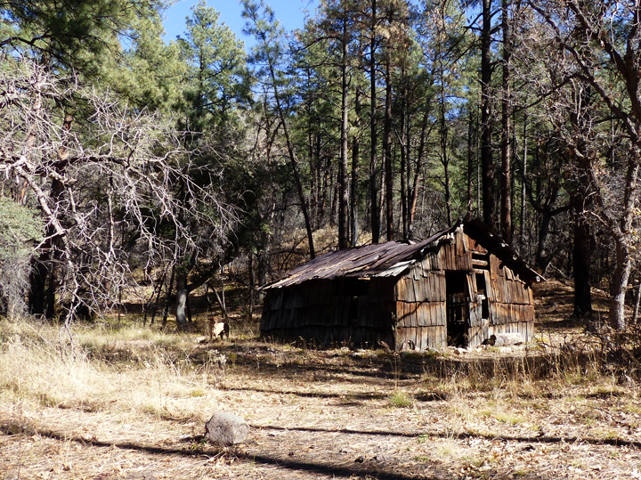
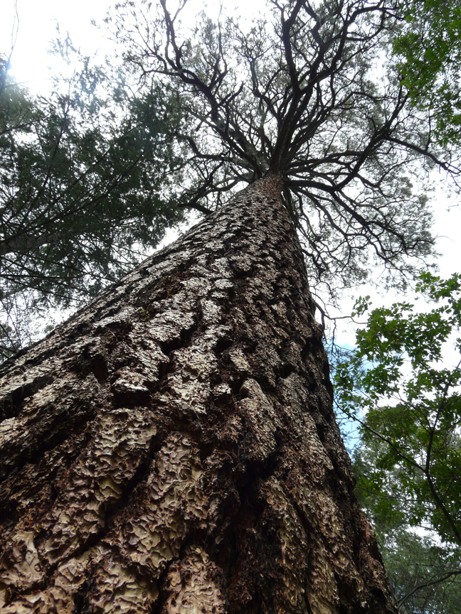
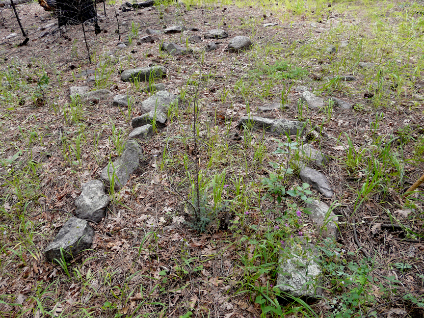
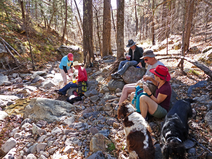
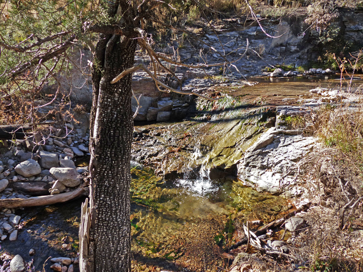
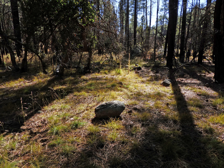
This year’s Day after Thanksgiving excursion was such a hike. Our group of 10 moved slowly up the creek, like so many cats, each being attracted to different things – a great photo here, a curious plant there, an unusual rock outcrop. And, of course, the progression slowed to a crawl whenever one of the trail’s unique features came into view — the hundred-year-old cabin with its hand-split cedar shake siding, the colorful waterfall, the gigantic, three-to-four-foot diameter ponderosas, the bedrock-lined pools of aquamarine and topaz waters, the almost hidden foundation of a Mogollon Culture Pit House. And so it went, until stomachs and hikers alike began to growl the familiar refrain – “I’m hungry… is it time to eat yet?”.
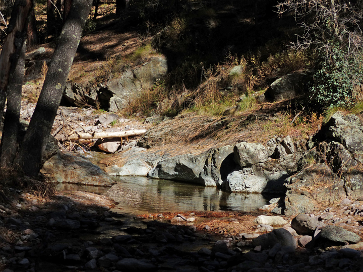
It’s funny, but great lunch spots always seem to materialize just at the right moment. No sooner did the growling begin then there it was … the perfect spot along the creek, with crystal clear pools lined with numerous slabs and boulders of white volcanic ash-fall welded tuff to sit on, all bathed in glorious warm shafts of light filtering down through the towering ponderosas overhead. Lunchtime!
But, then, just as some had started searching for that perfect personal lunching rock, came the words: “It’s up there, on that cliff! Do you see it?” “No!” “There, beneath that overhang … see it?” And then some of the group that had been here before began to climb up the steep, oak leaf and pine needle covered slope. Hmmm … lunch would have to wait.
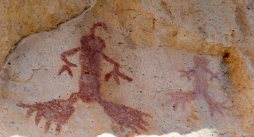
The pictographs were spectacular, painted in bright, vermillion red on a smooth joint surface of tan volcanic welded tuff in a sheltered nook in the cliff wall, illuminated perfectly by soft reflected light from the afternoon sun. There were two of them. One big and one small, both carefully drawn. “Why, they are frog people!”, someone said. Anthropomorphic frog people? Or just frogs? “But look at those feet, those huge five-toed hind feet and the small three-toed front feet … or hands?” Hmm… aliens maybe (hey! it’s New Mexico!)? How wonderful! How hauntingly mysterious! Then, of course, came the queries … “Why are they here?” “What could they mean?” “Who painted them and when?” And so the questions and comments went, until all the photographs were taken, and, unable to be put off any longer, the growling stomachs once more made their presence known, calling us down to lunch.
Now in late afternoon, the hike back down the canyon was a kaleidoscope of intense light and dark shadow as the Late Fall Sun arched ever closer to the west canyon rim. Silence reigned except for the steady murmur of the creek and the occasional jarring call of the raven. With the light now streaming in low from the west, every segment of the trail looked different, triggering the occasional fleeting uncertainty that every hiker has at sometime felt – “Is this the way we came this morning?” Rocks and trees passed by unnoticed, fully shadowed in the morning light, now glowed incandescently in the brilliance of the hard afternoon light, demanding one’s full attention. It was quite warm in the sun, but the shadows already held the chill that would soon fill the canyon. Very soon now the cold air would start flowing down the canyon from the headwaters of the creek on Sacaton Mountain 4,000 feet above.
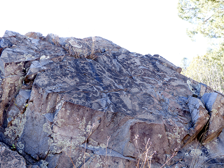
Arriving back at the trailhead, we lingered a long while, gazing at the surface of a massive rock outcrop we had discovered. The jumble of pictographs pecked into the desert varnish surface of the rock looked back at us in silence, their meanings cloaked in antiquity. Again, the lunchtime queries surfaced in the mind, only to fade away, unanswered as before. But unlike the pictograph frog people, purposefully hidden in that sheltered nook, these pictographs were there for all to see. Yet what once was clear to all that saw them, on this day their meanings were lost and attempts at deciphering them seemed futile. It was like being a visitor in a foreign land looking at faded posted announcements on an old building wall, all written in a language that one cannot read. More Gila mysteries. But with more study, maybe, just maybe next time …
It was time to go, the Sun was setting. But the memories of that day would live on and on.
