A Day Hike to the San Francisco Hot Springs and the Pristine Wilderness of the San Francisco River Canyon
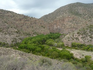
The San Francisco River is the largest tributary to the Gila River. Over its 160-mile course, it flows through some of the most scenic country in Southeastern Arizona and Southwestern New Mexico. Emerging from its mountainous headwaters near Alpine, Arizona, in eastern Apache County, the San Francisco flows eastward into New Mexico’s Catron County before looping south and then westward back into Arizona, where it joins the Gila River a few miles downstream from the historic town of Clifton in Greenlee County. Along its course, the San Francisco flows through diverse landscapes, alternating between sparsely settled, broad, open valleys, ranched and farmed since the pioneer days of the late 1800s; and narrow, rugged, deeply-incised canyons of pristine wilderness, once the familiar and well traveled thoroughfare of a hundred or more generations of Native Americans, but rarely visited today.
For much of its course through New Mexico, the San Francisco River flows through Gila National Forest land where various forest roads and trails provide public access points to the river within a rugged, mountainous terrain. But it is the last 15 miles of its New Mexican sojourn, just before reentering Arizona, where the San Francisco travels the most remote, isolated, and inaccessible segment of its journey. It is along this stretch of river that the San Francisco descends into a wild and pristine canyon comprised of an increasingly narrower and deeper series of tightly looped, entrenched meanders as it traverses an uplifted complex landscape of Miocene and Oligocene layered volcanic deposits over a thousand feet in thickness and some 18-26 million years old1.
It is at the upstream entrance to this deeply entrenched and narrow canyon that the San Francisco Hot Springs Trail is located.
THE SAN FRANCISCO HOT SPRINGS
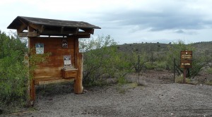
Of the numerous hot springs that occur throughout the Gila National Forest, the San Francisco Hot Springs group is one of the better known and more easily visited. The springs are located about 8 miles south of Glenwood, New Mexico (about 35 minutes northwest of Casitas de Gila Guesthouses). They are readily accessed from a half-mile long, county-maintained gravel road leading from US Route 180 to the trailhead for the San Francisco Hot Springs Trail. The trail to the hot springs is a 1.5-mile moderately-difficult hiking trail leading down into the magnificent San Francisco River Canyon where the springs are located.
The San Francisco Hot Springs consist of three separate groups of springs that are spread out along a quarter-mile of the river floodplain. The Upper Group of hot springs occur on private property, just north of the Gila National Forest boundary, and provide water to the privately-owned Sundial Springs. The Middle and Lower Group of springs are on Gila National Forest land immediately downstream from the Upper Group, and are accessible from the San Francisco Hot Springs Trail. Temperature of the springs is reported to range from 100 to 120°F depending upon the stage of river flow2.
The Middle Group of hot springs, sometimes referred to as “The Bubbles”, occurs against a rock cliff on the west side of the river, directly across from where the San Francisco Hot Spring Trail comes down to the river.
The Lower Group of hot springs occurs about 450 feet south of the Middle Group and is also located on the opposite side of the river, right where the canyon and river make a sharp turn to the west.
Like many of the hot springs found in the Gila National Forest, the San Francisco Hot Springs are located within the floodplain, at the bottom of a canyon, and are associated with a major fault, which in this case is the NNW trending Sundial Mountain Fault1, which crosses the San Francisco River canyon right at the Lower Hot Springs. The Sundial Mountain Fault is a high-angle dip-slip normal fault, dipping NE between 60 and 80°, and most probably serves as the conduit for the hot waters ascending from deep within the earth.
Because the San Francisco Hot Springs are located within the floodplain of the river, with several being right at the river’s edge, the exact location, size, and even the actual presence of the various springs will vary from year to year depending upon the number and magnitude of flood events on the river. During consecutive years of few or less-intense flood events, visitors to the springs will typically construct rock-lined pools around the emanating hot springs, which will serve as sitting pools until the next flood wipes them away, and the construction of new pools commences. However during the more severe flood events, it is often the case that the river channel will experience significant lateral movement, sometimes moving completely from one side of the canyon to the other. During these times, returning visitors may find that their favorite hot springs have been buried completely by the migrating river deposits, and then discover that new springs have emerged nearby.
It seems important to conclude this overview on the nature of the San Francisco Hot Springs by stating that a trip to the San Francisco Hot Springs is almost always a great hike even if the Springs themselves are not at their best for the reasons stated above. The scenery is gorgeous, the rugged and pristine San Francisco River Canyon downstream from the Springs is spectacular, intriguing, and challenging, and the bird and animal populations abundant and diverse. High water during the spring runoff (February through April), or the summer monsoon season (July through mid/late September) will sometimes limit trail access and prohibit river crossings, but during other months of the year it is not generally a problem for those interested in a longer hike down the river. For those looking for a short, easy to moderate, yet highly interesting hike through a diverse and unique landscape, a visit to the San Francisco Hot Springs area is highly recommended.
AN “INTERESTING” HIKE TO THE SAN FRANCISCO HOT SPRINGS
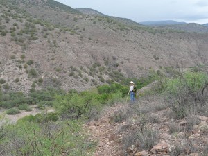
And thus it was, one late August day last month, that my good friend Bill Marcy and I decided to spend some time hiking and exploring in the San Francisco Hot Springs area and to check on the status of where the springs might be now. Bill had been there before, but I had not, despite having known of them and been told numerous times about how interesting the area is. While I am not a hot springs soaking enthusiast, as a geologist I find them fascinating and over the years have developed a strong interest in the geology and hydrology of their occurrence.
Now August, of course, is generally the peak of Southwest New Mexico’s Monsoon Season, but we weren’t at all concerned since the summer monsoon showers and thunderstorms, while they can be intense at times, generally don’t last more than half an hour before the sun comes out again to dry everything. Plus, according to the National Weather Service, the probability of rain for that day was only 40%. And so, without further thought, I packed my gear and lunch, drove over to Bill’s, where we loaded our two dogs, Big Red and Bower, into Bill’s truck and headed out.
A morning’s drive up US 180 towards Glenwood is always a gorgeous trip, with the ancient Burro Mountains rising to the south and the vast ramparts of the towering Mogollon Mountains of the Gila Wilderness to the north, glistening and beckoning in the morning sun. This morning was no different. At least it started out that way. However, after about a half hour’s journey, we noticed that the Mogollons were no longer glistening. In fact they were actually looking rather dark and foreboding, their higher peaks shrouded in rain clouds. Looking ahead towards the mountains surrounding our destination, the sky seemed to be even darker. But, no matter, the mountains and the open trail were calling and we were on our way!
Arriving at the San Francisco Hot Spring trailhead, we both noticed that the dark clouds were indeed now quite a bit darker, borderline black maybe, and seemed to have taken on a sort of roiling motion as well. But the call of the open trail was even louder now, so we hoisted our packs and headed out.
THE SAN FRANCISCO HOT SPRINGS TRAIL
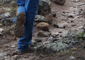
The first mile of the San Francisco Hot Springs trail follows a gently downhill sloping grass-covered arroyo, dotted with numerous Alligator Juniper (Juniperus deppeana), Piñon Pine (Pinus edulis), Honey Mesquite (Prosipus glandulosa), and Desert Scrub Oak (Quercus turbinella) trees. The trail itself is impossible to miss, having been worn down as much as a foot into a clayey, pebble-to-boulder strewn soil by numerous hikers, cows, wildlife, and rainwater runoff over the years. As the hike progressed, we noticed with some interest that clay minerals, not all that common over most trails in our area, here seemed to be the major constituent of the trail we were walking on. Once aware of this fact, we then noticed how much of the ground and trail surface showed extensive shrinkage cracks dried out by the summer sun. “Hmmm,” murmured the scientific voice quietly within, “bet this trail gets really sticky during a hard rain!”
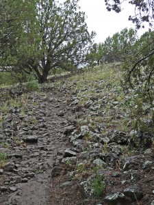
At about the one-mile mark the edge of the San Francisco River Canyon is reached, marked by a barbed wire stock fence with a convenient off-set stile provided for the trail to pass through. Once past the fence, the trail begins a steep, quarter-mile descent of about 200 vertical feet to the bottom of the canyon. Here, the loose clayey soil of the previous mile disappears and the trail switchbacks down a rock surface composed of hard, angular to sub-rounded cobbles and boulders of mostly dark gray volcanic andesite, which are set in a softer, fine-grained, light-colored matrix. It is an unusual rock type, and one that once exposed to weathering, produces a very rough and lumpy surface, not slippery at all, but providing excellent traction. Yet because of the way the encased cobbles and boulders protrude from the softer matrix, we quickly noticed that it can also be a somewhat treacherous surface that is easy to trip on, especially when one gets too engrossed in the magnificent view of the sheer, volcanic cliffs now lining the canyon ahead and below!
We were about halfway down this lumpy section of the trail when the first rain drops began to fall. It was also at this point that Big Red and Bower sensed the presence of the San Francisco River another 100 feet below. Water! How nice! … Our favorite thing! … Let’s go jump in! And off they went at a run, down the steep slope with their owners struggling to keep up, having just noticed with more than a little consternation that the river seemed to be running a bit high and swift.
We arrived at the river’s edge just as Bower charged in, only to discover that his point of entry is at a cut-bank of the river and he is immediately over his head. Sensing danger in the depth and strength of the current, Bower responded immediately to my frantic call, swam back, and climbed out. Big Red, the more mature and thoughtful red-bone hound that he is, had halted at the water’s edge, and watched all knowingly as his impetuous younger friend dragged himself up out of the dark swirling water and shook off. It is then we noticed that my normally white-and-brown Springer Spaniel has taken on the appearance of a very slimy, dark-chocolate-brown labrador retriever! The cause of the dark color of the water is immediately obvious. The effects of the Whitewater-Baldy fire (May-June 2012) within the Gila Wilderness were still making their way downstream … the normally crystal clear and lively waters of the San Francisco River were now a swirling, heavy, viscous torrent of very dark chocolate.
The first drops of rain had multiplied exponentially and it was now raining hard. We stood at the water’s edge where Bower had taken his brief swim and could see the Forest Service trail marker leading to the Middle Group of hot springs beckoning on the other side. But not today. The river was running very swiftly, and because we were unable to see the bottom (because of the suspended ash and soot), it was impossible to tell how deep it was. “Don’t even think about it”, advised the soft voice within.
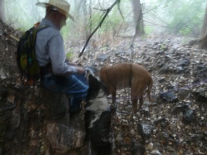
The rain had just turned from hard to harder. To the left of where we stood another Forest Service trail marker pointed south, down-stream through a mature riverine forest, towards the imposing cliffs we had seen during our descent into the canyon. This trail, we knew, would lead to a point where under normal water level conditions the trail would once again cross the river to the Lower Group of hot springs. Visiting those hot springs would have to wait for another day, but we hurried down the trail anyway towards the towering old growth cottonwoods (Populus fremontii) where we hoped to find some shelter from the approaching center of the thunderstorm cell, which by the telltale increasing frequency and decibel level of the thunder, would soon be upon us.
Anyone who has spent much time in the Southwest knows all too well the dangers of seeking shelter from a storm under old cottonwoods, particularly in the summer when they are in full foliage and their branches are heavy with water. Even in a moderate breeze on a fine sunny day their weak and brittle limbs can suddenly break off and fall to the ground, crushing anything below. But this was not a breeze; this was turning in a maelstrom of hurricane-force wind and rain. So we hurried by several big cottonwoods, taking notice of a one-foot diameter specimen freshly felled by some champion of the local beaver (Castor canadensis) population and an even more impressive and still standing, 16-inch diameter cottonwood that had been chewed all the way through except for a thin, 2-inch thick portion on one side. Now there was a real beaver trap … craftily set for unsuspecting humans!
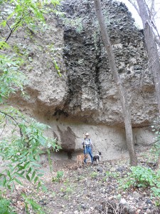
Just as the rain turned from harder to hardest, the trail passed by a small, narrow, and steep-sided arroyo with a gnarled Desert Scrub Oak (Quercus turbinella) spreading a thick canopy of non-lethal little branches that partly shielded the slightly undercut north side of the gravel bank of the arroyo. Thinking we could do no better, we decided to hunker down here to wait out the storm. No sooner was the decision made and we started to take off our packs when a lightening bolt struck the rocky slope of the canyon wall above us, less than a hundred feet away, with a simultaneous, resounding crack of thunder that made all four of us jump while simultaneously eliciting various yells, howls, and whimpers. The center of the storm had arrived. And along with it came an immediate change in wind direction and a crescendo of pounding rain that converted our once seemingly-protected spot into something akin to being trapped at the bottom of a giant waterfall.
But just as we felt we were going under for the third time, it was over. In a few minutes, the clouds began to brighten and it seemed that the sun was considering an appearance. Encouraged, we decided to follow the trail a little further. Soaked and chilled to the bone by the now 20 degree cooler temperature, the thought of moving was inviting.
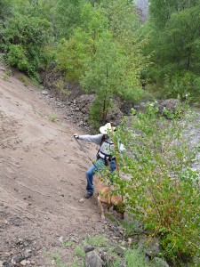
Just past the mouth of our small arroyo-of-little-relief, we were immediately confronted with a 50-foot section where the the trail suddenly disappeared, submerged by the swollen river that was now running hard up against a steep bank of very loosely consolidated, slippery, fine-grained silty material that was slowly eroding into the creek. After some serious cogitation of the situation, we convinced ourselves that the one-foot-wide rocky ledge that was slightly awash at creek level should enable us to make our way safely across. It did. Once on the other side, the trail re-emerged to once again enter a widened floodplain, substantially vegetated with mature cottonwoods and other trees. A short distance into this forested floodplain, the trail leads to an impressive and visually-striking vertical cliff of horizontal beds comprised of two very different and distinctive rock types. The lower 10 to 13 feet of the cliff consists of loosely consolidated fine-grained material, similar to what we had just passed over at the water’s edge, which has been eroded and weathered back at least a good 5 to 10 feet beneath an imposing overhanging layer of undetermined thickness composed of angular to sub-rounded, dark-colored cobbles and boulders of mostly andesite, set in a light tan, fine-grained matrix, very similar to what we had passed over on the steep portion of the trail on our descent into the canyon. Here was were we should have waited out the storm!
The skies had once again turned black and with the sound of thunder we knew another storm was approaching from the south-southwest. It was time to turn around and head back.The threat of another soaking was not the problem. The real concern was that the storms in the area seemed to be intensifying as the afternoon wore on and were tracking right over the western end of the highest section of the Mogollon Mountains, upstream and to the north of us, where the duration and amount of rainfall we knew would typically be greater and would soon be draining directly into the San Francisco River upstream from us. The likelihood of a flash flood was increasing by the minute, and because we were now downstream from the difficult spot we had just crossed at water’s edge, even a two- to three-foot rise in river level could prove to be very problematic. Knowing that having reached the spectacular cliff in front of us, we were now no more than a quarter-mile from entering the deeply entrenched, cliff-lined meanders of the San Francisco River, it was really tempting to continue. But it would have to wait for another day. Once more the little voice within was speaking out, “No! It’s time to go! Get the heck out of here!”
Examination of Ratte and Brooks’ 1989 geologic map of the San Francisco Hot Springs area1 shows that all of the San Francisco Hot Springs trail we had just traversed, from the trailhead to our turn-around point at the spectacular vertical cliff described above, is mapped as a locally derived, over-600-foot-thick fanglomerate deposit within the Gila Conglomerate Formation of Pleistocene to Miocene age, which occurs on the east, down-dropped side of the Sundial Mountain Fault described earlier. Had we continued our hike just a few hundred feet to the west of our turn-around point, we would have crossed the Sundial Mountain Fault and passed into the layered volcanic deposits of the Upper Andesite member of the Bearwallow Formation. This Upper Andesite Member, which has been dated at being 24.7 million years old, is the source of the fanglomerate deposit on the east side of the fault. The fanglomerate deposit was formed when the Upper Andesite deposits were being uplifted and eroded on the west side of the intermittently active Sundial Mountain Fault, and the eroded material was then being transported by streams to the east across the fault, where it was quickly deposited as coalescing alluvial fans in a rapidly subsiding down-dropped elongated basin or graben, between the northern Burro Mountains on the West and the Mogollon Mountains on the east. In the geological literature this basin is known as the Mangas Trench, and is one of several NW trending basins in the surrounding region of New Mexico and Arizona. Based on dating of various basalt deposits within these basins, the faulting along the margins of these down-dropped basins began shortly after 19 million years ago, and persisted intermittently for millions of years, allowing thick deposition of alluvial sedimentary deposits consisting mostly of conglomerates, fanglomerates, and sandstones derived from the uplifted surrounding mountains3.
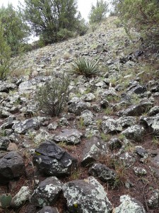
The initial part of the trip back out of the canyon went quickly as the next storm progressed slowly towards us. However once the top of the canyon was reached, our pace of travel slowed considerably as the trail wound its way uphill, across the mile of cobbles and boulders embedded in the heavy, clay-rich soil. The once firm, mud-cracked ground surface commented on during our hike in was not so firm anymore, and once again the little voice had been right. The going had now rapidly progressed from sticky to stickier, and finally to extremely sticky … And with every step, the size and weight of our cleated boots became larger and heavier, reminiscent of one of those dreams where no matter how hard you try, your feet and legs will hardly move and you can’t seem to get away or make any progress.
Eventually the homeward slog ended and we reached the trailhead, where several pounds of sticky clay was scraped off. After a short but most welcomed and enjoyable lunch, we loaded up the dogs and headed for home, just as the first drops of rain from the arriving thunderstorm began to splatter on the windshield. Indeed, it had been an “interesting” day.
DIRECTIONS TO THE SAN FRANCISCO HOT SPRINGS
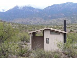
The San Francisco Hot Springs trailhead is located at the end of a one-half-mile long, county maintained, all weather, gravel access road that leaves US Route 180 around Mile Marker 58, a point 6.5 miles south of the road entrance to the Glenwood District Ranger Station and 5 miles north of the turnoff on US 180 for the Leopold Vista Overlook rest area. GPS coordinates for the access road turnoff leading to the trailhead are N33°14.025′, W108°51.651′. A newly-constructed restroom building is available at the trailhead, but water is not.
REFERENCES
1. Ratte, J.C. and Brooks, W.E., 1989, Geologic Map of the Wilson Mountain Quadrangle, Catron and Grant Counties, New Mexico: U.S. Geological Survey, Geologic Quadrangle Map GQ-1611.d
2. Bischoff, Matt C., 2008, Touring New Mexico Hot Springs, 2nd edition
3. Houser, B.B., 1994, Geology of the Late Cenozoic Alma Basin, New Mexico and Arizona, New Mexico Geological Society Guidebook (download .pdf file), 45th Field Conference, Mogollon Slope, West-Central New Mexico and East-Central Arizona


