Hiking the Mogollon Box Trail — Gateway to the Gila Wilderness
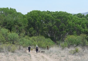
A short six miles upstream from the communities of Gila and Cliff, New Mexico, the Gila River exits the soaring mountains and rugged canyons of the Mogollon Range of the Gila Wilderness within the Gila National Forest to begin a more leisurely, meandering flow westward across the verdant Gila Valley. This transition from a narrow, steep-sided, volcanic rock-lined canyon to the wide alluvial floodplain of the Gila Valley, with its magnificent bordering groves of ancient cottonwoods, sycamores and willow, is as abrupt as if it had been carved by some gigantic knife of Nature. Which, in one sense, it has, for it is here that the Gila River crosses a major east-west fault separating the uplifted terrain of the Mogollon Mountains and the Gila Wilderness from the down-dropped lowlands of the Gila Valley. This very special natural area is known as the Mogollon Box or the Upper Box of the Gila, the Gateway to the Gila Wilderness.
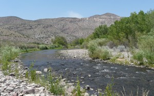
For the hiker and nature enthusiast, the Mogollon Box Trail offers a unique opportunity to connect with an amazing diversity of topography, geology, fauna, and flora for several miles along the pristine waters and surrounding riverine forest of the Gila River. Adding to the complexity of this landscape is the presence of Mogollon Creek, which has its confluence with the Gila at this transition spot, after flowing some 20 miles in from the west, along the base of the Mogollon Mountain escarpment and its headwaters high in the 10,000- to 11,000-foot mountain peaks of the Gila Wilderness.
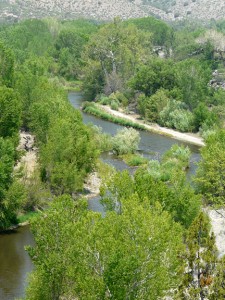
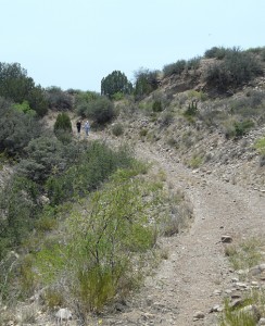
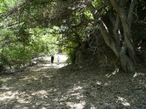
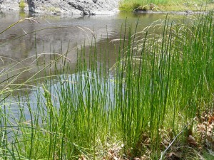
The Mogollon Box Trail begins by traversing a 1,200 acre parcel of land known as the Gila Riparian Preserve. Originally a privately-owned farm and ranch, bordered on all sides by the Gila National Forest, this land is now owned by the Nature Conservancy and is open to the public (map available). Animal and bird life are prolific within the Gila Riparian Preserve because of the wide diversity of available habitat, ranging from the year-round, cool, clear flow of the Gila River through quiet, deep pools and swift, gravelly shallows; to active floodplain deposits of sand and gravel, interspersed with numerous natural levees along old river channels now covered with young riverine forest; to marshy, abandoned channels and cutoffs; to sequentially elevated levels of older vegetated river terraces; to gently-rolling upland high-desert hills and ridges cut by dry-wash arroyos; to shear cliffs and ledges of volcanic bedrock … all to be found within a narrow riparian zone extending a few hundred feet either side of the Gila River itself.
Literally hundreds of bird species frequent the Mogollon Box over the course of the year because of the dependability of food and water, including many rare and endangered species, such as the Southwestern Willow Flycatcher (Empidonax traillii extimus). Within the river and riparian zone, numerous fish, amphibians, reptiles, and mammals are found, such as the common Smallmouth Bass (Micropterus dolomieui), the boistrous Canyon Treefrog (Hyla arenicolor), the rare Gila Monster (Heloderma suspectum), and the shy Coati (Nasua narica). In addition to these, sightings of more typically upland species are common, such as Mountain Lion (Pumua concolor), Black Bear (Ursus americanus), Bighorn Sheep (Ovis canadensis) and Mule Deer (Odocoileus hemionus), as they make their way down from the surrounding hills and mountains to drink, forage and prey. As always, best sightings will be made during the hours of early morning and late afternoon to dusk.
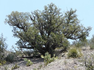
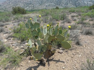
The plants of the Gila Riparian Preserve are equally as diverse, ranging from gigantic ancient, old-growth Freemont Cottonwood (Populus fremontii) and Arizona Sycamore (Platanus wrightii) towering over the flood plain, to the arid, ancient, elevated river terraces and upland hills with their sparse cover of Engelmann Prickly Pear (Opuntia engelmannii), Honey Mesquite (Prosopis glandulosa), and One-seed Juniper (Juniperus monosperma).
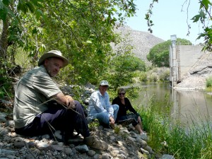
With the exception of a short climb up and over a 100-foot-high ridge composed of ancient river outwash and flood plain deposits (encountered just after crossing Mogollon Creek), the first 2 miles of the trail is within the Gila Riparian Preserve and is very easy to hike and follow as it lies entirely along the Gila River floodplain, following an old road (closed to public vehicles) to the US Geological Survey Gaging Station on the Gila River. The gaging station is an interesting feature itself, having measured stream flow on the Upper Gila River on a daily basis since 19271. About 200 feet beyond the Gaging Station, the trail fords the river, whereby the Mogollon Box Trail soon enters lands of the Gila National Forest.
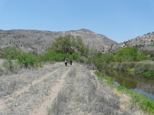
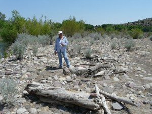
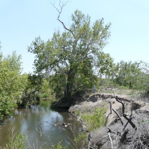
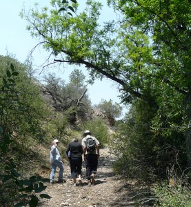
Once the first ford is crossed, the Mogollon Box Trail can become much more challenging both physically and mentally depending upon the season of the year and effect of recent floods. Often, especially in late Summer or after Spring floods, the condition of the trail degrades from faint to non-existent as it follows the Gila River upstream along a narrow floodplain through a series of deeply-incised meanders within steep-walled canyons where heavy riverside vegetation brush may require the breaking of new trail, and steep, rocky cliffs to the water’s edge demand frequent fording of the river. While it is possible to hike from the Gaging Station upstream about three miles to access Turkey Creek Road (Grant County Rd. G2-24, FR 155) at Brushy Canyon or Brock Canyon, it must be stated that due caution must be taken if this portion of the trail is attempted. While beautiful as only the Gila River can be, this stretch of the river is essentially pure wilderness – isolated and rarely travelled. It is only doable at certain times of the year, depending on the height of the river, and is especially problematic during Spring runoff and the Summer monsoon season (end of June through mid-September) when flash floods are common. Local knowledge on existing conditions should always be solicited before undertaking this part of the trail.

Directions to the Mogollon Box Trail
From the community of Gila take NM 211 towards the community of Cliff. Approximately one-half mile after passing over the Gila River bridge, turn right on Box Canyon Road (NM 293). Follow this road 5-1/2 miles to enter the Gila National Forest where the road becomes a county-maintained gravel road. After about 1 mile the road will drop down off an old river terrace to the modern Gila River floodplain. As soon as the road reaches the bottom of the slope, park on the left (GPS Coordinates N33° 02.665′, W108° 31.935′). Begin walking due north at this point along an old dirt path/4×4 roadway where, in about 100 feet, you will encounter a chained gate with an opening through the fence just to the right of the gate. This is the southern boundary of the Nature Conservancy’s Gila Riparian Preserve. Walk through the opening and continue, following the old roadway for about 2 miles to the USGS Gila River Gaging Station (GPS Coordinates N33° 03.691′, W108° 32.243′). The old roadway is the trail.
Directions to the US Forest Service Mogollon Box Recreation Area (at the beginning of the Mogollon Box Trail)
At the place where you park your car you are on Gila National Forest land. You will notice that at this point the road that you drove in on turns abruptly east and then south with a maze of numerous paths/primitive roadways leading off of it towards the river. The main road continues south for about 1/2 mile, providing access to the USFS Mogollon Box Recreation Area for walking, swimming, camping, and picnicing along the Gila River on Gila National Forest land. On a hot summer day it serves as the perfect local swimming hole. An outdoor toilet will be found along the southern access road.
REFERENCES:
1. Geomorphology of the Upper Gila River Within the State of New Mexico, Mussetter Engineering, Inc., June 2006


