SEARCHING FOR CRYSTALS AND HISTORY IN THE
GILA FLUORITE DISTRICT OF SOUTHWEST NEW MEXICO
THE GILA FLUORSPAR DISTRICT AND THE GILA FLUORSPAR MILL
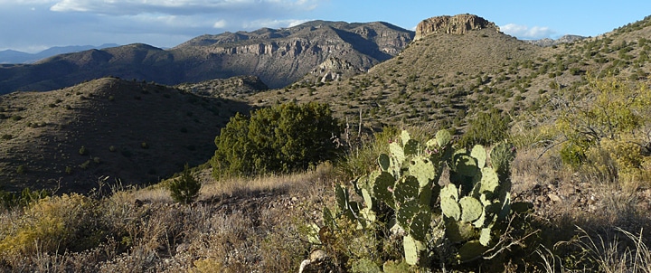
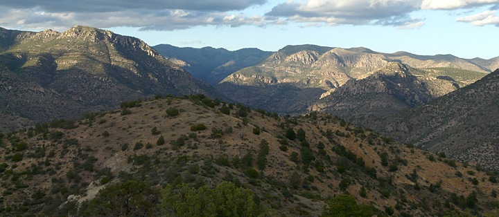
It was June of 1943 and the United States was now deep into its second year of involvement in World War II. All projections indicated that demand for fluorspar, an ore of the mineral Fluorite and an essential ingredient in the manufacture of steel, would continue to rise dramatically as the war continued. Accordingly, the Metals Reserve Company of Washington D.C, contracted International Minerals and Chemicals Company to build and operate a mineral processing mill in Gila, New Mexico. The purpose of this mill was to stimulate additional production of the fluorspar ore that was being mined in what is known as the Gila Fluorspar District about seven miles north of Gila in the foothills of the Pinos Altos Mountains.1
The Metals Reserve Company was one of eight subsidiary companies set up during WW II by the Reconstruction Finance Corporation, an independent agency of the United States government that was established by Congress in 1932. Like the other seven subsidiary companies, Metals Reserve Company was chartered with the objective of stimulating development of alternative sources of essential and strategic materials during the war.
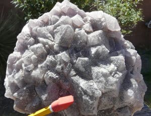
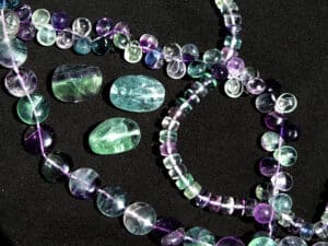
Fluorspar is the term used for ore that contains commercial quantities of the mineral Fluorite, which has the chemical composition of Calcium Fluoride, CaF2. Fluorite has a hardness of 4; a specific gravity of 3.18; and belongs to the Isometric crystal system, commonly occurring in nature as cubic and octahedron crystals. The mineral is vitreous or glassy in appearance, may be clear but is generally translucent, and comes in a wide variety of colors, most commonly light green, yellow, bluish-green and purple.
With the completion of the Gila Fluorspar Mill in 1943, and the availability of a dependable local market for the raw, unprocessed fluorspar ore, the objectives of the Metals Reserve Company were realized. Mining of fluorspar from the existing local deposits increased dramatically, along with extensive prospecting and identification of additional potential deposits in the surrounding area.
Fluorspar ore is categorized into three grades based on the percentage of calcium fluoride content: Metallurgical grade, 60-85%; Ceramic grade, 85-95%; and Acid grade (97%). The largest volume of fluorspar goes into metallurgical usage. Because of its essential use in the manufacture of steel and aluminum, fluorspar was classified as a Strategic Ore Mineral during WW II. Approximately 8 to 10 pounds of fluorspar is used in the open-hearth process to make one ton of steel, in which the fluorspar functions to make the slag more fluid, and to desulfurize the molten metal. In the manufacture of aluminum, fluorspar is used to make hydrofluoric acid, HF, an essential ingredient in the manufacturing process. Hydrofluoric acid was also used extensively during the war in the manufacture of catalytic compounds used in the refining of petroleum products to make gasoline. Ceramic grade fluorspar is used in the manufacture of glass, enamels and cooking utensils. In recent years fluorite has found a growing niche market in jewelry and stone carving.
With the completion of the Gila Fluorspar Mill in 1943, and the availability of a dependable local market for the raw, unprocessed fluorspar ore, the objectives of the Metals Reserve Company were realized. Mining of fluorspar from the existing local deposits increased dramatically, along with extensive prospecting and identification of additional potential deposits in the surrounding area.
The Gila Fluorspar Mill was located just east of where Bear Creek crosses NM 211 just south of the village of Gila. From its startup through the end of the war, the Gila Mill bought, stockpiled and processed approximately 50,000 tons of fluorspar ore, all of which was mined from a number of small deposits discovered, prospected, and subsequently claimed within the Gila National Forest by mostly local residents of Gila and Cliff area. While prospecting was extensive in the area and numerous new claims were recorded, only three mines yielded significant tonnage that was processed at the Gila Mill: the Clum Mines, the Foster Mine and the Victoria Mine. Combined production from these three mines in 1944 was about 50 tons per day, with most of it coming from the Clum Mines.
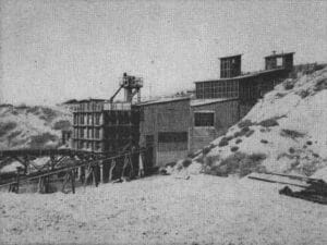
The processing capacity at the mill was about 14 tons an hour, 15-1/2 hours a day, 6 days a week, or about 5,400 tons a month, producing about 95 to 100 tons a day of metallurgical grade concentrate averaging 85% calcium fluoride. Most of this ore concentrate was then shipped to the Colorado Fuel and Iron Company steel mill in Pueblo, Colorado. Using a figure of roughly 50% recovery of 85% grade concentrate from the raw ore processed at the Gila Mill, and considering that most of the concentrate was used in the manufacture of steel, it is interesting to consider that mill concentrate derived from the Gila Fluorspar deposits would have contributed the production of up to 5 million tons of steel for the war effort! After the end of WW II, fluorspar mining in the Gila District gradually ceased, except for a brief period in the early 1970s, when the demand and price of hydrofluoric acid for domestic use once more stimulated fluorspar mining in the area.
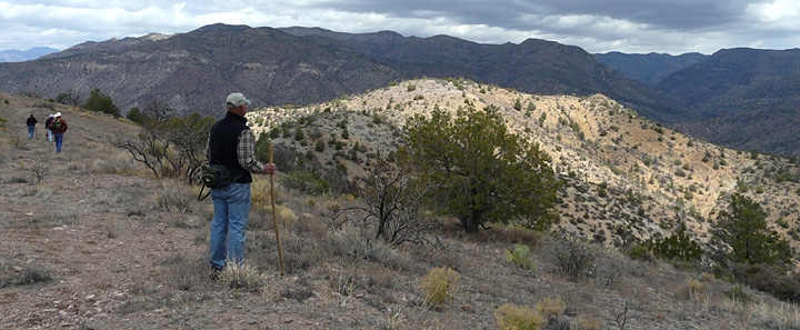
Today, all of the mines, prospects, and claims within the Gila Fluorspar District are long abandoned, with the land ownership belonging to the Gila National Forest. Like so many of the numerous small mines that flourished in this area in times past, these mines and prospects are mostly forgotten and rarely visited except for the occasional rockhound or hiker. Both novice as well as serious rockhounds will find the Gila Fluorspar District a real treat to visit, providing an excellent opportunity to find some nice specimens and crystals of fluorite. For those who enjoy hiking, coupled with an interest in exploring and history, the area offers hikes for all capabilities and interests. These hiking opportunities range from short, easy walks along old roads with spectacular views of the Gila Wilderness, to challenging, off-trail, cross-country trekking in extremely rugged, pristine terrain for the experienced and properly-equipped outdoor enthusiast.
EARLY MINING IN THE DISTRICT
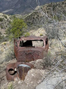
While the most intensive mining, prospecting, and production in the Gila Fluorspar District occurred during the World War II period, the initial mining in the District began some 60 years earlier with the discovery and subsequent development of two deposits now known as the Foster Mine and the Clum Mines in the 1880s. The Foster Mine began operation in the early 1880s and is considered either the oldest or second oldest fluorspar mine in New Mexico, the other contender being the the Burro Chief Mine in the Burro Mountains, 15 miles to the southwest. Little is known about the Foster Mine other than it was operated by Apoloinario Ogas and Pedro Carajal, who, like the operators of the Burro Chief Mine, sold their production to the silver and lead smelters in Silver City, 30 miles to the east. In those days Silver City was the classic booming, thriving mining town of the Old West, serving a never-ending flood of miners, merchants, and settlers that were pouring into the area on a daily basis, hoping to capitalize on the riches of silver, gold, copper and other minerals coming out of the mountains surrounding the town. In these heady, early days of mining and processing, few production records were kept, however it is reported that the Clum Mine was also producing fluorspar in the Gila District about a mile east of the Foster Mine about 1885. Production from both the Foster and Clum mines continued into the early 1900s with both mines supplying fluorspar to the war effort during World War I and into the 1930s, and then reaching their peak production during World War II. Apparently the Foster Mine was not worked after the late 1940s, but the Clum Mines did reopen for a brief time during the 1970s.
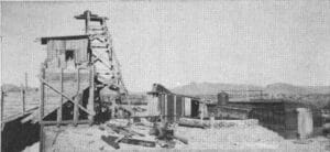
Eventually, increasing production at the Foster and Clum Mines lead to the construction of a primitive road into the Gila Fluorspar District to facilitate operations and haulage of the raw ore out of the area. Significant improvements to the road were made during the 1930s and 1940s and in the decades that followed. Today this road is known as Turkey Creek Road and Forest Road 155, a primitive but usually passable forest road that extends some nine miles into the Gila National Forest from the Gila Valley at the end of State Road 153 to terminate at the Gila River, about 3 miles downstream from the Gila Wilderness. The road is maintained by the County on a semi-regular basis, and except for brief periods during the Monsoon Season (late June/early July until early September) provides good access into this magnificent part of the Gila National Forest for hiking, rockhounding, fishing, hunting, and camping. In recent years most of the roughest spots on the road have been upgraded so that while high clearance is still advisable for vehicles, four-wheel drive is not necessary.
A VISIT TO THE FOSTER MINE
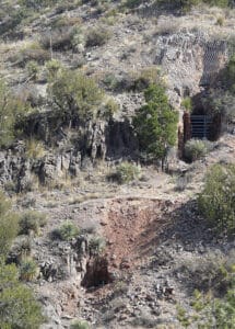
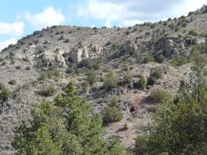
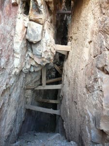
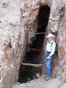
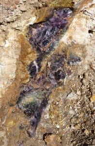
The Foster Mine is located a short distance off Turkey Creek Road and makes for an interesting day’s outing for hiking and rockhounding in spectacular surroundings. The mine is reached by a short hike along the old mine access road and affords the visitor the opportunity to search fluorite crystals and colorful specimens of fluorspar ore, as well as to examine the workings of a typical small mining operation. The old workings of the mine are extensive, stretching about a quarter of a mile along a NE to SW trending nearly-vertical fissure vein of fluorspar, averaging 3-4 feet in width, that is exposed at the surface along a southwest sloping ridge line that drops down into E-W trending gulch.
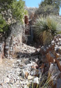
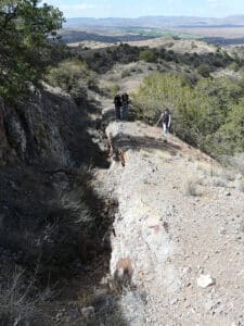
Several types of mining were employed at the Foster Mine including: the blasting of a primary adit (a horizontal tunnel driven into the mountain side to provide access to an ore body) into the vein at the bottom of the gulch, followed by overhead stoping (the mining of an ore body underground creating an open space or rooms); the blasting of several short drifts, (a horizontal tunnel driven into the mountainside following an ore body), coupled with stoping; the sinking of several shafts, (the excavating of a vertical tunnel from the surface, from which horizontal workings are made into the ore body) coupled with stoping; and several open trenches at the surface following the vein.
In the 1990s, the Abandoned Mine Land Bureau (AMLB) of the New Mexico Department of Energy and Minerals sealed off or otherwise rendered safe numerous mine workings in the Gila Fluorspar District considered hazardous for the visiting public. While due care should still be taken in visiting the Foster Mine because of loose rock and steep slopes, the really dangerous underground portions of the Foster Mine have been properly sealed off with heavy steel grating which still allow the visitor the chance to observe and photograph how the underground mining was done.2
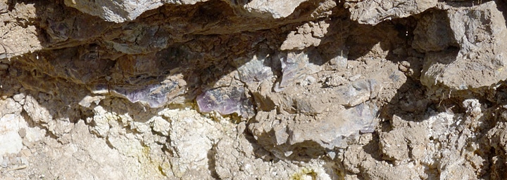
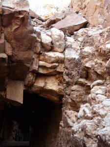
Most of the host rock in which the fluorite veins occur is a fine-grained volcanic lava flow rock which contains less than 5% quartz, a predominant mixture of alkali and plagioclase feldspar, and a small percentage of iron and magnesium rich silicate minerals such as biotite, hornblende, and pyroxene. In technical terms, the rock would be called an alkali-feldspar rich latite. The host rock is considered to be Early Oligocene in age and was probably ejected from the Mogollon Caldera eruption some 34 million years ago. The fluorite veins occur within a normal fault which took place millions of years after the host rock was deposited. The time of faulting and emplacement of the veins themselves is probably related to either the eruption or subsequent collapse of the Bursum Caldera, which occurred roughly 28 and 17 million years ago.
Here at Casitas de Gila Guesthouses, we are quite familiar with hiking and rockhounding opportunities in the Gila Fluorspar District area. We are happy to provide guests staying at the Casitas with detailed directions and maps for this fascinating area, as well as for all the hikes detailed in the Casitas de Gila Nature Blog and on our website. All one needs to do is ask!
IMPORTANT NOTICE AND ADVISORY REGARDING THE MINES AND PROSPECTS OF THE GILA FLUORSPAR DISTRICT
Extreme caution is advised when visiting any old mines or prospects regardless of where they are found. While many of the openings to underground mines and prospects on the public lands in Southwest New Mexico have been sealed off, others have not, especially in the more remote and less accessible locations. All abandoned underground mines and prospects should be considered dangerous and unsafe, and should never be entered. Even open surface trenches, mine tailings (waste rock) dumps and adjacent land surfaces can be very unstable and should be traversed with care. Also, as a final word of caution: during the late Spring through early Fall months, always be alert for rattlesnakes around these old workings; they seem to like them a lot …
REFERENCES
- 1946, Rothrock, H. E., C. H. Johnson, and A. D. Hahn, Fluorspar Resources of New Mexico, Bulletin 21, New Mexico Bureau of Mines and Mineral Resources, Socorro, New Mexico
- 1991, Schlanger, S., Archaeological Survey of Two Abandoned Mine sites in the Gila Fluorspar District, Grant County, New Mexico, Archaeology Notes No. 21, Museum of New Mexico, Office of Archaeological Studies, Santa Fe, New Mexico


