Southwestern Guesthouses on 265 Acres near Silver City, New Mexico overlooking Bear Creek and the Gila Wilderness
Menu
Casitas de Gila Nature Blog
A Southwest New Mexico Winter!
MIDWINTER ENCHANTMENT IN THE BEAR CREEK NATURE PRESERVE
AT CASITAS DE GILA GUESTHOUSES IN SOUTHWEST NEW MEXICO
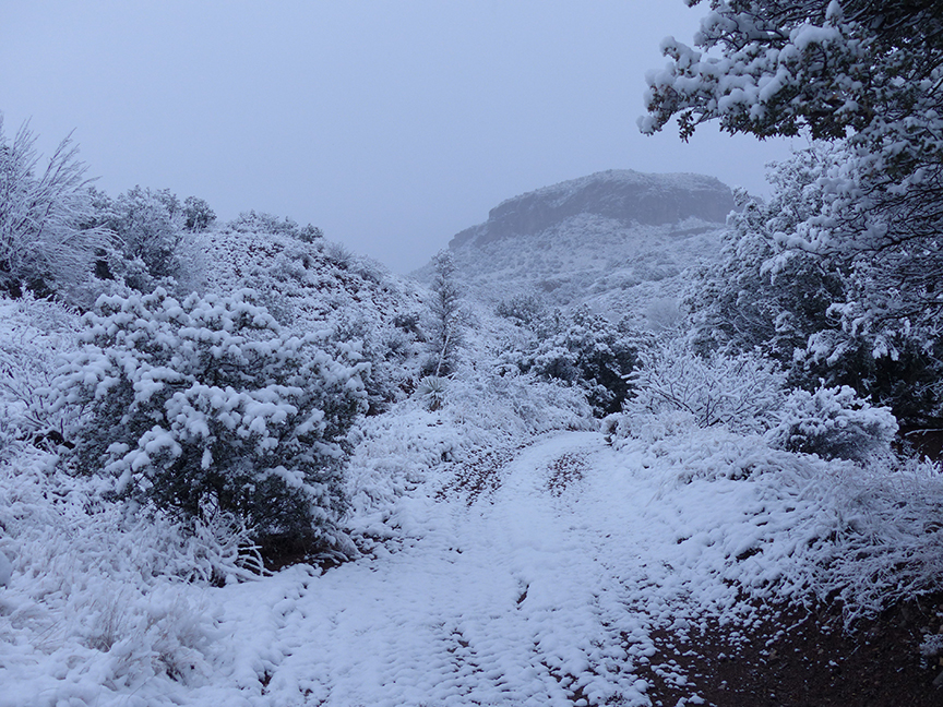
January 22, 2017 at Casitas de Gila on Bear Creek, looking north to the Gila Wilderness covered in deep snow
SOUTHWEST NEW MEXICO: A NATURE LOVER’S PARADISE WITH FOUR GENTLE SEASONS
The High Chihuahuan Desert of Southwest New Mexico is a landscape of exceptional beauty, diversity, and distinct seasonal climatic change due to a rugged topography ranging from 4,000 to 11,000 feet. For the city or urban dweller longing to reconnect with millions of acres of pristine and untrammeled Nature, the lowland deserts, soaring mountains, and numerous rivers and creeks of the vast Gila Wilderness, Gila National Forest and other public lands in Southwest New Mexico offer an unlimited array of outdoor opportunities that can be enjoyed every season of the year … including Winter!
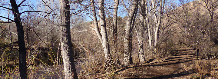
Situated on 265 private acres on Bear Creek, near to and directly overlooking the Gila Wilderness and National Forest, Casitas de Gila Guesthouses has since 1999 specialized in providing its guests with the best directions and information regarding access to, knowledge of, and pursuit of the various outdoor activities possible on these public lands. In addition, Casitas de Gila is most fortunate in having been able to develop within its own property the Bear Creek Nature Preserve, a unique landscape that offers Casita guests an exceptional connection and access with Nature right out the door of their Casita to over six miles of trails along Bear Creek and the adjacent mountains.
In Winter, Cottonwoods cast long shadows across trails along Bear Creek
THE WINTER OF 2016-17: AN EXCEPTIONAL DISPLAY OF NATURE’S SURPRISE, MAGIC, AND CHANGE WITHIN THE BEAR CREEK NATURE PRESERVE
In most years, Winter at the Casitas and the Bear Creek Nature Preserve is a rather laid-back season, a time for quiet personal reflection on the year gone by. It’s a time for leisurely walks on sun-dappled paths beneath towering groves of the leafless Cottonwood and Willow that line the tranquil, faintly gurgling waters of Bear Creek. Or a time for an exhilarating climb up the more challenging trail just across Bear Creek leading to a magnificent 360° panorama at the top of Paradise Overlook Mountain. Or, if the spirit is feeling a little more restless and adventurous, one might head out to the nearby spectacular Catwalk Recreation Area, the intriguing Gila Cliff Dwellings National Monument, or one of the many beckoning nearby trails in the Gila Wilderness and National Forest. Later, as the afternoon shadows lengthen and the temperature begins to fall, it is time to return to the comforts of one’s own warm Casita to end the day with a relaxing meal, followed by a good book in front of a crackling fire in the kiva fireplace, a serious game of Scrabble or Monopoly, or maybe even putting together a 1000-piece puzzle! Ah yes, that has been the Winter experience at the Casitas for most years. But so far, this Winter has certainly not been like most!
A WINTER OF SURPRISING WETNESS BEGINS …
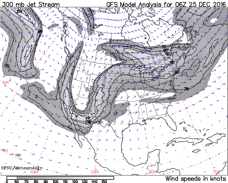
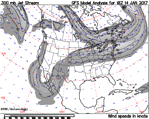
Jet Stream pattern responsible for White Christmas at Casitas, Dec. 25, 2016 (source: squall.sfsu.edu/crws.html)Jet Stream map showing cutoff loop bringing moisture from Baja California to Casitas on Dec. 22, 2016. (Source: CA Regional Weather Server, Dept of Earth & Climate Sciences, San Francisco State Univ, squall.sfsu.edu/crws.html)
Weather wise, early Fall at the Casitas in 2016 was essentially normal, a little drier perhaps and somewhat warmer, but typical great weather for outdoor pursuits. During the first three weeks of December this pattern continued for the greater part, but with interspersed short periods of clouds, minor precipitation, and colder than average weather in response to repeated events in which the Arctic jet stream would loop south from Canada down the US West Coast and then into Southwest New Mexico.
Then, on December 22, the first of what would become a month-long series of abnormal precipitation events began, when a persistent, cut-off segment of one of these Arctic Jet Stream loops began pumping a cell of Low Pressure moisture from Baja California across the Southwest into New Mexico, bringing the Casitas over an inch of rain. At the Casitas, most of this rain was quickly absorbed by the very dry ground. Bear Creek, however, rose several inches in response, making access to the trails on the other side of the creek a little more difficult, but still doable for most of the guests who were now coming in for the holidays. Following a brief day of clearing, on Christmas Eve the clouds came in once more as a new Arctic Jet Stream loop of cold air pushed down from the North to collide with a still active Southern Jet Stream segment that was pumping moist Low Pressure air in from Baja California.
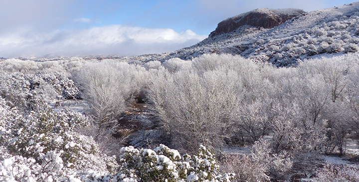
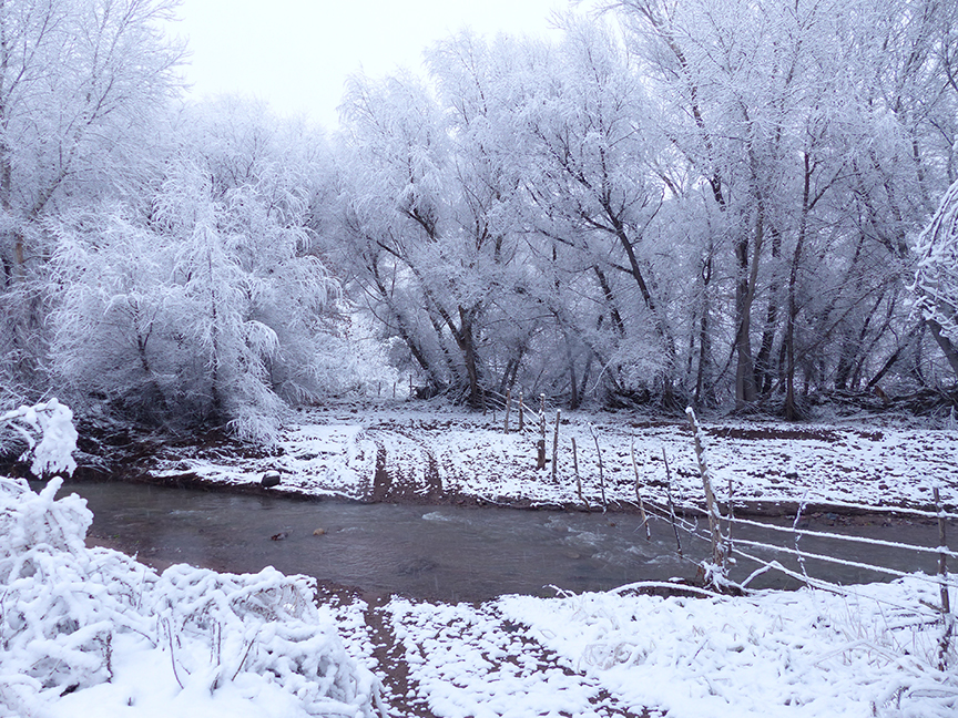
Christmas morning 2016 at Casitas de Gila, looking north to the Gila Wilderness (hidden in clouds)
The snow began falling after midnight and by morning the Casitas awoke to a big surprise: a magnificent White Christmas with three inches of snow coating everything in sight. By early afternoon, temperatures had warmed considerably as the Arctic loop of cold air dissipated, melting all of the snow except in the higher elevations in the Gila Wilderness mountains to the north. Over the next few days a persistent plume of Jet Stream coming up from Baja California continued to bring warm, cloudy, moist unsettled weather in over Southwest New Mexico, culminating with a major storm on December 31, to finish out the month of December with over two inches of rain at the Casitas. Throughout this time water levels in Bear Creek continued to rise as the rain and warm weather melted the snow in the higher mountains, rendering trail stream crossings in the Bear Creek Nature Preserve impossible. Outdoor pursuits elsewhere in the surrounding area were likewise severely curtailed as the same storms caused numerous problems: highways, roads and destinations were closed by snow or washed out, including the Gila Cliff Dwellings and the Catwalk, as well as many of the trails of the Gila Wilderness and National Forest. Two groups of hikers in the Gila Wilderness had to be helicoptered to safety on Christmas Day when land based rescue teams could not reach them because of high water on tributaries of the Gila River.
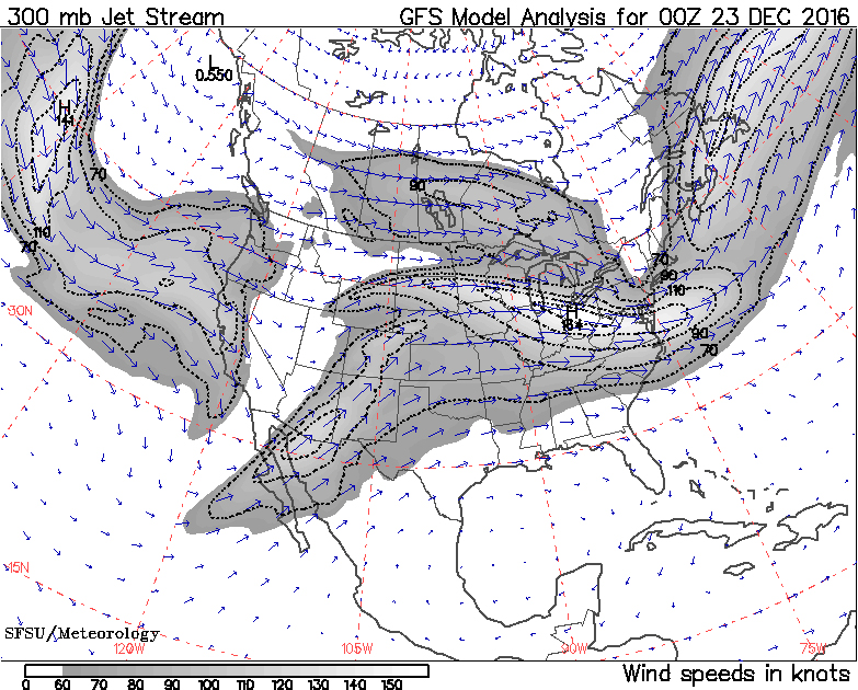
Jet Stream loop responsible for bringing 1-1/2 inches of rain to the Casitas January 14-16, 2017 (source: squall.sfsu.edu/crws.html)Jet Stream pattern responsible for bringing persistent clouds and moisture to Casitas from Pacific and Baja California for first week and a half of January 2017 (source: squall.sfsu.edu/crws.html)
During the first week and a half of January, another strong Southern Jet Stream flow continued to bring in clouds, moist air, and various amounts of rain from the Pacific and Baja California to Southwest New Mexico, keeping Bear Creek running high, fast, and uncrossable. Not to be deterred, however, intrepid Casita guests ventured out on most days to give the various trails on the Casita side of the Creek a good workout or hiking Gila Wilderness trails that still remained open. On the bad days, they stayed inside their cosy Casita reading by the kiva fire, besting their partner at Scrabble, completing that puzzle, keeping up with the outside world on the Internet, or simply resting up for that all-to-soon return to the outside world. Elsewhere in the area, the Catwalk, Cliff Dwellings, and many Gila Wilderness and National Forest trails remained closed.
Then … surprise again! Just when one thought the rain was over, another Arctic loop came down from the north for another three days, dropping another inch and a half of rain from January 14-16 before gradually moderating into three days of patchy clouds, wind, and cold, but without rain. An improvement! But not for long, as, totally unsurprising at this point, on the 20th yet another major Arctic loop dropped down from the north bringing more than an inch of rain over the next four days for a total monthly rainfall on January 24, 2017, of 2.68 inches!
Is the Midwinter Deluge of 2017 over? Well, as of January 24th, the five-day Jet Stream forecast looks promising, and the ten-day Weather Underground forecast reads clear and sunny with rising temperatures! We shall see …
SOME MAGIC AND CHANGE EXPERIENCED WITHIN THE BEAR CREEK NATURE PRESERVE DURING THE DELUGE OF 2016-17
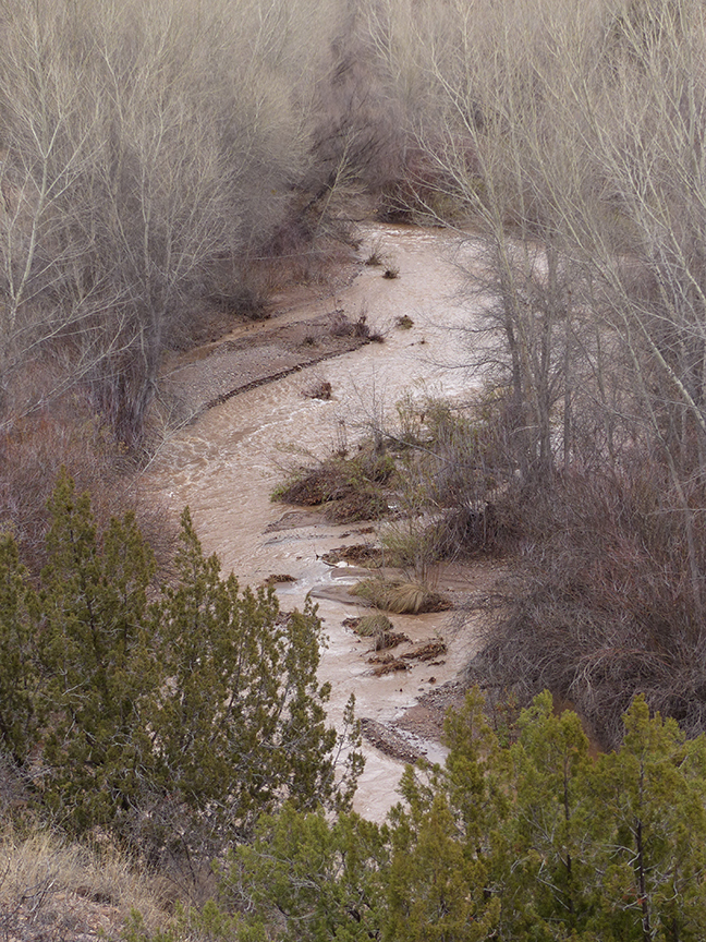
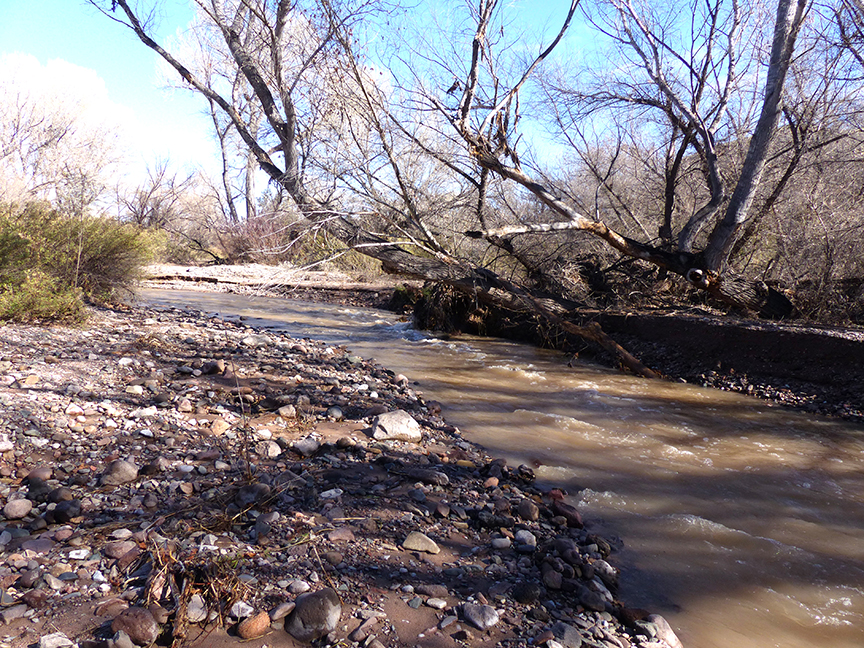
Bear Creek out of its channel and flowing across the adjacent floodplain, making crossing the creek impossible
Put in historical perspective, the Midwinter Deluge of 2016-17 was a truly-unique Winter weather event during the 18 years of operation of Casitas de Gila Guesthouses. Never during that period has this much rain (4.5 inches in 5 weeks) fallen in such a short time at this time of year, turning seasonally placid and faintly gurgling Bear Creek into an raging, growling Bear RIVER for over a month! The closest similar Winter Season event was the Great Flood of February 12, 2005, when a slow-moving warm front coming up from Mexico dropped 2.5 inches of rain over a three-day period over the entire Bear Creek drainage and also melted most of that Winter’s snow pack in the Pinos Altos Mountains and Silver City Range in the headwaters of Bear Creek. The combined runoff from that storm resulted a two-week flood at the Casitas that crested at 8 feet above normal level, and relocated the channel from the east side to the west side of the floodplain in front of the Casitas.
During most of the time period covered in this blog, half of the floodplain trails and the trail up Paradise Overlook Mountain on the east side of Bear Creek remained unreachable because of high water. All of the numerous trails along the west side of the floodplain below the Casitas, however, remained accessible, offering guests unique opportunities to experience up close and personal the magic, the many changes taking place, and insight into cause and effects of Nature’s unleashed power that were unfolding below their Casita on a daily basis.
MIDWINTER MAGIC
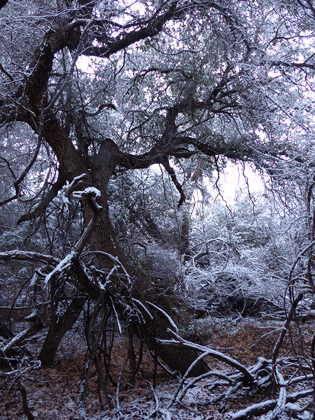
Entering the grove of Gray Oaks by Bear Creek, the trail passes through a fantasy world of white lace on gnarled branches!Along the trail heading down to Bear Creek and the cliffs beyond
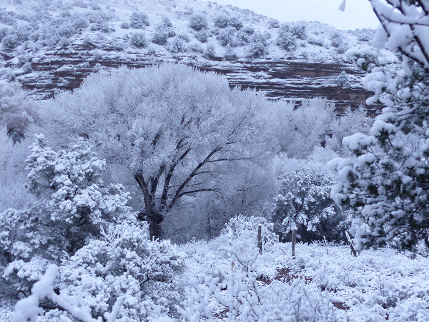
No matter what the season, unexpected moments of Nature’s Magic are frequent at the Casitas for those who seek them, whether just sitting in front of the Casita on the edge of the Canyon gazing out at Bear Creek below and the mountainous Gila Wilderness beyond, or while answering the call of the ever-beckoning trails. In Spring, it might be the sudden encounter of a profusion of rare wild flowers blooming along one of the Casita trails. In Summer, the sudden flash flood from a monsoon thunderstorm surging across the Bear Creek floodplain is an awesome experience. In Fall, a brief flurry of golden Cottonwood leaves swirling to the ground along Bear Creek can cause one’s Spirit to soar. But come Winter’s cold, typically it is the magical rays of the Sun that stir one’s senses, be it those first rays of a frosty morning Sun breaking over Turtle Rock to illuminate a snow-covered wonderland, or the brilliance of the late afternoon Sun piercing through the maze of barren branches above to cast a kaleidoscope pattern of hard light and deep shadow over the floodplain path below.
This winter, the magic of the snow-covered wonderland came early Christmas morning, and for those guests who trekked out early on the trails before dawn, the magic was palpable at every turn. This was especially so down along Bear Creek where the snow created a fantasy world in high contrast black and white among the majestic trunks and tangled branches of the gnarled Gray Oak, Cottonwood, and Willow. However, on this Christmas morning, the Sun’s rays didn’t break over Turtle Rock as the clouds hung on until around ten o’clock before clearing slowly to reveal the gleaming soaring peaks of the Gila Wilderness mountains just to the north. During the following weeks, the Sun’s rays became an increasingly rare magical treat as the persistent jet stream continued to drag clouds and rain in from the Pacific, reminding the Casita hosts more and more of their seven-year sojourn in Southwest Ireland than of the normally ever-sunny Winter enchantment of Southwest New Mexico!
Heading down the Corral Road to Bear Creek with Turtle Rock beyondOver the Creek and through the Willows leads the trail to Paradise Mountain.
But while the Sun’s rays continued to play a mostly well-hidden game of hide and seek, down below the Casitas there was a rare form of Nature’s Magic taking place for those who would care to observe … the magic of Active Change within the Bear Creek floodplain.
ACTIVE STREAM PROCESSES AND CHANGES OBSERVED WITHIN THE BEAR CREEK NATURE PRESERVE
The month-long duration of the Mid-Winter Deluge of 2016-17 provided an exceptional opportunity for interested Casita guests to observe and reach an understanding of the primary forces and processes of Nature that have acted overtime to create the Bear Creek Nature Preserve environment.
CHANGES IN STREAM CHANNELS AND FLOODPLAINS
Stream channels and floodplains, by their very nature, are environments of constant physical change in terms of shape and location (geomorphology). This is due to the constantly fluctuating volume, velocity, and turbulence of stream water flow through time that causes the erosion, transport, and deposition of the loose sediment being carried downstream. Most of the time the changes are imperceptibly slow; at other times they can be extremely rapid, causing major change in a matter of hours. During the Midwinter Deluge of 2017 the stream channels and portions of the floodplain underwent major physical change largely because of the exceptional, month-long duration of a persistent rain and snowmelt runoff event.
Stream Gradient and Base Level
As the high water continued, both the bottom and sides of the channel were eroded, undercutting the Cottonwoods on the edge of the floodplain
It is the nature of all streams, rivers, and creeks, no matter what size or where they are located, to evolve towards a state of an equilibrium where there is neither erosion nor deposition of sediment within the channel of the flowing water. Factors inherent in achieving such a balance include the variables of volume, velocity and degree of turbulence of the flowing water, plus the gradient of the stream.
Stream gradient is a term that describes the grade or slope of the stream’s surface, and is a measurement of the drop in elevation of the stream’s surface over a horizontal distance. Stream gradient is typically stated in feet per mile or meters per kilometer. High gradient streams have a steep grade with greater velocities and turbulence within the flowing water, typically resulting in erosion of loose sediment from the bottom and the degradation or cutting down of the channel bottom. Conversely, low gradient streams have less slope with slower flowing water and less turbulence that typically results in deposition of transported sediment and aggradation of the channel bottom.
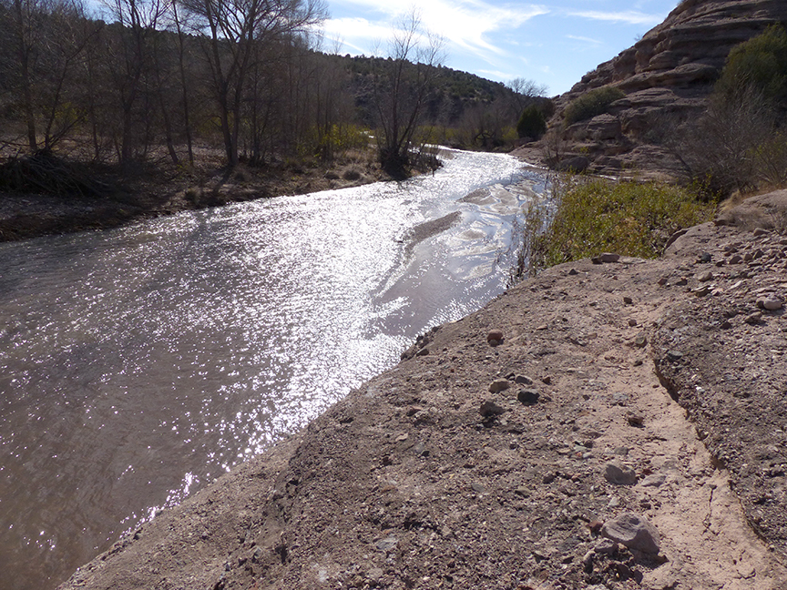
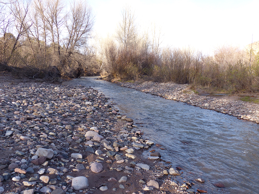
Downstream at the southern end of Casita lands, as Bear Creek Canyon widens, so do the channel and floodplain, resulting in a lower gradient stream with deposition of finer-grained bed load and coarse suspended load
As the gradient of a stream approaches zero the stream is said to be approaching equilibrium at base level where all sediment transport and deposition ceases. Attainment of equilibrium along the course of a stream is rarely achieved for more than a brief span of time during periods of changing velocity or volume of water flow, exceptions being when the stream encounters a temporary base level, such as a stream flowing into a lake or reservoir. Ultimate base level is reached when a stream finally flows into the ocean.
Stream Sediment Transport
Sediment transport by running water in rivers, streams, or creeks, such as Bear Creek, occurs in two ways: as bed load where the coarse sediment (sand and gravel) maintains contact with the stream bottom by rolling, sliding, and skipping along the bottom (a process also known as saltation); and as suspended load where finer-grained sediment (sand, silt, and clay) are carried suspended by turbulence within the moving water column.
The unconsolidated fluvial sediment that makes up the channels, floodplain, and adjacent stream terraces of Bear Creek ranges from clay size particles less than 4 microns (.004 millimeters) in diameter to boulders up to 1 meter in diameter. The rate at which this sediment is transported downstream as bed load and suspended load varies greatly depending on the sediment size, the velocity and the turbulence of the moving water. In general, the larger the sediment particle, the slower it travels downstream.
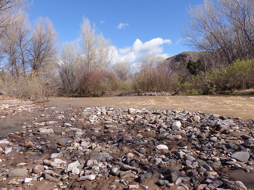
As the flood waters begin to recede, a coarse deposit of cobbles and boulders bed load is deposited on a gravel bar at the side of Bear Creek while the suspended load muddying the water continues downstream
Suspended load sediment is carried downstream at the velocity of the stream, which during flood stage on Bear Creek can move at rates of up to 20 miles an hour. The size of sediment particles carried in the suspended load is dependent on the velocity of the water plus the roughness of the stream bottom due to big rocks, roots, branches, etc., along the bottom and sides of the channel which create turbulence in the water column that acts to keep the sediment suspended.
In most years, the waters of Bear Creek within the Bear Creek Nature Preserve measure a few inches in depth and only 10 to 20 feet in breadth for about ten months out of the year; the water is crystal clear, and moves downstream at speeds of only a few feet per second. During such times, sediment transport and changes in the morphology of the stream channels and the adjacent floodplain are, to the casual observer, essentially non-existent. It is only upon very close examination that movement of fine-grained sediment as bed load can be observed along the bottom.
SOME CHANGES REVEALED
During the Midwinter Deluge Event, the flow of water in Bear Creek remained high, fluctuating between just remaining within the main stream channels with depths of 2 to 3 feet to occasionally overflowing the channels by an additional 1 to 2 feet and flowing out across the floodplain. While the velocity and volume of the water during the event were elevated, it was not just the velocity or volume of the flowing water that produced the major changes observed in the Bear Creek Nature Preserve during and following the event. In this case, it was the duration of the high water event, which persisted unabated at consistently elevated levels for more than a month. This produced many dramatic changes, including:
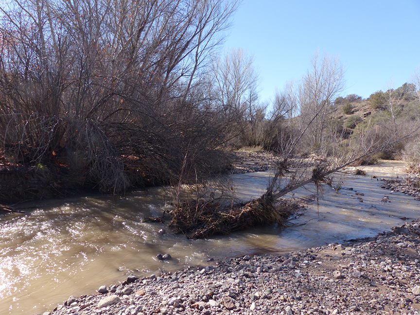
As high water erodes banks of the channel, floodplain trees topple in the Creek diverting the course of the channel
• Significant channel modification through erosion of channel banks and diversion of stream flow by the undercutting and toppling of trees along channel margin
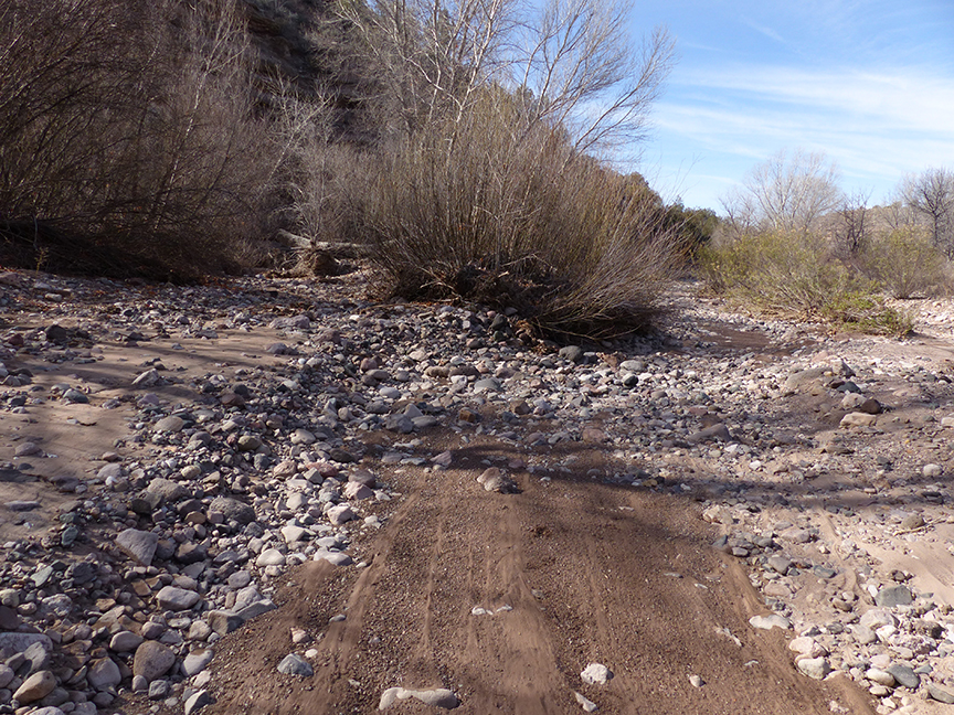
• Initiation of new channel development and deepening of older high water channels across the floodplain
• Massive erosion, transportation, deposition, or relocation of vast tonnages of coarse bed load and suspended load sediments
• Selective suspension and removal of sand, silt, and clay sediment from the bottom and sides of stream channels due to high level turbulence within the fast moving water. Under these conditions, once this sediment was suspended it was carried downstream out of the Bear Creek Nature Preserve leaving behind channels that have been cut deeper by one to several feet and filled with coarse gravel and boulders.
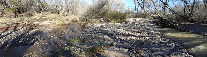
As floodwaters leave the channel and flow across the floodplain, new channels are cut, such as in this photo with the old channel on the right and the new channel that was started at high water on the left
With only a few more floods, this new channel being cut into the floodplain will soon become the main channel; note the massive amounts of bed load and suspended load left behind by the receding watersBy early February 2017, the flood waters had dropped significantly, revealing the active Bear Creek channel cut down about 2 feet with the sides and bottom lined with large coarse gravel, cobbles, and boulders deposited from the bed load; the sand, silt, and clay sediment having been selectively removed from the channel as suspended load and carried away downstream