Two week ago, two of our good friends from County Kerry, Ireland, spent a few days with us at Casitas de Gila Guesthouses while touring the American West. At the time, the lightening-caused Whitewater-Baldy fire had been burning for two weeks in the heart of the Gila Wilderness some 20 miles to the northwest of us. Since our guests were avid hikers, and the Forest Service had closed some of our usual hiking trails due to the fire, we decided it was a good opportunity to explore a different part of the Gila National Forest: the Burro Mountains.
The Gila National Forest is huge, offering some 1,500 miles of trails within its 3.3 million acres, and while we have spent a lot of time hiking and exploring the Gila country over the past 13 years, at best we have only scratched the surface, having a tendency to take our various visiting guests to the same favorite areas over and over again.
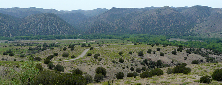
Lightening caused fires in the Gila Wilderness are a common occurrence, and during the 13 years that we have lived in Gila we have witnessed several such events. As with previous fires in the Wilderness, the Whitewater-Baldy fire was not affecting the Casitas in any way, either by smoke or other problems, since the Casitas are located south of and, due to prevailing winds, upwind from the Gila Wilderness and the fire. So with prevailing wind in mind, we decided that a good choice for our hike would be the Burro Mountains, about 9 miles south of the Casitas. Most of the Burro Mountains, about 250 square miles or 160,000 acres, lies within the Gila National Forest. It is an interesting and varied mountain range, steeped in history, that is transected by the Gila River at its northern end, and an area which we had only briefly visited a few times before.
THE BURRO MOUNTAINS – AN ANCIENT LAND WITH A RICH HISTORY
Geologically, the Burro Mountains display a fascinating and extremely complex history of ancient sedimentary deposition; deep burial; deep seated, magmatic, pluton-forming activity; repeated uplift and erosion; accumulation of thick layers of welded tuff following explosive volcanic caldera eruptions; and extensive faulting, followed by late-stage mineral emplacement. It is a story in stone extending back over 1.5 billion years, where, today, many of the various chapters of this ancient history of the earth are exposed and laid open for all to see in the Middle Box by the eternal downward cutting action of the Gila River over many millions of years.
The more recent history of the Middle Box of the Gila is equally as intriguing. In pre-historic times, the entire length of the Gila River was a major thoroughfare for east-west travel, and was considered home to countless generations of early Native Americans such as the Mogollon Culture who hunted, fished, farmed, camped, and built villages both small and large along its course from about 150 to 1400. For the interested and observant hiker, remnant signs of these early cultures can be found in numerous places along the Gila River.
A hundred years or more after the Mogollon peoples left, the Apaches arrived and claimed this dependable desert oasis of the Gila River as home. In the years to come the Burro Mountains were at the center of much of the Apache Wars with the incoming wave of pioneer miners, ranchers, and farmers from the East. During this chaotic period, all the Apache chiefs—Cochise, Mangas Coloradas, Nana, Victorio, Chihuahua, and Geronimo—knew the Middle Box of the Gila River intimately.
With the gradual taming of the West, it was inevitable that the ubiquitous and intrepid group of men known as prospectors would find their way into the Burro Mountains. And, much to their great joy and delight, here they found silver and yellow metals in great abundance. Beginning in the 1880s, and fully established by the early 1900s, several mining districts were recognized at various places within the Burro Mountain chain. Scattered throughout these rugged mountains and canyons numerous small prospects and mines were developed, yielding significant amounts of gold, silver, copper, turquoise, and fluorite1,2. Within a few decades, however, all but a few of these small mining operations had been worked out and had ceased production. But, then, just as the small mines began to close, intensive mineral exploration projects were undertaken in the southern Burro Mountains which eventually delineated the presence of extensive and massive deposits of low-grade copper ore which could be extracted at a profit, if done on a large scale. Thus was born a new phase of mining in the Burro Mountains. It is one that continues today in the form of the mega-scale operation of Freeport-McMoRan Copper and Gold Corporation’s Tyrone Mine, located in the southern Burro Mountains, about 15 miles south of Silver City. The Tyrone Mine is a huge open pit and processing facility which in 2010 produced 37.19 thousand tons of copper3.
In the northern Burros, however, most of the old mines, prospects, and workings ceased operations long ago and are now mostly forgotten and inaccessible, scattered throughout a rugged and roadless terrain.
THE MIDDLE BOX OF THE GILA RIVER AND FOREST TRAIL 746
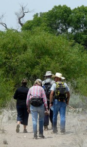
And so it, was with a sense of heightened anticipation on my part for a trail never travelled, that our two guests, two neighbor friends, two dogs, and myself set off for a day hiking and exploring Forest Trail 746 in the Middle Box of the Gila River.
In New Mexico, the term “box” is used to describe the narrow canyons along the course of a river or creek, which can serve as a handy place for ranchers to drive and corral or “box” up their wide-ranging cattle. In the case of the Middle Box, it refers to the narrow canyon cut by the Gila River as it transects the north-south trending Burro Mountain Range between the Upper Box at the edge of the Gila Wilderness upstream and the Lower Box of the Gila near the Arizona border downstream.
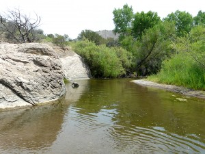
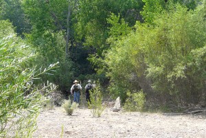
Forest Trail 746 is a well-marked trail which leads downstream, deep into the high-walled canyon narrows of the Middle Box of the Gila River. Recently the trail has been upgraded for at least the first two miles. Substantial rock cairns mark the way across the wider stretches of sand and gravel floodplain that are devoid of vegetation, and the trail has been cleared as it goes through the dense stands of young cottonwood, willow, and shrubby vegetation that border the river channel. The trail follows the east side of the river for the first 0.7 mile, and then crosses to the west side of the river for the remaining 1.3 miles to the destination and end point of this trail discussion, the Swimming Hole of the Ancients.
Trail 746 is a trail that can be enjoyed by people of every age and ability. The first two miles the trail are mostly across level floodplain with only a few gentle grades. The trail meanders back and forth, towards and away from the river, first across sunlit expanses of river sand and gravel, and then beneath shady canopies of thick stands of young, 80- to 100-foot-tall Fremont Cottonwoods (Populus fremontii) that germinated along the natural levees of former floodplain channels.
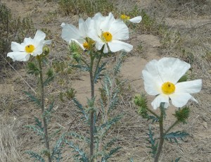
In many ways, FT 746 is a passage of riverine solitude for the senses and one’s soul, offering an unforgettable, tranquil, and calming journey into the subtle essence of Gila River country. The weather on the day of our excursion was typical for the first week of June: sunny and in the mid-80s with clear blue skies and a nice breeze out of the south blowing upstream. At this late-spring time of the year, the floodplain vegetation along the river was already in full summer dress, a ribbon of green having diverse fragrant smells, and many flowers, such as Prickly Poppy (Argemone pleiacantha), lining the trail. Although the Spring bird migration had peaked a few weeks earlier, the varied calls of numerous transient species could be heard frequently, rising melodically over the ceaseless background murmur of the cottonwood leaves rustling in the canopy high above. Indeed, it was a glorious morning, and we were all reveling in it, including Red and Bower, our two canine companions.
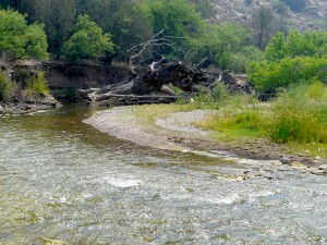
FT 746 begins by first crossing a dissected outwash plain of sand, gravel and boulders washed out from Ira Canyon to the east. It then rises briefly to cross a stretch of older river terrace of sand and gravel, densely covered with Honey Mesquite (Prosopis glandulosa) and a few One-seeded Juniper (Juniperus monosperma), before dropping down to the upper part of a broad modern floodplain sparsely covered with Rubber Rabbitbrush (Ericameria nauseosa), Seepwillow (Baccaris salicifolia) and the occasional old-growth cottonwood. After 0.2 mile, the floodplain narrows and the trail passes into a dense stand of mature cottonwood and willow which continues for another 0.2 miles. After passing through a particularly dense stand of trees, the trail then emerges abruptly at a broad, shallow river crossing. The crossing point is well marked by the remains of a huge, old growth cottonwood that toppled into creek in recent years when the river bank was undercut during a period of flooding and the eastward lateral migration of the main channel. As typical for this time of year, the flow of the Gila was low, only about calf-deep, when we made the crossing. The Spring runoff, minimal as it was this year because of a second-year-in-a-row dry La Niña Winter, had peaked several weeks earlier.
Once the river was crossed, the trail again entered into a zone of alternating stretches of floodplain sand and gravels, and dense, high-vaulted stands of young cottonwood and willow, with an understory of waist-high, thick-growth young willow trees.
The contrast in sensual perception between the alternating sunlit, barren sand and gravel, and shaded, lush vegetated tunnels of plant growth was intense and inescapable as we hiked the next half mile of the trail. Leaving the floodplain, we followed the trail as it climbed up onto the bordering mesquite and juniper covered terrace, and then abruptly emerged at the top of a 15- to 20-foot-high, white rocky promontory jutting out into the river. We had arrived at our lunch time destination, the Swimming Hole of the Ancients!
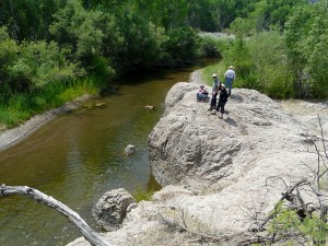
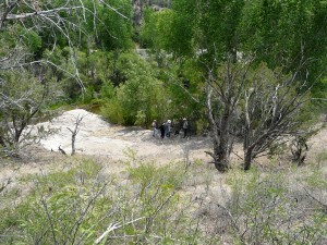
And what an idyllic and magical spot it is! Within less than a minute, our canine buddies were frolicking in the river, swimming, and chasing sticks, while their owners and friends relaxed at the promontory’s edge and examined the intriguing grinding holes made a thousand or more years ago by the ancient tribes that passed this way. There could be no doubt that the ancients considered this place as special as we did. The 4 to 6 inch depth of the several holes at the top of the rock promontory where they ground their maize and other food stuffs offer mute testimony that countless generations of ancient travelers had paused here to swim, rest, and eat before or after passing through the rugged, narrow, rocky chasm of the heart of the Middle Box that our map indicated was just another half mile or so downstream.
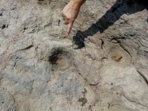
This rocky promontory is the first outcrop of bedrock to be found within the river as one hikes downstream towards the narrows of the Middle Box, a telltale sign of the chasm ahead. The ancients, of course, knew this, and also knew that this rock was excellent for grinding grain, although they didn’t know why. It would be a thousand years or more before geologists would come to understand the why, that this abrasive rock is a rhyolite ash flow welded tuff, deposited there some 33.5 million years ago in the Late Oligocene Epoch during an eruption of the Schoolhouse Mountain Caldera, about 3 miles to the east (Ref. 1).
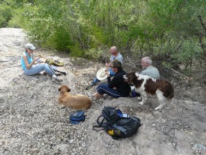
Sitting there quietly munching a sandwich and observing our surroundings as the afternoon breeze rushed upstream through the leaves of the thick stands of willow and cottonwood lining the banks, it was not at all surprising when the vision of how it must have been began to play in one’s mind … a scene of young children playing, swimming, and jumping from the promontory into the river below, under the ever-watchful eyes of their mothers grinding the corn on the rocky promontory above, while the older men scoured the mesquite thickets on the hillside behind for a nice plump rabbit to round out the meal.
And then, all too soon the scene faded, and we knew it was time to pack up and head back.
DIRECTIONS FOR FINDING FOREST TRAIL 746
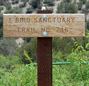
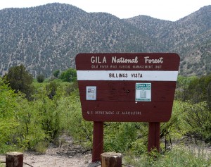
To reach the trailhead for Forest Trail 746 from Casitas de Gila Guesthouses, take NM 211 south from the Gila Post Office for 4 miles to US 180; turn right (west), and in 1 mile turn left on Bill Evans Lake Road. At 3.4 miles the road forks, with the road to the left leading away from the river to Bill Evans Lake. At this fork stay straight ahead for 1.9 miles to enter the Gila National Forest. After going another 4.5 miles the road leads to a designated and marked birding area with access to the Gila River. At this point continue driving south, parallel to the river, on a less travelled dirt road to dead end at the Billings Vista Birding Area and the trailhead for Forest Trail 746.
REFERENCES:
- 2005, Virginia T. McLemore, Mineral Resources of the Wild Horse Mesa Area, Northeastern Burro Mountains, Grant County, Open-file Report 486.
- 1964, Elliot Gillerman, Mineral Deposits of Western Grant County, New Mexico, New Mexico Bureau of Mines and Mineral Resources, Bulletin 83.
- Mining Almanac

