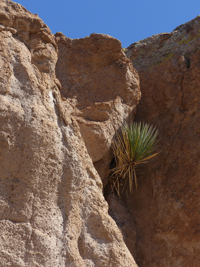
AT ARIZONA’S BLACK HILLS ROCKHOUNDING AREA

THE SOUTHWESTERN NEW MEXICO AND SOUTHEASTERN ARIZONA BORDER COUNTRY
– A ROCKHOUNDER’S PARADISE
The Southwestern New Mexico and Southeastern Arizona Border Country offers some of the finest and most diverse rockhounding opportunities to be found anywhere in the Southwest. Semi-precious gems, minerals, and rocks of an extremely wide diversity can be found here, including white to pink chalcedony, fire agate, banded agate, red and yellow jaspers, carnelian, obsidian, geodes and thunder eggs, and banded rhyolites, as well as exotic copper minerals like turquoise, malachite, azurite, and chrysocolla. These are but a few of the treasures that can be hunted and collected here, scattered over the surface on many thousands of acres of public lands, as well as excellent specimens that can be dug from the tailings dumps at numerous abandoned gold, silver, and copper mines that operated in the late 1800s and early 1900s.
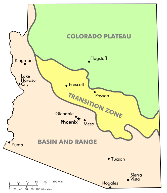
The reason for this great abundance and diversity of collectable rocks and minerals is that the Southern New Mexico-Arizona border straddles a complex geological transition zone encompassing the eastern edge of the Basin and Range Province and the southwestern side of the Mogollon-Datil Volcanic Field at the southern end of the Colorado Plateau. During the Oligocene and Miocene Epochs of the Mid-Tertiary Period between 35 and 15 million years ago, this vast area in the American Southwest was the site of repeated episodes of extensive faulting, vulcanism, and extensive mineral vein intrusion, each of which are critical factors favoring the formation of unique and desirable specimens sought by the avid rockhound. Situated just 30 miles east of the New Mexico-Arizona border, Casitas de Gila Guesthouses is located in the heart of this rockhounding paradise. As such, no matter which direction one takes from the Casitas on a single day’s outing, there are excellent collecting sites to be discovered.
FIRE AGATE: THE PREMIER SEMI-PRECIOUS GEMSTONE
OF THE SOUTHERN NEW MEXICO-ARIZONA BORDER COUNTRY
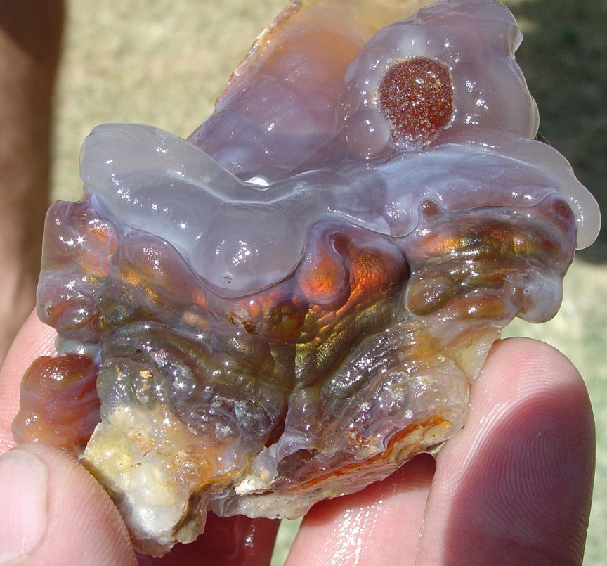
One of the semi-precious stones most highly sought after by rockhound guests staying at the Casitas is fire agate. Fire agate is a type of chalcedony (SiO2) which contains multiple, extremely thin layers of the iron oxide minerals of Goethite (FeO(OH)) and Limonite (FeO(OH)·nH20) imbedded within, and commonly completely enclosed by, semi-transparent to translucent layers of cryptocrystalline chalcedony. When cut and polished down to the layers containing the iron oxides, the stone displays a metallic, shimmering iridescence known as the Schiller Effect, where light is reflected and refracted off the various layers containing the Goethite and Limonite iron oxides to give the exquisite play of colors—or “fire”—for which the gemstone is named. Colors displayed by the “fire” vary greatly, the most common being shades of orangish brown, but also all shades and tones of yellow, orange, red, and green, and more rarely, purples and blues.
Pure chalcedony, while composed of only cryptocrystalline SiO2, is actually a very fine intergrowth of two separate minerals, quartz and moganite, which have the same chemical composition but differ in their crystal structure. In the New Mexico-Arizona border country, chalcedony is typically found in shades of translucent white to pink and light grays and blues. It commonly displays a waxy luster and botryoidal texture.
HOW FIRE AGATE AND CHALCEDONY FORM
The fire agate and chalcedony of the Southern New Mexico–Arizona border area is formed when low pressure and low temperature epithermal hydrothermal waters (50°-200°C / 122°-392°F) carrying colloidal SiO2 and iron oxides are injected into cavities in volcanic rocks such as gas bubbles in flow rocks, irregular-shaped vug fillings, or along fault or bedding plane fractures. Deposition of the chalcedony can take place by the slow buildup of numerous thin layers over an extended time from watery fluids, or rapidly all at one time from viscous silica gels, which appear to have had a viscosity of tooth paste … an extremely hot tooth paste! The May 27, 2014 Blog “Seeking Chalcedony and Jasper in Southwest New Mexico” includes numerous photos on the various forms and shapes of chalcedony and fire agate that have been found at or near the Casitas over the years, and presents more details on their various modes of formation.
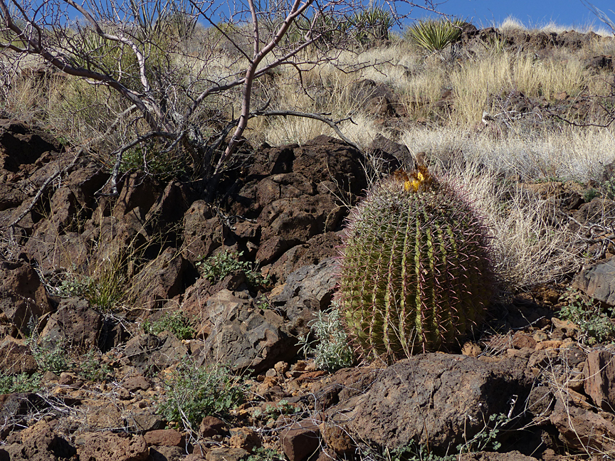
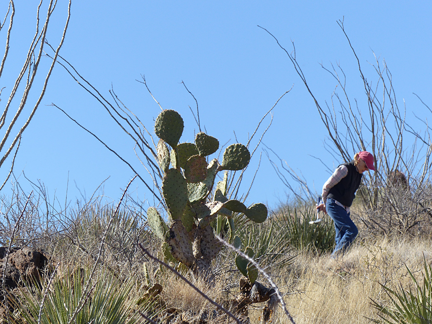
A DAY TRIP OF COLLECTING AT THE BLACK HILLS ROCKHOUND AREA
The Black Hills Rockhound Area is located in Arizona, 50 miles west of Casitas de Gila Guesthouses, just off US Highway 191, about 13 miles west of the crossroads community of Three Way and 19 miles east of Safford, Arizona. The site is a designated rockhound area on BLM (U.S. Bureau of Land Management) land, and is open to the public year round.
A BEAUTIFUL EARLY MORNING DRIVE OVER THE HIGH CHIHUAHUAN DESERT MOGOLLON-DATIL VOLCANIC FIELD TO THE SONORAL DESERT BELOW
The drive from the Casitas to the Black Hills Area takes about 1.5 hours, traveling on excellent highways that pass through some of the most scenic mountain country in Southwestern New Mexico and Southeastern Arizona. From the Casitas, the route goes northwest on US 180 through a High Chihuahuan Desert landscape affording magnificent views of the Mogollon Mountains before turning west on NM 78 through the incredibly beautiful Mule Creek Country.
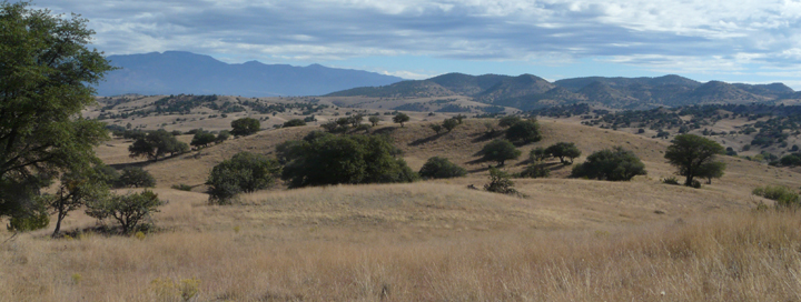
Notable for having some of the finest ranch land in Southern New Mexico, the Mule Creek area is a mile-high landscape of rolling grasslands offset by a sparse scattering of Alligator Juniper trees. After passing through the tiny community of Mule Creek — don’t blink or you’ll miss it! — the road immediately enters the Gila National Forest where it begins a gradual six-mile climb over the northern extent of the Burro Mountains before crossing into Arizona and entering the Apache National Forest at an elevation of 6,000 feet.
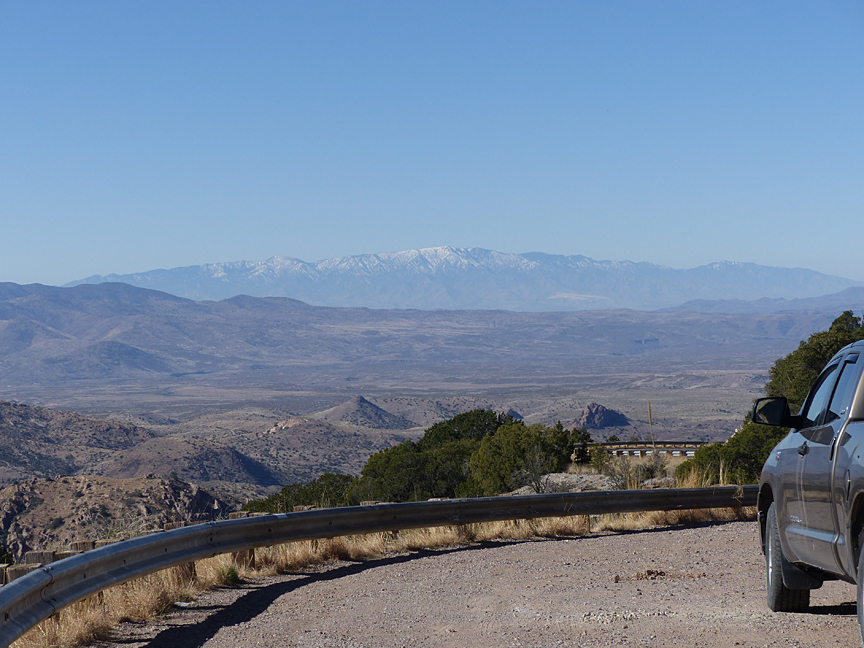
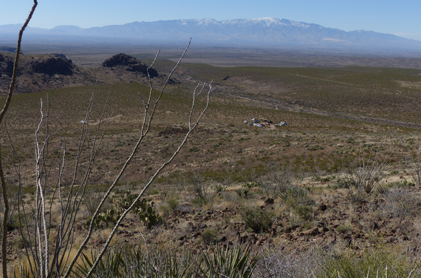
For the next 5.6 miles the road winds through a Ponderosa-shaded mountain roadway within the Apache National Forest before reaching an amazing overlook and parking area at the edge of a major topographic, physiographic, geologic, biologic, and ecologic boundary that marks the abrupt transition from the southwestern extent of the High Chihuahuan Desert of the Mogollon-Datil Volcanic Field into the eastern edge of the High Sonoran Desert of the Basin and Range Province. The westward view from this overlook affords a marvelous long-distance view into the Sonoran Desert Country within the Basin and Range Province of Arizona, with the 10,696 foot towering presence of Mt. Graham looming 52 miles to the west.
Leaving the lookout parking area at an elevation of 6,250 feet, the highway descends rapidly through a series of switchbacks and a distance of 4 miles some 1,200 feet down the face of a west-facing escarpment, leaving behind the flora and fauna of the High Chihuahuan Desert and entering the totally different natural world of the High Sonoran Desert. Upon reaching the base of the steep escarpment, Highway 78 continues a downward but more gradual descent of another 1,400 feet in elevation over the next 10 miles to arrive at Three Way, Arizona, at elevation of 3,600 feet. The change in landscape, both topographically, geologically, biologically and ecologically over this 14 mile stretch of highway is both dramatic and amazing and for most travelers will be remembered as one highlight of the day’s journey.

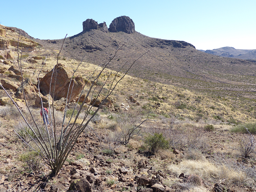
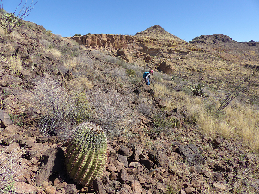
At Three Way, Highway 78 ends and the journey continues straight ahead on U.S. Highway 191 to once again cross the Gila River and for the next 13 miles passes through a fascinating Sonoran Desert landscape of weathered and dissected volcanic hills, mountainous ridges, mesas, and sharp pinnacles or buttes, almost all of which is public BLM or State of Arizona land. At mile marker 141.6, a sign on the right (north) side of the road marks the entrance road to the Black Hills Rockhound Area.
Turning in off the highway, a well-maintain gravel road is followed for two miles to a parking area where another sign informs the visitor that they are at the center of the Black Hills Fire Agate deposit, and further states that while small pieces of fire agate can be found on the surface, large pieces will have to be dug for! Translation of BLM wordage: “the big pieces have already been picked up by somebody else before you got here.” But don’t be put off: there are still tons of collectable material out there … somewhere!
THE FIRE AGATE AND CHALCEDONY OF THE BLACK HILLS ROCKHOUND AREA
The Black Hills Rockhound Area is one of two designated fire agate localities on BLM land in Southeastern Arizona, the other being the Round Mountain Rockhound Area, some 27 miles to the southeast near the Arizona-New Mexico border. Both of these areas are well known and receive many visitors each year. Because of this, one might wonder if there is any material left to be collected. Actually this is not a problem for two reasons: the first being that the area at the Black Hills site where fire agate and chalcedony can be found is vast, comprising thousands of acres of public BLM land surrounding the main collecting area, some of which comprises incredibly rough and steep terrain which is rarely visited. The second reason is that because of the heavy rainfall the area receives during the annual Summer Monsoon thunderstorm rains, which can exceed 2 to 3 inches in a half hour, fire agate and chalcedony buried beneath of surface of the ground is constantly being uncovered and exposed by high energy flash flood runoff every year. Proof of this process of replenished collectable material is the fact that over the past 18 years no Casita guests visiting the area have ever returned empty handed!
Are some areas better to look than others? Of course! And in that respect, rockhounding is much like fishing:. experience and understanding of the quarry counts! And so, it is in that context that the following brief geologic overview is offered as an aid to knowing where to look for the Black Hills fire agate and chalcedony. After reading this, however, it must always be kept in mind when setting out for a day of rockhounding, that just like it is in fishing, there will always be the occasional great day, many good days, and those other days where, well, it was certainly a nice day for being out in the desert connecting with nature! But, then, isn’t that at least half of the fun anyway?
A MODICUM OF UNDERSTANDING REGARDING THE SUCCESSFUL SEARCH FOR AND RECOVERY OF THE RECLUSIVE AND ELUSIVE FIRE AGATE AND CHALCEDONY OF THE BLACK HILLS ROCKHOUND AREA
The geology of the Black Hills Area is not very complex. Basically, there are two main volcanic rock types of Mid-Tertiary age (Oligocene to Middle Miocene or 30 to 15 million years ago) which make up the bedrock that crops out at the surface on the tops of the hills, ridges, and small mountains that surround the Black Hills parking area. These rock types consist of 1) dark gray to reddish gray andesite lava flow rock that is deposited in a sequence of essentially horizontal layers, many of which contain abundant gas bubbles, and 2) gray to light tan, silica rich, rhyolite pyroclastic ash flow or ash fall welded tuff that overlies or is interbedded with the andesite flow rock. The andesite flow rock is the host rock for the fire-agate and chalcedony which, as explained above, forms over time through secondary deposition from hydrothermal waters containing colloidal silica and iron oxide colloids that slowly fill or are injected into cavities such as gas bubbles, irregular shaped vugs, and thin veins within the andesite flow deposits. In most cases the overall volume percentage of chalcedony and fire agate that forms within the flow rock is extremely small — much less than 1%, although examination of the vertical sequence of the Black Hill andesite deposits does show that certain layers or levels do contain more void space and hence higher concentrations of chalcedony and fire agate than others.
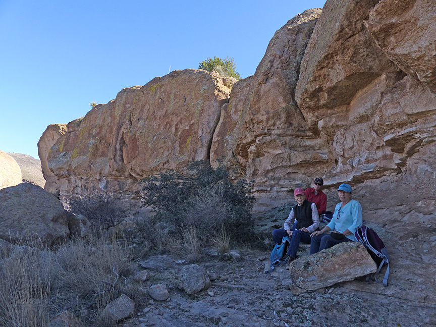
Massive cliffs and large broken blocks of andesite flow rock and rhyolite welded tuff bedrock comprise the tops of a low ridge lying about a half mile to the north of the designated parking area in the center of the Black Hills Fire Agate area. On the sides of this ridge, below and surrounding the solid rock outcrops, are loose accumulations of smaller broken rock, coarse rock debris, and soil that is in the process of being carried downslope from the rock outcrops.
Andesite is composed of a high concentration of feldspar and other minerals which over time will break down physically and chemically decompose to form an unconsolidated mineral soil of clay minerals and fine rock particles, thereby releasing the contained fire agate and chalcedony which retains its original size and shape because SiO2 minerals are very stable and inert to weathering and chemical decomposition at the Earth’s surface.
Following this breakdown of the andesite bedrock, the processes of gravity, wind (desert pavement), and running water in the form of flash floods, acting over thousands of years, will carry the altered and disintegrated clay particles, fine rock debris, and the fire agate and chalcedony further and further downslope and away from the bedrock to be redeposited in and over the surrounding lowlands, flats, valleys, and washes.
Gradually, this process will produce a thick, wedge shaped deposit of successive layers of transported sedimentary material surrounding the bedrock core of the ridge. Since the clay and finest rock particles are selectively carried furthest away by the periodic flash flood runoff from the source bedrock upslope, a concentration or lag deposit of the larger rock fragments and, of most interest to rockhounds, the physically and chemically inert pieces of chalcedony and fire agate, accumulates over the ground surface following each successive flash flood coming off the surrounding the uplands. Successive floods will, of course, bury previously deposited layers of the concentrated fire agate and chalcedony as the erosion of the bedrock upslope on the ridge continues and the wedge shaped deposits surrounding the ridge thicken.
The important result of this process is, of course, that the concentration of fire agate and chalcedony which was less than 1% in the original solid host rock may now be increased many times over in the loose, unconsolidated sediments and mineral soil, which in addition to being picked up on the surface can be successfully recovered by digging with pick and shovel.
Naturally, the big question of course is: Where does one dig? Hopefully, the above discussion offers some clues as to where to begin, and your hosts at the Casitas will be pleased to offer additional suggestions if asked. However, it must be kept in mind that it is this very same question that has perplexed every prospector in the American Southwest for over a hundred years, and in most cases it is only after much personal experience and perseverance that Mother Nature will even consider beginning to answer the question. So in the meantime, good luck in your quest and enjoy the chase!
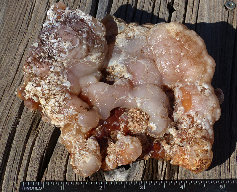
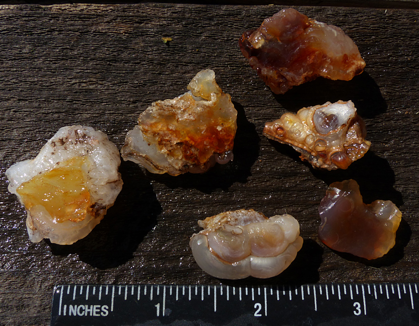
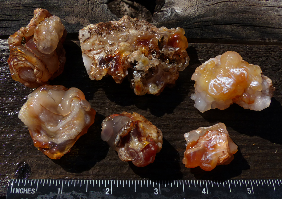
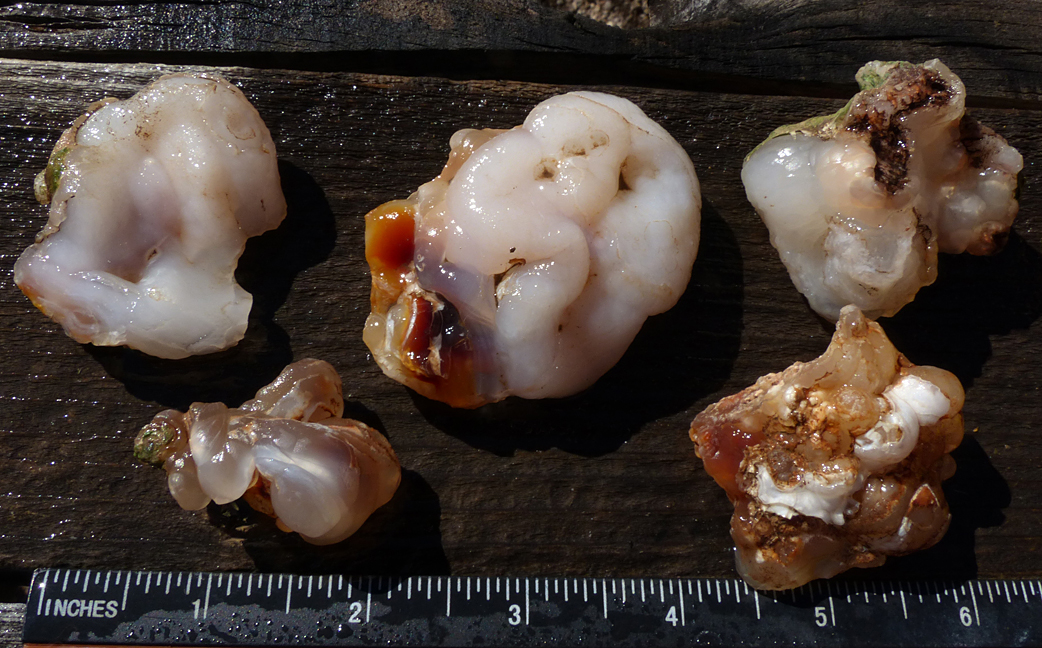
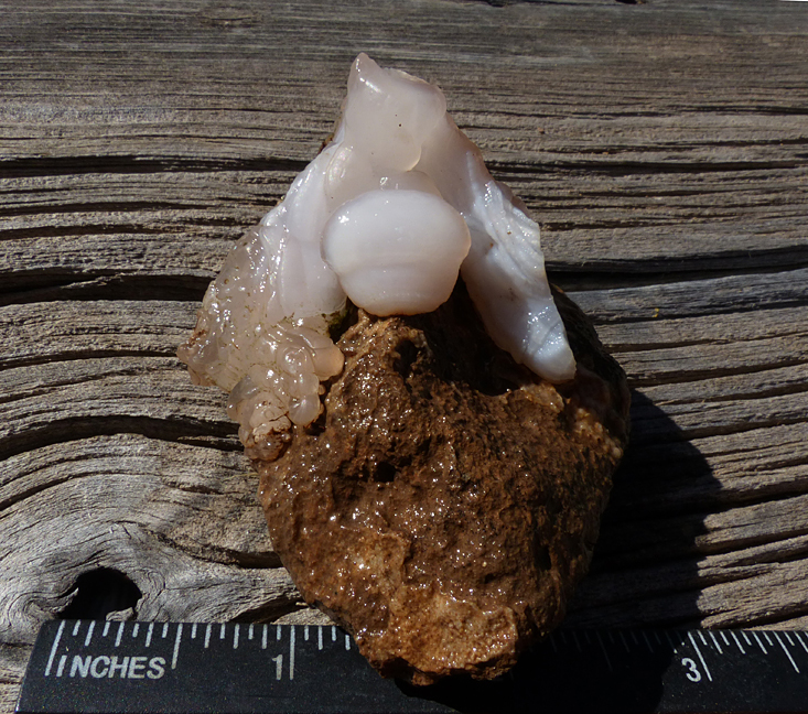
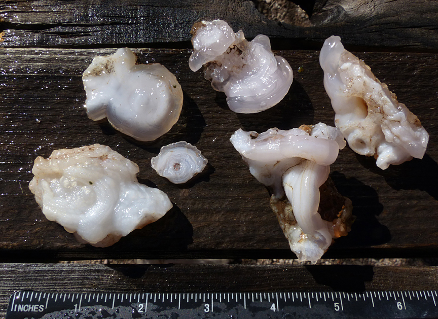
A “DAY’S CATCH” AT THE BLACK HILLS ROCKHOUND AREA
As further proof that there is still lots of good fire agate and chalcedony to be found at the Black Hills Rockhound Area, the following photos represent the best of the “Day’s Catch” over a four-hour period by your Casitas’ hosts on a beautiful early Spring day in February 2016.