Southwestern Guesthouses on 265 Acres near Silver City, New Mexico overlooking Bear Creek and the Gila Wilderness
Menu
Casitas de Gila Nature Blog
APACHERIA IN SOUTHWEST NEW MEXICO
EXPLORING THE HOMELAND OF THE CHIRICAHUA APACHE IN SOUTHWEST NEW MEXICO PART 2 OF 2
NOTE: This is Part 2 of a blog covering the history of the Chiricahua Apache from the initial Spanish incursion and later Anglo-American settlement in their ancestral homeland up to the final surrender of the Chiricahua in 1886. (Read Part 1)
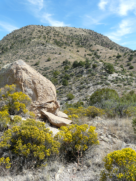
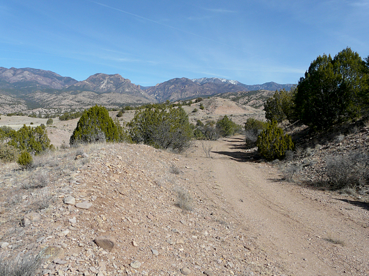
HIDDEN VALLEY, MARCH 2000
Looking down into Hidden Valley (all photos will open larger when clicked)
Yaqui and Saino, our two Mexican horses, were breathing heavily when we finally reached the top of the ridge to the north of us. We were about a mile or so from Casitas de Gila Guesthouses, in the mountains on the other side of Bear Creek, enjoying a short getaway-ride before our guests would begin arriving. It was time for lunch and we were responding to the little inner voice that said “Why not go up to the top of that ridge where we’ll have a nice view”. Reaching the ridge top, the view was indeed superb, but the early March wind on this bright late winter day was strong and very much on the cool side as it raced over the ridge out of the north. No, it was far too strong for a comfortable lunch, regardless of the magnificent view of the towering Mogollon Mountains in the distance. Considering alternatives, we noticed that in front of us the ridge dropped abruptly away into a small bowl-shaped valley floored with interesting outcrops of white-colored, rhyolite ash-flow welded tuffs. The valley was about one hundred feet deep, rimmed and protected on all sides by a circle of sheltering ridges and a steep mountain slope to the east. We agreed it would be a great place for lunch as we made our way to the bottom.
Reaching the bottom of the valley, it was if we had entered another world … a small, magical place of bare volcanic rock outcrops dotted with sparse grass, mesquite, prickly pear cactus, small juniper and scrub oak, all bathed in brilliant, warming sunlight and awash in incredible silence. Here, in this little valley, it was impossible to escape a feeling of being totally separated and hidden from the world beyond. Basking in the bright warm sun, we enjoyed our lunch. We had some time before we needed to get back to work at the Casitas, so we began our ritual search for interesting rocks, particularly the unique white and pink chalcedony that abounds in the the volcanic terrain surrounding the Casitas.
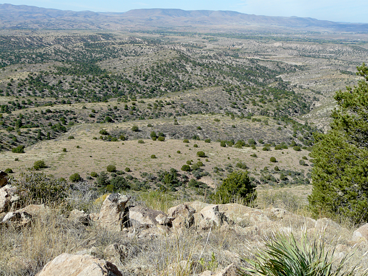
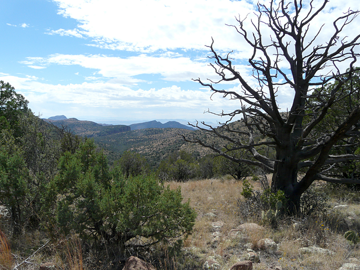
Slowly we worked our way up the slope to our west. Reaching the top of the ridge, the vast panorama greeting the eye was breathtaking. In the foreground stretched the sinuous trail of Bear Creek as it made its way to its terminus in the Gila River Valley. Beyond lay the triangle-shaped coalescing alluvial fans of Sacaton Mesa at the foot of the soaring heights of the majestic Mogollons, with the peaks of the Blue Range Wilderness forming the distant skyline some 50 miles northwest.
Looking west from ridge above Hidden Valley with Bear Creek in foreground and Gila River in distance
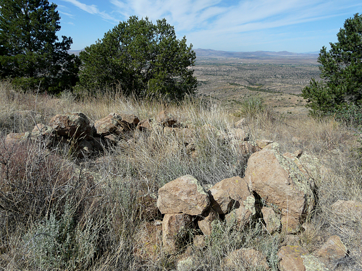
The wind had died and once more silence prevailed. It was then that we noticed a curious depression in the top of the ridge. It was a shallow circular hole a couple of feet deep and maybe eight feet across. Loose boulders of angular welded tuff and dirt had been piled around it. It was obviously very old, and definitely man-made. But who would have dug this? And why? Looking around close by, and still pondering these questions, we came upon several, offset, short discontinuous walls of piled rocks, running north-south along the top of the ridge that dropped off steeply to the west.
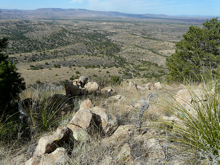
Whether crouched behind the rock structures or hunkered down in the circular depression and looking westward, it was obvious that the structures provided a mostly continuous and unobstructed birdseye view along the entire Bear Creek drainage several miles downstream to its junction with the Gila River. It was unmistakable that whoever had made these structures was waiting and looking for someone coming east up Bear Creek. And it was clear by the effort that went into making these structures that they didn’t want to be seen.
But who? Why? When? It would be 10 years before we stumbled onto possible answers to these questions.
Circular, rock-lined pit overlooking Bear Creek to the west in the distanceStacked rock walls overlooking Bear Creek to the west in the distance
EARLY CONFLICT IN THE NEW MEXICO TERRITORY 1848-1861
The following paragraph is repeated from Part 1 (February 2013) as it sets the stage for the final 25 years of the “Chiricahua Problem” in the American Southwest. As in Part 1, the source for most of the historical facts and details that follow derive from three volumes on the Chiricahua by historian and writer Edwin R. Sweeney, whose writing presents a comprehensive, chronological and balanced history of this critical period of cultural change and transformation in the American Southwest.
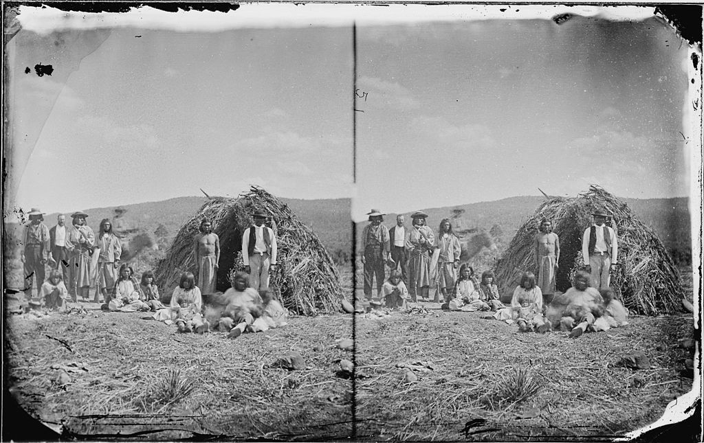
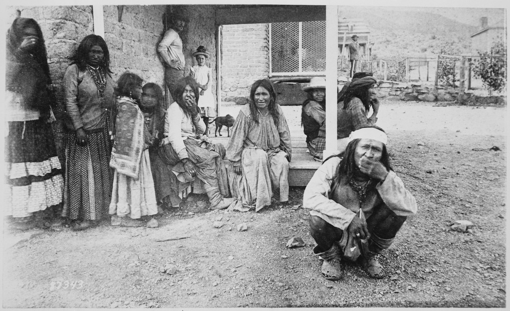
Group of apaches in front of their wikiups near Camp Apache, Arizona, 1873
During the Mexican-American war the Chiricahua allowed the U.S. Army safe passage through what was to become Southwest New Mexico to fight the Mexicans, ascribing to the old adage – ”the enemy of my enemy is my friend” … With the close of the war and the acquisition of the Mexican Cession in 1848, a peace treaty was signed between the U. S. and the Chiricahua, but shortly broke down as inevitable conflicts broke out between the Chiricahua and some of the thousands of prospectors, miners and settlers flooding into the country. In 1851, the great Chihene Chiricahua Chief Mangas Coloradas was allegedly attacked by a group of miners near Piños Altos, tied to a tree and severely flogged. Numerous subsequent violations of the treaty followed, resulting in various Chiricahua reprisals. One particularly egregious event occurred in December 1860, when thirty miners conducted a surprise attack on a group of Chihene Chiricahua east of Piños Altos, killing four and capturing 13 others. Then, on January 27, 1861, the infamous Bascom Affair occurred in which the great Chokonan Chief Cochise and members of his family were captured at Apache Pass in the Chiricahua Mountains under duplicitous circumstances by Lt. George Bascom and a large force of of U.S. Infantry. Cochise escaped, but in subsequent days Cochise’s brother and two nephews were hanged by Bascom’s forces. It was this event that precipitated the following 12 years of Cochise’s War. It was shortly after the Bascom Affair that Mangas Coloradas declared war on the Whites himself, joining forces with his son-in-law Cochise.
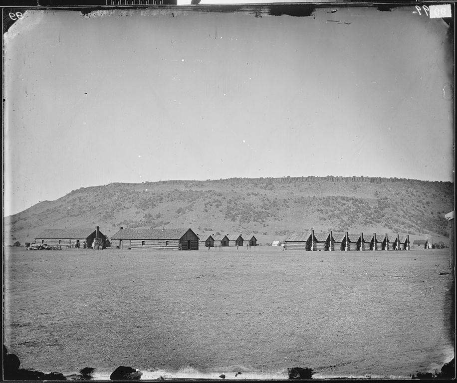
Soldiers’ quarters at Camp Apache, Arizona Territory, 1871
LATER CONFLICT IN THE NEW MEXICO TERRITORY 1861-1873
With the joining of forces of the Chokonen and Chihene bands under Cochise and Mangus Coloradas, an unprecedented 12-year period of chaos and violence ensued within the New Mexico and Arizona Territories. The threat of surprise Chiricahua attack was a constant reality for any settler or miner choosing to live there or even attempting to pass through this part of the Southwest. Mining camps such as Piños Altos, small settlements and ranches, and transportation routes were targeted repeatedly. Some important events of this period include:
On January 18, 1863, Mangas Coloradas, then 70 years old and having at last decided to pursue peace, was tortured and murdered at Fort McClane by members of the U.S. California Volunteer Infantry under the command of Brigadier General Joseph Rodman West.
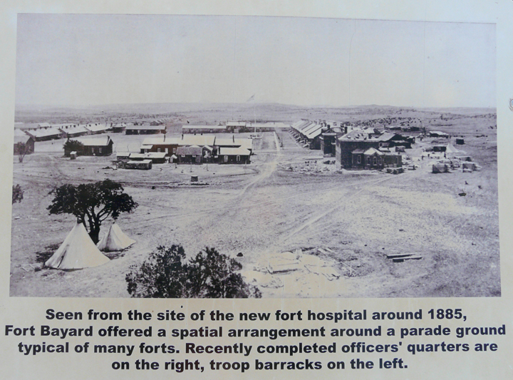
In 1866, Fort Bayard was established about 7.5 miles east of Silver City to protect the mines and settlements in the area, a function which it served with great honor until the surrender of the famed Chiricahua leader Geronimo in 1886, ending the Chiricahua Wars.
Sally Port, circa 1870. Post headquarters and one of the first buildings constructed. Stood at southwest corner of parade ground. Calvary barracks at back left.Fort Bayard, circa 1885, with typical parade ground in center. New officers quarters on right, troop barracks on left, Sally Port in center back.
On October 11, 1872, Cochise, then 67 years old, agreed to a peace treaty with General Oliver O. Howard and Indian Agent Thomas Jeffords which included the establishment of the Chiricahua Reservation adjoining Fort Bowie in Arizona Territory. Cochise remained at peace in his beloved Chiricahua Mountains on the reservation for the rest of his life, dying of natural causes in 1874.
By the end of 1872, all Chiricahua were living on two reservations: the Chiricahua Reservation and the Tularosa Reservation in the Mogollon Mountains of New Mexico. While the Chiricahua maintained peace in Arizona and New Mexico, they continued to make periodic raids into Mexico, returning to the safe haven of their reservation in Arizona.
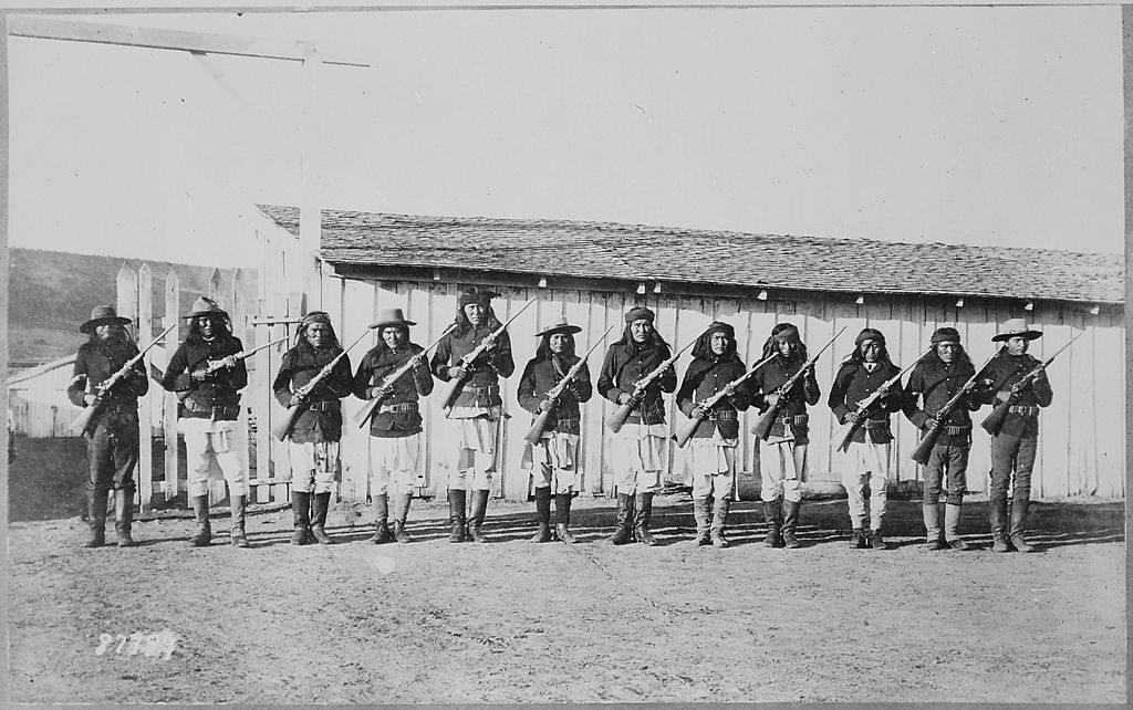
Apache scouts drilling with rifles, Fort Wingate, New Mexico
THE CONCLUSION OF CONFLICT IN THE NEW MEXICO TERRITORY 1874–1886
With the death of Cochise in 1874, the Chiricahua no longer had a overall leader that commanded the respect and allegiance of the four major bands and smaller groups within them. From this time forward, the leadership of the various Chiricahua bands was decentralized, with a number of chiefs emerging to lead various bands and family groups.
In 1874 the Tularosa Reservation was closed and the resident Chihene Chiricahua were transferred to the Ojo Caliente Reservation.
Apache prisoners at Fort Bowie, Arizona, 1884
In 1876, the Chircahua Reservation at Ft. Bowie in Southeast Arizona Territory closed. As had happened with the Gila Reservation at St. Lucia Springs in New Mexico Territory 11 years earlier (see Part 1, February 2013), once again Anglo mining and agricultural interests trumped Chiricahua desire to remain in their homeland. Reportedly, less than half of the Chiricahuas moved to the San Carlos Apache Indian Reservation, were they were forced to live with other Apache bands, friend and foe alike, on the Gila River in north-central Arizona Territory. The other half dispersed into New Mexico and Mexico, some going to the Ojo Caliente Reservation in New Mexico, others preferring a last attempt to live free following their traditional lifestyle. Life was to become extremely difficult for those Chiricahua sent to the San Carlos Reservation, where many were soon to die of infectious diseases such as malaria, then rampant in the Gila River lowlands. For those choosing to live free, a life of 10 years of conflict and life on the run had begun.
Because of increasing discontent with reservation conditions and government policy, plus innate cultural inability to adapt to the forced agriculturally-based lifestyle, it wasn’t long before various factions soon began departing the reservation to live free and resume their raids throughout Arizona and New Mexico Territories and Mexico. Military operations to capture, subdue, or eliminate the rampaging renegades once again became a way of life on the frontier until Geronimo’s final surrender and capture in 1886. During this time numerous new leaders of the Chiricahua emerged, some preferring the path of peace, others the path of war. Naiche (son of Cochise), Mangas (son of Mangas Coloradas), Victorio, Chihuahua, Ulzana, and Geronimo are some of the more influential Chiricahua leaders to shape the course of events during this time.
On September 4,1886, Geronimo surrendered to General Nelson A. Miles of the U.S. Army at Skeleton Canyon, Arizona. Except for a few holdouts, the Anglo-American “Chiricahua problem” had come to an end. But for the Chiricahua, their problem of 27 years of incarceration as Prisoners of War in Florida, Alabama and Oklahoma was just beginning.
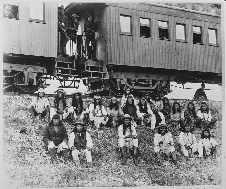
Apache chief Geronimo (right) and his warriors in 1886, from left: Yanozha (Geronimo’s brother-in-law), Chappo (Geronimo’s son of 2nd wife), and Fun (Yanozha’s half brother)Band of Apache prisoners at rest stop beside Southern Pacific Railway, near Nueces River, Texas, Sept. 10, 1886. Among those on their way to exile in Florida are Natchez (Naiche, son of Cochise), center front, and to the right, Geronimo and his son in matching shirts.
HIDDEN VALLEY 2012: THE REST OF THE STORY REVEALED
Circular pit with stacked rock walls in background.
It was late in the year of 2012 that the Casitas obtained their own copy of Edwin Sweeney’s excellent book: From Cochise to Geronimo: The Chiricahua Apaches, 1874-1886. The book had come out earlier that year and one of our guests had recommended it to us. Sweeney is a meticulous historian and writer, searching deeply for the facts and the “true story”. There are many, many books that have been written on the Apaches, which range from extreme fiction to highly-researched fact. Sweeney’s three books on the Apaches (Mangas Coloradas: Chief of the Chiricahua Apaches, and Cochise: Chiricahua Apache Chief are the other two) fall into the latter category. They are definitely not what might be called “light reading”. However, for the person who wants to know what really happened during this fascinating period of Southwest history, and who appreciates a comprehensive narrative presented from a neutral perspective, these books are the definitive choice.
So, it came to pass one cold winter night, when my reading of Sweeney’s tome had progressed to the concluding chapters, that the reportage of a series of events occurring in early 1885 caught my eye, and with it the triggering of a series of “hmms” and “ahas”, as our 2010 discoveries in Hidden Valley fell into place.
THE STORY UNFOLDS
Sometime during the evening of May 17, 1885, 134 Chiricahua, including 34 men (including 4 reservation scouts), 8 teenage boys, and 92 women and children fled the reservation a few miles east of Ft. Apache in north-central Arizona. Leading the exodus were the Apache Chiefs Geronimo, Mangas, Naiche, Chihuahua, and Nana. Instigated largely by Geronimo and Mangas, the uprising resulted of the Chiricahua leaders’ fear and anxiety over having broken reservation rules and regulations and the punishment that they would likely face. Initially, the group fled east towards the Black Range in New Mexico, with Mangas in command. Pursued by the U.S. Troops and Apache Scouts, the fleeing Chiricahuas soon reached the Mogollon Mountains where they split into two groups.
With Federal Troups and Apache Scouts close on their trail for most of their journey, Geronimo and Mangas and their followers crossed the Black Range, then went south past Fort Cummings. From there they headed southwest to Tres Hermanas Peaks south of Deming, where on May 29, they crossed safely into Mexicio near Palomas Lake.
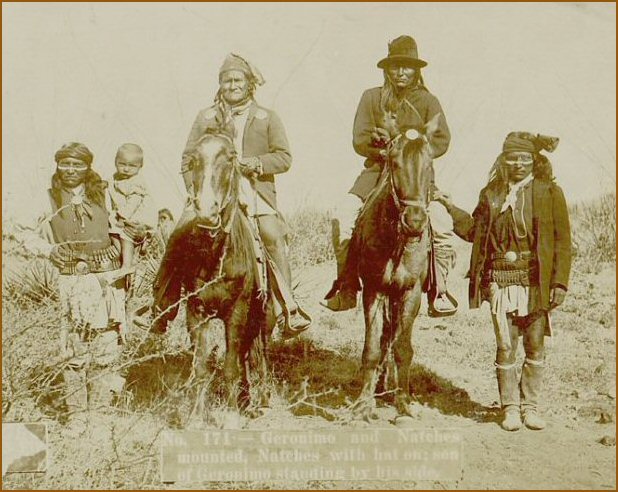
Geronimo (left) and Naiche (right) on horseback. Geronimo’s son standing beside him.
Meanwhile, the other group led by Chihuahua and Naiche, having been successful in eluding the military, stayed in the northern Mogollons until about May 24, at which time they, too, began their flight towards Mexico. On May 26, Chiricahua raiding parties were reported attacking ranches along Mogollon Creek at the head of Sacaton Mesa about 15 miles northwest of Casitas de Gila Guesthouses. A day later, on May 27, Chief Chihuahua led most of the party, including the women and children, to the Gila River near Cliff, just 5 miles west of the Casitas. Once across the river, they then headed for the safe corridor of rugged Bear Creek Canyon which empties into the Gila River Valley at that point from the east. After a hurried crossing of 6 miles of open and dangerously-exposed country, they knew the canyon walls would soon begin to close in. Within an hour’s travel they could relax somewhat as they entered the dense forest of cottonwood and sycamore beneath the conglomerate cliffs and towering volcanic promontory of Turtle Rock across from the Casitas. Once past Turtle Rock, and another 9 more miles up Bear Creek, they soon arrived at Juniper Springs, about 10 miles northwest of Silver City. Here they would wait for the return of Chiefs Naiche and Ulzana and a small raiding party who, once across the Gila, had headed south to try and secure horses to speed up the pace of the group’s travel. Evidence for this is verified by accounts given by ranchers living in the Mangas Valley at the time who reported seeing a group of 8 Apaches around 8 AM on May 27th. By mid-afternoon Naiche and the raiding party had joined up with the others at Juniper Springs.
So, there it was … a documented explanation for the rock walls and rifle pit on the ridge above Hidden Valley! Probably constructed between May 26 and May 27, 1885, these structures were most likely a rear guard observation post to watch for pursuing military, and if necessary, provide diversionary protection to give additional escape time for the main group as they fled up Bear Creek Canyon. Indeed, it was the perfect place. From this hilltop position, the rear guard had a clear, unobstructed view of the first 6 miles of the Bear Creek drainage leading from the Gila River to where the canyon walls began to close in. Just a few warriors behind these low rock walls and rifle pit could hold off a large detail of pursuing military for hours, before retreating and diverting their pursuers into the extremely rugged YL Canyon country that the Chiricahua knew all too well, which lay immediately to the east behind Hidden Valley.
SEEKING OUT CHIRICAHUA TALES AND TRAILS IN THE GILA COUNTRY
Casitas de Gila Guesthouses are ideally situated as a base of exploration for visiting several locations where key events or confrontations occurred between the Chiricahua and the newly arrived prospectors, miners, and settlers. All of the sites listed below can be visited on a day-trip basis. Casitas de Gila will gladly provide maps, directions, and details for those guests who wish to pursue first-hand these and other localities and the stories that surround them. Most of these sites are in exceptionally beautiful terrain on public lands, ideal for hiking, a nice afternoon picnic, or just a quiet interlude in pristine Nature.
MINERAL CREEK AND ALMA
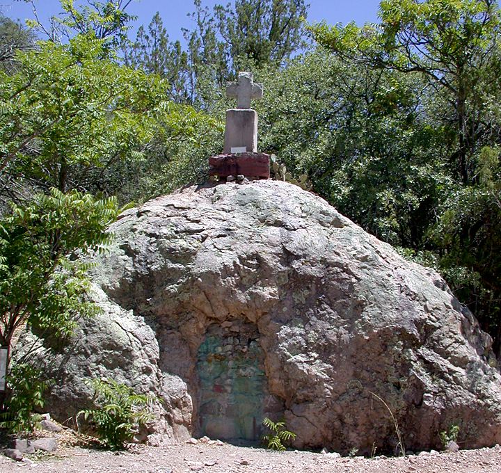
Cooney’s Tomb, Mineral Creek Road near FT 701 trailhead
Site of the Alma Massacre by Chihene Chief Victorio and his warriors on April 28, 1880. Mineral Creek is a great place to spend a full-day hiking and reliving the pioneer and mining history of this area in a spectacular, rugged, pristine mountainous environment. The day’s outing begins with a six-mile drive up Mineral Creek Road from Alma and a stop beside the road to visit Cooney’s Tomb and the small pioneer cemetery behind it. Here, Sgt. James Cooney and other miners were interred following the Alma Massacre. After leaving Cooney’s Tomb, the road continues another half-mile to dead-end at the Forest 701 Trailhead. This easy to moderately difficult trail follows the course of Mineral Creek through a narrow slot canyon bordered on each side by towering shear cliffs of brightly colored volcanic rocks. Within the first two miles of the trail one will see the remnants of the old mining camp of Cooney which was active from 1875 until about 1900, when most of the mining activity shifted a couple of miles south where larger and richer veins of ore were found, giving birth to the historic boom town of Mogollon. Cooney’s mine itself, where the initial battle of Victorio’s Raid took place, lies about two miles up the creek. To sit quietly amongst the ruins at the old Cooney Mine and reflect on the events that took place here one fateful afternoon some 128 years ago, just as the miners were quitting for the day, is an experience never to be forgotten, as the late afternoon sun begins to shadow the rocky cliffs above, and the soft murmuring of the creek and the wind in pines are the only sounds to be heard.
SOLDIER HILL
Possible site of massacre at top of Soldier Hill, looking east down road towards the Mogollon Mountains
Site of the ambush of Lt. Samuel W. Fountain, 1 officer, a surgeon, 19 cavalry men, 10 Navajo scouts, and 2 civilian scouts by Chokonon Chief Ulzana and 9 warriors on December 19, 1885. Soldier Hill is located within the Gila National Forest, a half mile west of US 180, 4.5 miles north of the US 180–NM 78 junction, and about a mile north of the Aldo Leopold Gila Wilderness Overlook. This site is easily visited and offers the opportunity of a short hike, following the trace of the old road that Fountain and his men rode into the unsuspected ambush early on the morning of December 19, 1885. The top of Soldier Hill is a great place for a picnic lunch, offering a magnificent panorama of the Mogollon Mountains to the east and views down Little Dry Creek and the mountains to the west. An interesting hike is available from Soldier Hill by following the course of Little Dry Creek towards its confluence with Big Dry Creek and eventually the San Francisco River, passing through deeply-incised canyons with spectacular volcanic rock formations and lined with magnificent old-growth sycamore.
Important Notice: Because of the potential danger of flash floods in the canyons, this hike should only be attempted during dry seasons, and even then, only after inquiring locally as to conditions prevailing at the time of visit.
BRUSHY MOUNTAIN ROAD, APACHE CREEK AND THE OLD APACHE TRAIL
Looking east down Geronimo Draw towards Arizona on the Old Apache Trail
A major trail in the Burro Mountains used by the Chiricahua Apache when traveling from the desert lowlands of Southeastern Arizona to the high country of the Mogollon Mountains. Portions of this trail followed closely along what is now Brushy Mountain Road, a 16-mile county-maintained road leading south from the community of Mule Creek into the Gila National Forest. This road provides a very scenic motor tour which begins in the rolling hills of grass-covered ranch lands of Mule Creek Country, dotted with juniper, oak and pinon, before passing into more heavily forested reaches of the northern Burro Mountains, where one has access to unlimited rough country hiking in the Gila National Forest.
THE MOGOLLON MOUNTAINS AND THE GILA WILDERNESS
High mountain heartland and safe haven of the Bedonkehe and Chihene Chiricahua. Here one can visit Geronimo’s birthplace at the headwaters of the Gila River, and seek out the location of numerous skirmishes, battles, and military expeditions. The Chiricahua knew the Mogollons and Gila Wilderness intimately, traversing the deep canyons of the Gila River and its tributaries and sky-high ridge-top trails for generations. To the Chiricahua, this lofty mountain wilderness was cherished as a dependable source of food, water, medicine, and a spiritual sanctuary. Many of the trails that one hikes today in the Gila follow these old Indian trails, and one can be sure that all of the various hot springs that are sought out and enjoyed by visitors today were a well-known and favorite stopover for the Chiricahua whenever they were passing through.
THE GILA PRESERVE CHIRICAHUA APACHE RESERVATION
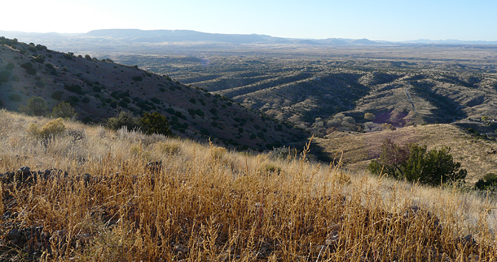
View from top of Paradise Overlook Trail at Casitas de Gila, overlooking northern half of proposed Gila Preserve Chiricahua Apache Reservation
Set aside by Congress in 1860, the Gila Preserve Reservation was to encompass a 15-mile square area or 144,000 acres, with its SE corner near Mangas Springs, about 15 miles northwest of Silver City. Because of the commencement of the American Civil War in 1861, the reservation never materialized, and the land was returned to public land status following the termination of the War. All of the land along U.S.180 between today’s communities of Mangas and Buckhorn, plus the entire Gila River Valley between the Burro Mountains on the west and the foothills of the Piños Altos and Mogollon Mountains to the east, including the present-day communities of Cliff and Gila, would have been part of this reservation. Guests at Casitas de Gila can obtain a birdseye view of a major portion of the land that this reservation would have encompassed by climbing to the top of the Casitas’ Paradise Overlook Trail.
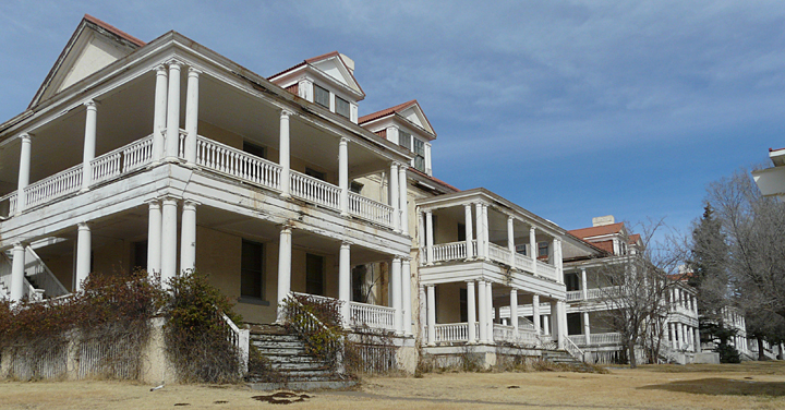
FORT BAYARD NATIONAL HISTORIC DISTRICT
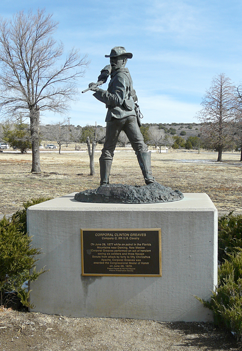
Sculpture of Corporal Clinton Greaves
Frontier U.S. Army post established in 1866 to protect the early miners and pioneer settlers in what is now Grant and Catron Counties, as well as transportation routes through Southern New Mexico. Historic Fort Bayard is located near the village of Santa Clara about 7 miles east of Silver City, and a mile north of US 180. In 1869 the post was expanded to include 15 square miles of land to be known as the Fort Bayard Military Reservation. During the Apache Wars, members of the racially segregated units of the U.S. Army, known as the “Buffalo Soldiers” by the Apaches who fought them, served with distinction at Fort Bayard for many years. After the capture of Geronimo in 1886, the Fort was selected to become an Army tuberculosis hospital and research center, and later served in numerous capacities. Today Fort Bayard is a great place to spend part of a day, touring the National Cemetery, the old parade ground, and numerous old buildings. The Fort Bayard Preservation Historical Society is very active in preserving this historic installation and provides tours several times each month.
Corporal Clinton Greaves (photo right), Company C, 9th U.S. Cavalry, the “Buffalo Soldiers”, was awarded the Congressional medal of honor for his heroism in saving 6 soldiers and 3 Navajo Scouts from attack by 40 to 50 Chiricahua in the Florida Mountains near Deming on June 26, 1877.
Officers Row, today. New quarters built circa 1910.
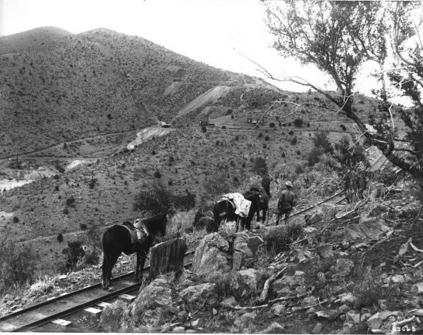
PIÑOS ALTOS
A narrow gauge railroad to the mines at Piños Altos, in the Gila National Forest, circa early 1900s.
Historic mining camp dating from 1860 when placer gold was discovered in Bear Creek. Substantial deposits of hard-rock gold and silver were also mined in Piños Altos until after the turn of the century. The town was the scene of several raids and battles between the Chiricahua and the miners, with the greatest battle occurring on September 27, 1861 when a large force of Chiricahua under the combined leadership of Chiefs Mangas Coloradas and Cochise attacked the town, with heavy losses on both sides. Today many of the old buildings remain, including an old log cabin dating from c1860s that has been in the Schafer family for over 130 years, and which now houses the unique Piños Altos Historical Museum filled with memorabilia from the early days of the town.
SANTA RITA DEL COBRE
The Apaches had mined veins of pure copper at what was to become the town of Santa Rita del Cobre, near the present day town of Bayard, and some 15 miles east of Silver City, for an unknown number of years before the Spanish began mining there in 1800. Chiricahua raids upon the mines started soon after and continued sporadically, off and on, nearly until Geronimo’s surrender in 1886. Eventually the little town of Santa Rita disappeared, literally into thin air, as the huge open-pit mining operation, which still continues today under the ownership of Freeport-MacMoran Copper and Gold, consumed the land on which the town was built. Still increasing in size, this immense pit can be easily viewed today from a dedicated roadside overlook on NM 152, about 12 miles east of Silver City. The Santa Rita del Cobre Mine of the 1800s would have been at ground level somewhere around the middle of the vast open pit in the photo below. Each of the benches on the far side of the pit are 50 feet deep. The depth of the pit is now in excess of a quarter of a mile.
Santa Rita in 1919, with mine in backgroundChino Mine in 2000
REFERENCES:
1. Edwin R. Sweeney, 1995, Cochise: Chiricahua Apache Chief, University of Oklahoma Press
2. Edwin R. Sweeney, 2011, Mangas Coloradas: Chief of the Chiricahua Apaches, University of Oklahoma Press
3. Edwin R. Sweeney, 2012, From Cochise to Geronimo: The Chiricahua Apaches, 1874-1886, University of Oklahoma Press
4. Eve Ball, 1988, Indeh: An Apache Odyssey, with New Maps, University of Oklahoma Press
5. David Roberts, 1994, Once They Moved Like the Wind, Touchstone
6. Geronimo and S.M. Barrett, 1906, 2005, Geronimo: My Life (Native American), Dover Publications. Geronimo’s autobiography as told in his own words to author S.M. Barrett while he was a Prisoner of War at Fort Sill, Oklahoma
7. Robert M. Utley, 2012, Geronimo, Yale University Press
FILM:
Ulzana’s Raid, 1972, MCA/Universal Pictures, starring Burt Lancaster. This is an interesting film, with considerable accurate detail, and a fictionalized plot involving the Chokonen Chief Ulzana and a small number of warriors who flee the San Carlos Reservation and go on the war path. Filmed on location in Arizona.